MOUNTAINS
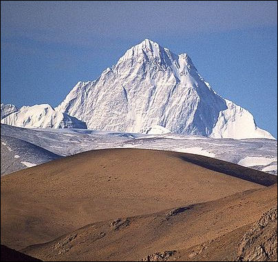
Shishapangma, world's 14th highest mountain Mountains are often formed where tectonic plates collide and land is pushed upwards or to a lesser extent where magma rises towards the surfaces and causes the ground to swell and bulge or where faults move and crack. New mountains tend be higher than old ones because they have been recently pushed up by these forces. Old mountains are smaller because the forces that built them ended long ago and they have been worn down by millions of years of weathering and erosion. Mountains with craggy peaks, sheer cliffs and spectacular Alpine features are usually that way because they have been carved and chiseled by glaciers and ice. [Source: Mostly from Cliff Notes, USGS and newspaper articles]
Mountain building features include: 1) anticlines, a folds that points upward like an arch. 2) synclines, folds that points downward; 3) geosynclines, large synclines caused when sediments from mountain ranges bend down the crust. Faults can cause the land to rise or fall. Valleys called grabbens often form and fill with sediment.
Mountains are often formed where plates collide and land is pushed upwards or to a lesser extent where magma rises towards the surfaces and causes the ground to swell and bulge or where faults move and crack. New mountains tend be higher than old ones because they have been recently pushed up by these forces. Old mountains are smaller because the forces that built them ended long ago and they have been worn down by millions of years of weathering and erosion. Mountains with craggy peaks, sheer cliffs and spectacular Alpine features are usually that way because they have been carved and chiseled by glaciers and ice.
Mountains result from the application of tectonic forces to rocks, usually sedimentary or volcanic rocks. (These may be changed to metamorphic rocks as mountain-building progresses, and at times metamorphic rocks can be pushed into mountains). Mountain-building on continents is associated with intense deformation, folding, and faulting, usually along convergent plate boundaries. An orogeny, or orogenesis, is the overall process by which a mountain system is built. [Source: CliffsNotes.com. Features of Mountain Belts Cliff Notes Cliff Notes ]
Mountain ranges are groups of mountain peaks or ridges that form discrete topographic areas that are usually bordered by valleys or rivers. It takes tens or hundreds of millions of years to develop mountain belts, long chains of mountain ranges that can extend across continents or along their edges.
The higher you climb the colder it gets. This is because as air rises is expands and therefore cools. On average the temperature drops 1degree F for every 300 feet rise in elevation. Above the freezing line snow falls and may accumulate into glaciers.
About 10 percent of the world’s population lives in mountains regions and about half are vulnerable to food shortages and chronic malnutrition. Mountain states also have a proportionally high number of armed conflicts. Out of the 28 conflicts that broke or continued in the early 2000s, 26 of them were in mountainous places.
Many mountain ecosystems are disappearing as result of excessive use of resources, inappropriate infrastructure development, deforestation and natural hazards,
Mountains: Summit Climb Summit Climb ; Trekking Tibet Trekking Tibet ; Samrat Nepal Samrat Nepal ; Himalayas Wikipedia article on the Himalayas Wikipedia ; Making of Himalayas geol.unibas ; Himalayas site himalayas.dk ; Mt. Everest : Wikipedia Wikipedia National Geographic National Geographic Mount Everest.net Mont Everest.net Summit Post Summit Post ; Glaciers: All About Glaciers nsidc.org ; Wikipedia article on Glaciers Wikipedia ; Wikipedia article on Avalanches Wikipedia
HIMALAYAS factsanddetails.com ; MT. EVEREST: NAMES, GEOLOGY, WEATHER AND HEIGHT MEASURING ISSUES; factsanddetails.com ; HIMALAYAN GLACIERS: IMPORTANCE, AVALANCHES AND DANGEROUS FLOODS See Separate Articles: factsanddetails.com; GLACIERS: THEIR MECHANICS, STRUCTURE AND VOCABULARY factsanddetails.com; MOUNTAIN GLACIERS AND GLOBAL WARMING factsanddetails.com TIBET, THE HIMALAYAS, MELTING GLACIERS AND GLOBAL WARMING factsanddetails.com
World’s Highest Mountains and Greatest Relief Differences
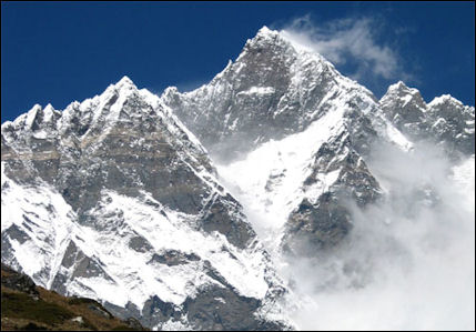
Lhotse, world's 4th highest mountain By some reckoning Hawaii’s Mauna Kea is the world's tallest mountain. From top to bottom it is over 10,000 meters (32,280 feet) — 4,207.3 meter (13,803 feet) above sea level and around 6,000 meters (19,685 feet) below the sea. Chimborazo is 6.4 million meter (21 million feet) or 6,384 kilometers (3,967 miles) from the center of the earth.
Mauna Kea on the island of Hawaii stands 10,205 meters (33,480 feet) above the ocean floor and 4,205 meter (13,796 feet) above sea level. Mount Everest is 8,849 meters (29,030 feet) high. According to the Guinness Book of Records, Chimborazo, a 6,267-meter (20,560 foot) -high volcano in Ecuador, is 2,150 meters (7,054 feet) further from the center of the earth than Mt. Everest. It's distance from the earth's center is a result of the fact that Chimborazo is only 160 kilometers (98 miles) from the equator (the earth is slightly flat at the poles and wide at the equator). Chimborazo was thought to be the highest mountain in the world until the 1850s.
According to the Guinness Book of Records the highest mountain face underwater is Monte Pico, of Azores Islands of Portugal: With an altitude of 2,351 meters (7,711 feet) above sea surface and 6,098 meter (20,000 feet) below sea surface to the sea floor, Monte Pico in the Azores Islands (Portugal) is the highest underwater face mountain in the world. The 42 kilometer-long island formed by this volcano is one of the nine islands that conform the Azores and it is also considered to be the youngest. I guess here Guinness doesn’t count Mauna Kea as a mountains face.
How about the highest mountains completely submerged in the sea. Brian Kinsey, an IT professor, posted on Quora.com: Tallest mountain on earth — base to peak — is Mauna Kea in Hawaii... If you want the tallest that is completely underwater, that would be the Vema Seamount, which lies in the Atlantic off the coast of S. Africa. It’s over 15,000 feet [4,572 meters] high, and tops out just a few meters below the surface.
From another perspective from the bottom of the 11,035-meter-deep (36,205-foot-deep) Marianas Trench to a 4000-meter-deep (13,123-foot-deep) hill next to the Marianas Trench a relief difference of over 7,035 meters (20,080 feet)
How about the greatest relief difference on Earth. The Tonga Trench is the second deepest oceanic trench in the world at around 10,800 meters below sea level. The island of Tonga is not far away. The highest mountains on Tonga is 1,030-meter-high (3,380-feet-high) Kao. From the bottom of the trench to the top of Kao is relief difference of 11,030 meters (36,188 feet). That is over one kilometers greater than the height of Mauna Kea from the ocean floor.
Features of Mountain Belts
Mountain belts typically are thousands of kilometers long and hundreds of kilometers across and parallel continental coastlines. The American Cordillera is a series of steep mountain ranges that rim the western edge of North and South America; it is one of the longest mountain belts in the world. In general, the taller mountains are geologically younger than lower mountains (for example, the steeper Rocky Mountains are younger than the lower and more rounded Appalachian Mountains) because older ranges have undergone more weathering and erosion. Most mountain ranges are uplifted, erode to low elevations, and are uplifted again before they become stable.[Source: CliffsNotes.com. Features of Mountain Belts, Cliff Notes Cliff Notes ]
Cratons. Billions of years ago the now-stable interior of North America was a mountainous, tectonically active region that eventually stabilized and weathered to a peneplain (an area reduced by erosion nearly to a plain). A continental interior that has been structurally inactive for hundreds of millions of years is called a craton. It is composed of mostly plutonic and metamorphic rocks. The craton is a “basement” upon which sequences of sedimentary rocks were deposited under marine or nonmarine conditions. The central United States is covered by about 2,000 meters of sedimentary rocks that were deposited in shallow Paleozoic oceans. Continents have grown larger through accretionary episodes in which mostly sedimentary material and volcanic arcs were welded to the craton through plate collisions, usually resulting in mountain-building.
Rock types. Mountains are typically composed of folded sedimentary strata that may be up to five times as thick as the original sedimentary sequence that covered the cratonic interior. The folded and broken layers indicate the rock has undergone deformation during mountain-building. Since mountain belts typically form along tectonically active coastlines and above subduction zones, much of the sedimentary rock is marine in origin. The sediments are often parts of the accretionary wedge that have been compressed, folded, and driven onto the continent by plate tectonic processes.
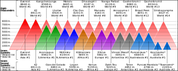
Comparison of highest mountains
How intensely a mountain belt is folded depends on how great the tectonic forces were. Mountain-building forces are intensely compressional, and the sedimentary sequence in a basin is often squeezed into a mountain range that is less than half the width of the original basin. Rock layers are typically contorted into tight fold patterns, including overturned or recumbent folds. Fold and thrust belts in many mountain ranges are the result of multiple thrust layers (sheets) of rock that have been thrust forward and stacked vertically along the low-angle detachment faults that separate the thrust sheets. After uplift has been completed, a later stage of tensional stress develops that forms a series of fault-block (horst and graben) mountains. The faulting is an adjustment to the extensional stress created by the vertical uplift.
The core of a mountain range tends to be its most intensely metamorphosed part. The metamorphic rocks were originally sedimentary rocks or volcanic rocks that were intensely metamorphosed through deep burial, folding, and tectonic uplift. It is often difficult to recognize the original rock types, and metamorphic rocks are typically mapped as “schist” or “gneiss.” Migmatites are some of the most intensely metamorphosed rocks that are found in the cores of mountain ranges. The large batholithic intrusions that underlie mountain ranges were formed by partial melting during the mountain-building process. The continental crust under mountain ranges is thicker than that under the cratonic interior; similarly, the crust under younger mountain ranges is thicker than the crust under older ranges. The uplift of these blocks of crust eventually stabilizes through isostatic adjustments. Geologically young, tectonically active mountains have more earthquakes and volcanic activity than the older, more stabilized mountain chains.
Types of Mountains
There are four types of mountains: 1) folded mountains, formed by pressure within the Earth that caused uplifting; 2) fault block mountains, formed by shifts along faults; 3) dome mountains, formed by uplift by magma that doesn't break through the surface; and 4) volcanoes.
Although each mountain range has a unique set of characteristics, a particular mountain can be structurally classified as upwarped, volcanic, fault-block (horst and graben), or folded (complex). It is not unusual to find all four categories of mountains within a single mountain range.[Source: CliffsNotes.com. Types of Mountain Belts, Cliff Notes Cliff Notes ]
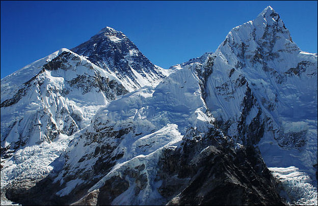
Everest on the Nepal side with Nubtse
Upwarped mountains are generally the result of broad arching of the crust or sometimes great vertical displacement along a highangle fault. The Black Hills in South Dakota and the Adirondack Mountains in New York are upwarped mountain ranges. These mountains are more rounded and show some unloading features such as exfoliation. Volcanic mountains are the accumulations of large amounts of volcanic lavas and pyroclastic material around the volcanic vent, such as seamounts and stratovolcanoes. The Hawaiian and Aleutian Islands are volcanic mountains.
Fault-block mountains result from tensional stress. They are bounded by high-angle normal faults, and usually form a series of horsts and grabens. Broad crustal uplift (possibly a result of subduction stresses or mantle upwelling) can stretch and break the crust, creating fault zones along which the blocks move or slide. Uneven tectonic uplift can tilt the blocks. A good example of fault-block mountains are those in Nevada that are part of the Basin and Range region. Folded, or complex, mountains are created by intense compressional forces that fold, fault, and metamorphose the rocks, resulting in many of the world's biggest mountain belts, such as the Himalayas.
How Mountains Form
Mountain building features include: 1) anticlines, a folds that points upward like an arch. 2) synclines, folds that points downward; 3) geosynclines, large synclines caused when sediments from mountain ranges bend down the crust. Faults can cause the land to rise ro fall. Valleys called grabbens often form and fill with sediment.
In general, it takes hundreds of millions of years for mountain belts to form, stabilize, and erode to become part of a stable craton. This evolution is marked by three stages: accumulation, orogeny, and uplift/block-faulting. [Source: CliffsNotes.com. How Mountains Form, Cliff Notes Cliff Notes ]
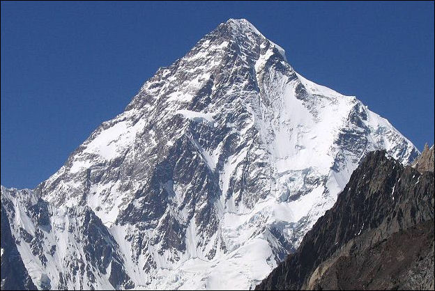
K2, world's second highest mountain
Accumulation. Many mountains contain sequences of sedimentary and volcanic rocks that reach thicknesses of 2,000 to 3,000 meters. Most of this material was deposited in a passive or active continental marine environment during the accumulation stage. The sedimentary material typically weathers from the continental landmass or offshore island arc; deep marine sediments can also be scraped from the subducting plate and piled onto the accretionary wedge. Thick sequences of sandstone, shale, and limestone with minor volcanic material accumulate along passive continental margins, such as the eastern coast of the United States. Sediments that accumulate along a convergent boundary (active continental margin) are more varied than those along a passive margin and often contain up to 50 percent andesitic flows and tuffs. Limestones are rare to absent. Graywackes are common and represent a rapid accumulation of sediment from a nearby magmatic arc. These sedimentary and volcanic deposits along the continental margins have been pushed up into many of the mountain ranges we see today.
Mountain-building convergence. Orogenesis is the mountain-building and associated folding, faulting, deformation, and metamorphism that result from the onset of intense tectonic stress. Igneous intrusions are also common. The layered rocks are tightly compressed into folds that often result in thrust faulting. The deepest rocks are metamorphosed into schists, gneisses, and migmatites. Compression also results in vertical uplift of the deformed rock sequence. Block faulting can also occur after the forces have thrust the metamorphosed and deformed rocks upward and outward.
Ocean-continent convergence deforms the accretionary wedge, metamorphoses rocks in the subduction zone, creates a mountainous magmatic arc, and develops fold-and-thrust belts on the backarc side of the magmatic arc. Ocean-continent convergence results in the formation of the rugged topography of the deep ocean trenches and seamounts. The magmatic arc is elevated because of the massive igneous upwellings underneath it.
Arc-continent convergence results when the intervening ocean is destroyed by subduction, welding an island arc to the continental edge. This convergence also results in deformation, uplift, and orogeny. Tectonic forces along the continental edge continue to generate heat, igneous intrusions, and compressional forces to the continental edge. It is probable that the northwestern United States was formed by a series of arcs that collided with and were welded to the North American craton.
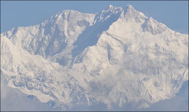
Kanshenjunga, world's third highest mountain
The collision of two continental masses, or continent-continent convergence, also results in the formation of mountain belts. The thick sedimentary sequences that formed on both continental edges are squeezed into intensely deformed mountain ranges that are some of the highest in the world, such as the Himalayas between India and the rest of Asia. The Himalayas are still rising because of continued compression along the suture boundary, and they host frequent earthquakes. Some geologists theorize that the Appalachian Mountains in the eastern United States were built as a result of the collision of the European and African plates with the North American plate that helped form the supercontinent Pangaea. The Appalachians and the Caledonian Mountains of Great Britain and Norway were all once joined along the same suture zone before Pangaea rifted into the continents that we see today.
Postconvergence mountain-building. A mountain range undergoes additional uplift and block-faulting after orogeny has ceased. Because the continental crust was thickened during mountain-building, the gradual uplift over tens of millions of years is a result of isostatic adjustment. As material is eroded from the mountain belt, more uplift compensates for the loss of weight (mass) during erosion. The uplift creates vertical and extensional (tensional) stresses that result in the block-faulting of mountain ranges along a series of normal faults. Fault blocks may also be tilted if the stresses are unevenly distributed. Scattered volcanic activity can also be part of this phase of mountain development. Fault-blocked mountain ranges are usually separated by valleys filled with thousands of feet of sediment, such as those of the Great Basin (the Basin and Range region) in the western United States.
Much of our understanding of mountain-building processes has come from studying ancient mountain belts that have since eroded to form flat erosional surfaces. Fieldwork in mountain ranges can be difficult because the rocks are complexly folded and faulted and because of the great changes in elevation. But such fieldwork can be productive because these features are important in the mapping and examination of the third dimension of the earth.
Scientists can reconstruct mountain-building activity and plate moment in the past by studying terrestrial sediment deposits. Thick deposits generally mean bigger mountains as bigger slopes cause more material to erode than relatively flat plains.
Alpine Glaciers
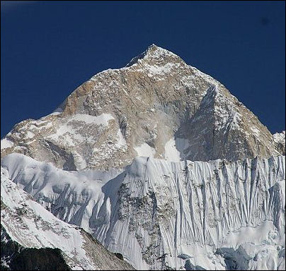
Makalu, world's 5th highest mountain A typical Alpine glacier resembles a hand. The palm is the main part of the glacier and where snow is accumulating and turning into ice. The fingers, sometimes called tongues or snouts, are rivers of ice that flow down various valleys and out of the mountains.
Tributary glaciers are similar to the streams that feed a river. They are created in reaches of the mountains, where they scrape off rock and pick up gravel and carry them with into the main glacier, resulting in the twisting, parallel black lines that you often see in large glaciers.
Crevasses are large cracks that occur in glaciers. Icefalls are areas where the glacier is moving relatively quickly and breaking apart, producing large areas of crevasses and jagged ice. Calving refers to large pieces of ice falling off the end of glaciers. This is usually associated with glaciers that terminate in bodies of water, which causes the ice to melt and fracture more quickly. After a calved piece of ice falls into the water it becomes an iceberg.
Moraines are the walls of debris that mark the edge of major Alpine glacier tongues. When the ice melts at the bottom of a glaciers rock and soil are deposited. Over time large amounts of this debris accumulate into moraines.
Alpine Glacier Geological Features
Glacier pick up and carry massive amounts of rock and soils. These and the ice itself can wear away the hardest rocks and scour the landscape under and beside a glacier, creating a geological features associated with glaciers.
Alpine glacier features include: 1) U-shaped valleys, mountain valleys that have been carved out by glaciers; 2) hanging valleys, U-shaped valleys that chopped off by a glacier going another direction, leaving a valley with a big cliff at its widest and lowest point (spectacular waterfalls often form here); 3) cirques, bowl-like basins formed by glacial erosion; 4) cols, jagged glacier-carved peaks.
Glaciers act like dams that store water in the winter and release it the summer when farmers most need it. But if too much water is releases, such as during a spring heavy rain, when spring melting is at peak, flood can occur. Sometimes lakes created within glaciers burst their dams and cause catastrophic flooding.
When a glacier retreats, the land is occupied by a succession of plants, beginning with lichens, grasses and flowering plants. As they produce detritus that fertilizes the soil, mat-forming trees such as willows appear. Within about 50 years, thickets of alder trees have established themselves. A mature forest generally takes about 200 to 250 years to establish itself after a glacier is gone.
Measuring Mountains
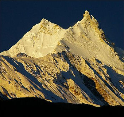
Manaslu, world's 8th highest mountain
Mountains do not have "official" heights because there is no officially designated international body that sorts out conflicting claims. The final word on such measurements in the United States is the United States Geological Survey. Outside the United States, for Americans anyway, it is often the National Geographic Society.
To calculate the elevation of mountains early surveyors used precision theodolites (high-resolution telescopes that measure horizontal and vertical angles) to take measurements from several different places. After the data was collected it was taken to surveying offices where men calculated the heights using complex formulas. The explorer Louis Baume wrote "the calculation of the heights of Himalayan peaks is a realm of such erudite complexity than even angels armed with theodolites and plum lines would dare to tread within." [Source: Jon Krakauer, Smithsonian]
Using the method of triangulation, a surveyor used a theodolite to "shoot the angle of the peak's rise" from two different locations, each of which had a known altitude. After measuring the distance between to the two locations, the survey team knew the side and two angles of triangle. Using a trigonometry the length of the other sides could be determined. After allowances were made for the curvature of the earth, atmospheric refraction, and plum line deflection caused by the gravity of a large object like a mountain a height figure could be determined.
Problems with Measuring Mountains the Traditional Way
Making allowances for the curvature of the earth is a relatively straight forward process but calculating atmospheric refraction, and plum line deflection is more of an art than a science
Atmospheric refraction is the bending of light by the atmosphere before it reaches the theodolite. It causes a mountain to appear higher than it really is and is influenced by things like temperature, humidity, atmospheric pressure which are constantly changing throughout out the day, causing measurements to rise or fall several hundred feet. The further away from a mountain measurements are made the greater the likelihood the surveyors measurements are off.
Another problem is how the altitude of the survey locations is determined. They too are made from the triangulation of two locations, and these locations are in turn made from the triangulation of two other locations, and so it goes on down the line until locations at sea level are reached. If errors are made at one location there errors are passed on to calculations of other locations.
Measuring Mountains the Modern Way
Today the elevation of mountains can be determined using Global Positioning System (GPS) devices, which measure the distance of the devise from the center of the earth using satellites. The distance from the center of the earth to sea level is determined accurately using the same method and subtracted from the original figure to give the height of the mountain.
Determining elevation with GPS is trickier than determining location, in terms of latitude and longitude. Readings have be taken from several locations to get an accurate overall reading.
The most difficult thing about using GPS devices, which weigh about four pounds, is getting them to the summits of mountains. As hard as that may be it is easier than lugging up much heavier surveying equipment and Doppler receivers, which ar also used to measure elevation.
Mountains and Global Warming
Global warming seems to be having a more profound impact on higher elevations than lower elevations the same ways it seems to a more profound affect on higher latitudes than lower latitudes. Temperatures are increasing at upper elevations. Vegetation that formality could not survive there has appeared. Taller plants are crowding out shorter tundra and high altitude plants
The higher elevations of Africa, the Andes mountains in South America, and the Alps in Europe are warming at a faster pace than lowlands. Forests are creping up to higher elevations along with disease-carrying insects.
The flamboyant multimillionaire Mou Qizhong suggested blasting a 30-mile hole in the Himalayas to let in warm air.
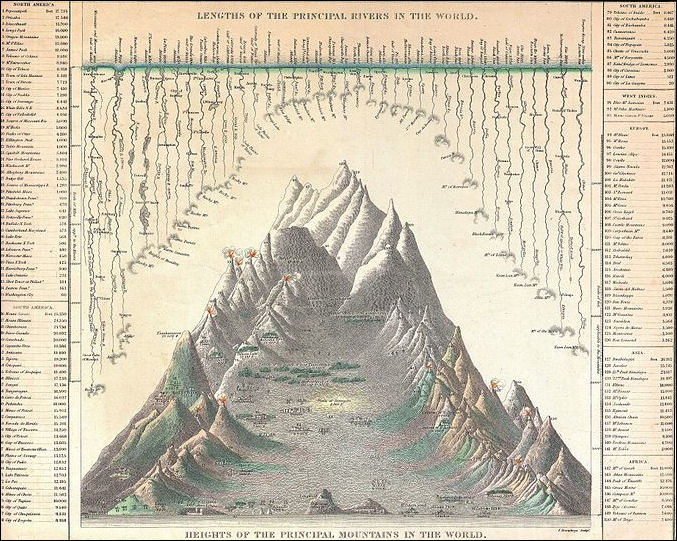
Mitchell's Chart of the World's High Mountains and Rivers, 1850
Image Sources: Wikimedia Commons; Except Everest climbing routes, Luca Galuzzi and Alan Arnette
Text Sources: New York Times, Washington Post, Los Angeles Times, Times of London, National Geographic, The New Yorker, Time, Newsweek, Reuters, AP, Lonely Planet Guides, Compton’s Encyclopedia and various books and other publications.
Last updated February 2023
