GEOGRAPHICAL SETTING OF THE SILK ROAD
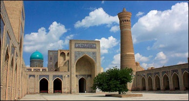
Bukhara in Uzbekistan
According to the Asia Society Museum: “The term Silk Road does not refer to a single, clearly delineated road or highway, but rather denotes a network of trails and trading posts, oases, and emporia scattered all across Central Asia. All along the way, branch routes led to destinations off to the side of the main route, with one especially important branch leading to northwestern India and thus to other routes throughout the subcontinent. The Silk Road network is generally thought of as stretching from an eastern terminus at the old Chinese capital city of Chang'an (now Xi'an, just west of the great bend where the Yellow River emerges into the North China Plain) to westward termini at Byzantium (Constantinople), Antioch, Damascus, and other Middle Eastern cities. But beyond those end-points, other trade networks distributed Silk Road goods throughout the Mediterranean world and Europe, on one end, and throughout eastern Asia on the other. [Source: “Monks and Merchants,” curated by Annette L. Juliano and Judith A. Lerner, November 17, 2001,Asia Society Museum asiasocietymuseum.org == ]
“Thus it is not possible to think clearly about the Silk Road without taking into consideration the whole of Eurasia as its geographical context. Trade along the Silk Road waxed or waned according to conditions in China, Byzantium, Persia, and other countries great and small along the way. There was also competition for alternative routes, by land and sea, to absorb long-distance Eurasian trade when conditions along the Silk Road were unfavorable. ==
“The terrain of the Silk Road was difficult, the possible routes were numerous and complex, and the dangers of the journey were deadly serious. What made the trade possible at all, besides the techniques of caravan travel and the expertise of the caravaneers, was the existence of substantial oases across Central Asia. These islands of greenery, watered by rivers and springs, ranged in extent from a few square miles to hundreds of square miles, but even the largest were isolated by huge expanses of surrounding deserts. In mapping all of the alternative routes of the Silk Road, one can easily imagine the terrors and hardships of the desert; one can imagine also the joys of arriving at oases like Dunhuang, Hami or Herat, filled with sweet water and fresh fruit to refresh the traveler and provide respite before the journey's next stage. ==
“Much of the Middle East is desert, traversed by caravan routes linking scattered oasis cities, much as is the case along the Silk Road further east. Silk Road traffic coming from Central Asia passed through the Middle East along many different routes and with many different destinations; the Middle East was in some sense an end-point for the Silk Road, but perhaps more importantly a trans-shipment zone.” ==
Chinese map-makers from Han dynasty (206 B.C.–220) made gridded maps with a graduated scale in the tradition of Pei Xiu (224–271). The Tang chancellor Xu Jingzong (592–672) In the year 785 the Emperor Dezong commissioned the geographer and cartographer Jia Dan (730–805) to complete a map of China and her former colonies in Central Asia. Upon its completion in 801, the map was 9.1 meters (30 feet) in length and 10 meters (33 feet) in height, mapped out on a grid scale of one inch equaling one hundred li (Chinese unit of measuring distance). The earliest extant terrain maps of China come from the ancient State of Qin; maps from the 4th century B.C. that were excavated in 1986. [Source: Wikipedia]
Good Websites and Sources on the Silk Road: Silk Road Seattle washington.edu/silkroad ; Silk Road Foundation silk-road.com ; Wikipedia Wikipedia ; Silk Road Atlas depts.washington.edu ; Old World Trade Routes ciolek.com;
RELATED ARTICLES IN THIS WEBSITE: SILK ROAD factsanddetails.com; SILK ROAD EXPLORERS factsanddetails.com; SILK ROAD: PRODUCTS, TRADE, MONEY AND SOGDIAN MERCHANTS factsanddetails.com; MARITIME SILK ROAD factsanddetails.com
RECOMMENDED BOOKS: “The Silk Roads: A New History of the World” by Peter Frankopan, Laurence Kennedy, et al. Amazon.com; “The Silk Road: A New History” by Valerie Hansen Amazon.com; “Empires of the Silk Road: A History of Central Eurasia from the Bronze Age to the Present” by Christopher I. Beckwith Amazon.com; “Life Along the Silk Road” by Susan Whitfield Amazon.com; “Fujian in the Sea: Fujian and the Maritime Silk Road” (Illustrated Fujian and the Maritime Silk) by Shuoxuan Chen and Bizhen Xie Amazon.com ; “When Silk Was Gold: Central Asian and Chinese Textiles” by Metropolitan Museum of Art, Anne Wardwell, et al. Amazon.com “The Travels of Marco Polo” by Marco Polo and Ronald Latham Amazon.com
Silk Road Routes
According to UNESCO: The “routes developed over time and according to shifting geopolitical contexts throughout history. For example, merchants from the Roman Empire would try to avoid crossing the territory of the Parthians, Rome’s enemies, and therefore took routes to the north, across the Caucasus region and over the Caspian Sea. Similarly, whilst extensive trade took place over the network of rivers that crossed the Central Asian steppes in the early Middle Ages, their water levels rose and fell, and sometimes dried up altogether, and trade routes shifted accordingly. [Source: UNESCO unesco.org/silkroad ~]
“Maritime trade was another extremely important branch of this global trade network. Most famously used for the transportation of spices, the maritime trade routes have also been known as the Spice Roads, supplying markets across the world with cinnamon, pepper, ginger, cloves and nutmeg from the Moluccas islands in Indonesia (known as the Spice Islands). ~

“There was a great variety of routes that were available to merchants bearing a wide range of goods and travelling from different parts of the world, by both land and sea. Most often, individual merchant caravans would cover specific sections of the routes, pausing to rest and replenish supplies, or stopping altogether and selling on their cargos at points throughout the length of the roads, leading to the growth of lively trading cities and ports. The Silk Roads were dynamic and porous; goods were traded with local populations throughout, and local products were added into merchants’ cargos. This process enriched not only the merchants’ material wealth and the variety of their cargos, but also allowed for exchanges of culture, language and ideas to take place along the Silk Roads.”~
“Indeed, the Silk Roads became more popular and increasingly well-travelled over the course of the Middle Ages, and were still in use in the 19th century, a testimony not only to their usefulness but also to their flexibility and adaptability to the changing demands of society. Nor did these trading paths follow any one trail – merchants had a wide choice of different routes crossing a variety of regions of Eastern Europe, the Middle East, Central Asia and the Far East, as well as the maritime routes, which transported goods from China and South East Asia through the Indian Ocean to Africa, India and the Near East.” ~
Patricia Buckley Ebrey of the University of Washington wrote: “In the broadest sense, the silk routes extended to the Mediterranean along the itinerary described in the Parthian Stations by Isidore of Charax in the A.D. first century (translated by Wilfred Schoff). Overland routes led from the Mediterranean through Syria to Mesopotamia, ancient Iran, and Margiana (Merv) in western Central Asia. [Source: Patricia Buckley Ebrey, University of Washington, Simpson Center for the Humanities, depts.washington.edu/silkroad *]
“Routes from Margiana reached Bactria in the Oxus valley, or branched northwards to Sogdia and continued through the Fergana valley and across the Alai range to Kashgar. Capillary routes through the Karakoram mountains directly linked the silk routes of eastern Central Asia with the major arteries of the Indian subcontinent. The "northern route" (Uttarapatha) extending from Bactria to northern India was connected to the "southern route" (Dakshinapatha) in the Deccan plateau and seaports on the western coast of India. The Periplus Maris Erythraei describes prosperous maritime trade between western and southern India, Arabia, Egypt, and the Roman Empire during the A.D. first century.” *\
Silk Road Sea Routes, See Maritime Silk Road
Silk Road Route in China
The overland Silk Road route to the west began in Changan (Xian), the capital of China during the Han, Qin and Tang dynasties. It stopped in the towns of Zhangye, Jiayuguan, Langzhou, Yumen, Anxi and Nanhu before dividing in three main routes at Dunhuang.
The three main routes between Dunhuang and Central Asia were: 1) the northern route, which went through northwest China through the towns of Hami and Turpan to Central Asia: 2) the central route, which veered southwest from Turpan and passed through Kucha, Aksu and Kashgar; and 3) the southern route, which passed through the heart of the Taklamakan Desert via the oasis towns of Miran, Khotan and Yarkand before joining with the central route in Kashgar.

Routes in western China and Central Asia
On the southern route through western China the going began getting difficult near present-day Langzhou, where the "Gate of Demons," marked the approach to an area, which the writer Mildred Cable said featured "rushing rivers, cutting their way through sand...an unfathomable lake hidden among the dunes...sand-hills with a voice like thunder" and "water which could be clearly seen and yet was a deception."
The going started to get really rough around the Ravine of Baboons (Xingxing Xia), traditionally regarded as the frontier of Chinese Turkestan and entrance to the vast and inhospitable Taklamakan Desert. where Cable wrote, the desert "is a howling wilderness, and the first thing which strikes the wayfarer is the dismalness of its uniform, black, pebble strewn surface." After the Ravine of Baboons, the Silk Road followed a line of oases to Kashgar.
Patricia Buckley Ebrey of the University of Washington wrote: “The routes around the Takla Makan desert in the Tarim Basin connected the Chinese capitals at Ch'ang-an (modern Xi'an) and Loyang with the western frontiers from the Han to Tang periods. The routes divided into northern, southern and central branches around the Tarim Basin at Dunhuang. The northern route started from the Jade Gate outside of Dunhuang and proceeded to the oasis of Turfan, near the Buddhist cave complex at Bezeklik. From Turfan, this route followed the southern foothills of the Tien-shan mountains to Karashahr and Shorchuk (near modern Korla) before reaching Kucha, an oasis surrounded by Buddhist cave complexes such as Kyzil and Kumtura. The northern route continued through Aksu, a junction for routes over the Tien-shan, and Maralbashi, near the Buddhist caves of Tumshuk, to Kashgar, where the southern route reconnects. [Source: Patricia Buckley Ebrey, University of Washington, Simpson Center for the Humanities, depts.washington.edu/silkroad *]
“The southern route began at the Yang-kuan gate outside of Dunhuang and continued to oases on the southern rim of the Takla Makan desert such as Miran, Charklik, Cherchen, Endere, and Niya. This route followed the northern base of the Kun-lun mountains to Khotan and Kashgar. An intermediate route from Dunhuang led to the military garrison at Lou-lan on Lop-nor Lake, where branches diverged to Miran on the southern route and Karashahr on the northern route. Travelers' itineraries around the Tarim Basin depended on their goals and destinations, the political and physical environment, and economic conditions. *\
See Marco Polo.
Archeological Evidence of the Silk Road Trade in China

Bezeklil Grottoes, near Turpan Patricia Buckley Ebrey of the University of Washington wrote: “Many artifacts demonstrate long-distance trade connections and cultural transmission between China, Khotan (Hotan in present-day Xinjiang, China) on the southern silk route, and the northwestern frontiers of the Indian subcontinent. Fragments of finely woven tabby silk from China reflect long-distance trade or tribute relations with Khotan during the third or early fourth centuries CE. Coins of Indo-Scythian (Saka) and Kushan rulers (see essays on Sakas and Kushans) and an incomplete manuscript of a Gandhari version of the Dharmapada were found near Khotan. Other items imported to Khotan from the northwestern Indian subcontinent included small Gandharan stone sculptures and moulded terracotta figures. Long-distance trade in highly valued Buddhist items (such as manuscripts, small sculptures, miniature stupas, and possibly relics) prefigured later connections between Buddhist communities in Khotan and Gilgit. Khotan was not only a regional commercial and religious center of the southwestern Tarim Basin, but also functioned as a connecting point between China, India, western Central Asia, and Iran.
[Source: Patricia Buckley Ebrey, University of Washington, Simpson Center for the Humanities, depts.washington.edu/silkroad *]
“The Shan-shan kingdom, which flourished on the southern silk route between Niya and Lou-lan until the fourth century CE, benefited from long-distance trade between China and eastern Central Asia. In exchange for luxury items from these regions, Chinese silk was probably used in commercial transactions, since silk was preferred to copper coins as currency. The economic prosperity of agricultural oases and trading centers on the southern silk route enabled Buddhist communities to establish stupas and monasteries. As Marilyn Rhie observes in Early Buddhist Art of China & Central Asia (vol. 1, p. 429), Buddhist sculptures from Miran and Khotan display many similarities with the artistic traditions of Gandhara, Swat, and Kashmir in the northwestern Indian subcontinent. Mural paintings at Miran reflect ties with both the art of western Central Asia and northwest India (Rhie, p. 385). Administrative documents found at Niya, Endere, and Lou-lan written in the Gandhari language and Kharosthi script demonstrate linguistic and cultural ties between the southern silk route oases and the northwestern Indian subcontinent in the third to fourth centuries CE. *\
“Intermediate routes through Karashahr and northern routes through Turfan probably eclipsed the southern route by the fifth century CE (according to Rhie, p. 392). Many of the most important archaeological sites on the northern silk route are clustered around Kucha and the Turfan oasis. Mural paintings in cave monasteries, stupa architecture, artifacts, and other remains from approximately the third to seventh centuries at sites around Kucha show closer stylistic affinities with the northwestern Indian subcontinent, western Central Asia and Iran than with China. Sites located further east along the northern silk route belonging to relatively later dates in the seventh to tenth centuries typically reveal more Chinese and Turkish elements. Mural paintings from the cave monastery of Kyzil demonstrate continuities between the art of the western part of the northern silk routes and the artistic traditions of Swat, Gandhara and Sassanian Iran in the middle of the first millennium CE. Monks and merchants traveling on the northern and southern silk routes were responsible for maintaining commercial, religious, and cultural contacts between India, Central Asia, and China. *\
“Material remains from sites along the silk routes reflect close relations between long-distance trade and patterns of cultural and religious transmission. Demand for Chinese silk and luxury commodities which were high in value but low in volume stimulated commerce. Valuable items such as lapis lazuli, rubies, and other precious stones from the mountains of Afghanistan, Pakistan, and Kashmir probably led travelers to venture into these difficult regions. Some of these products became popular items for Buddhist donations, as attested in Buddhist literary references to the "seven jewels" (saptaratna) and reliquary deposits (see Xinru Liu, Acient India and Ancient China, pp. 92-102). Long-distance trade in luxury commodities, which were linked with the transmission of Buddhism [see essay on Buddhism and Trade], led to increased cultural interaction between South Asia, Central Asia, and China. *\
Archaeologists Uncover Branch of the Silk Road in Tibet

Ganden monastery in Tibet
In 2016, scientists announced that evidence from a high-altitude tomb that suggests the Silk Road went through Tibet. Jane Qiu wrote in Scientific American: “Discovered in 2005 by monks, the 1,800-year-old tomb sits 4.3 kilometers above sea level in the Ngari district of Tibet. When excavations began in 2012, the research team examining the site was surprised to find a large number of quintessential Chinese goods inside. The haul lends itself to the idea that merchants were traveling from China to Tibet along a branch of the Silk Road that had been lost to history. [Sources: Jane Qiu, Scientific American, April 1, 2016; Source: “Earliest Tea as Evidence for One Branch of the Silk Road Across the Tibetan Plateau,” by Houyuan Lu et Al., in Scientific Reports, Vol. 6, Article No. 18955; January 7, 2016; Map by Mapping Specialists \=]
““The findings are astonishing,” says Houyuan Lu, an archaeobotanist at the Chinese Academy of Sciences' Institute of Geology and Geophysics in Beijing. Among other artifacts, archaeologists unearthed exquisite pieces of silk with woven Chinese characters wang hou (meaning “king” and “princes”), a mask made of pure gold, and ceramic and bronze vessels. \=\
“They also were taken aback by what looked like tea buds. The earliest documentation of tea in Tibet dates to the seventh century A.D., but these buds would be 400 to 500 years older. To confirm the identification, Lu and his colleagues analyzed the chemical components of the samples and detected ample amounts of caffeine and theanine, a type of amino acid abundant in tea. Moreover, the chemical fingerprints of the tea residues were similar to those of tea found in the tomb of a Chinese emperor of the Han Dynasty dated to 2,100 years ago, and both could be traced to tea varieties grown in Yunnan in southern China. “This strongly suggests that the tea [found in the Tibetan tomb] came from China,” Lu says. The findings were recently published in Scientific Reports.
“Such early contacts between Tibet and China “point to a high-altitude component of the Silk Road in Tibet that has been largely neglected,” says Martin Jones, an archaeobotanist at the University of Cambridge. The evidence contributes to the emerging picture that the Silk Road—which the Ottoman Empire closed off in the 15th century—was a highly three-dimensional network that not only traversed vast linear distances but also scaled tall mountains. \=\
“Other studies, too, have documented signs of trade along mountain trails in Asia from around 3000 B.C.—routes now known as the Inner Asia Mountain Corridors. “This suggests that mountains are not barriers,” says Rowan Flad, an archaeologist at Harvard University. “They can be effective conduits for the exchange of cultures, ideas and technologies.”“ \=\
Silk Road in Central Asia
The Silk Road routes in Central Asia were very complicated and usually defined by oases and passes which were open and accessible. Many goods carried across Central Asia were transported on the backs of shaggy, two-humped Bactrian camels or horses, or, in the high elevations, on yaks. The Himalayan caravan routes from India that passed through Karakoram Pass and Khunjerab Pass (on the modern Karakoram Highway) joined the Silk Road in Kashgar or Central Asia.
The two main routes that entered Central Asia from China were: 1) the northern route, which passed from western China into what is now Kazakhstan and went through or near what is now Alma Aty (Kazakhstan), Bishkek (Krygyzstan) and Tashkent (Uzbekistan); and 2) the southern route which left Kashgar and passed from western China in Central Asia through passes of the Tien Shan and Pamirs mountains that are now on China's borders with Kyrgyzstan, Tajikistan and Afghanistan.
The main route likely passed through Irkeshtam Pass between Kashgar and the Fergana Valley in present-day Uzbekistan. Many Silk Road tours go from Kashgar over Torugart pass to Bishkek and then Tashkent and Samarkand because modern roads traverse this route. This route however is much longer and out of the way than the direct route from Kashgar to the Fergana Valley. Marco Polo used a route through the Pamirs between China and Afghanistan.
Overland Route in Iran and the Middle East
From Samarkand the main Silk Road route heading west passed through Bukhara (Uzbekistan), Merv (Turkmenistan), Mashad (Iran), Hamadan (Iran) to Baghdad. From Baghdad some traders traveled to the Mediterranean port of Tyre via Palmyra while other went to the Black Sea port of Trabzon through western Iran or to Constantinople (Istanbul) via Turkey.
But even here there where all kinds of alternative routes such as 1) through Balkh and Herat in Afghanistan; 2) via the Caspian Sea to the Crimea, the Black Sea and the Volga; or 3) through Iran, connecting with Persian Gulf vessels in Basra (Iraq).
To give you some idea of how changeable, complicated and confusing the Silk Road was, Marco Polo went to hardly any of the places most commonly associated with the Silk Road in Central Asia and the Middle East and it took him 17 years to go from Italy to China and back.
Image Sources: Map, Hofstra University; Turpan, CNTO; Wikimedia Commons
Text Sources: Asia for Educators, Columbia University afe.easia.columbia.edu ; University of Washington’s Visual Sourcebook of Chinese Civilization, depts.washington.edu/chinaciv /=\; National Palace Museum, Taipei \=/; Library of Congress; New York Times; Washington Post; Los Angeles Times; China National Tourist Office (CNTO); Xinhua; China.org; China Daily; Japan News; Times of London; National Geographic; The New Yorker; Time; Newsweek; Reuters; Associated Press; Lonely Planet Guides; Compton’s Encyclopedia; Smithsonian magazine; The Guardian; Yomiuri Shimbun; AFP; Wikipedia; BBC. Many sources are cited at the end of the facts for which they are used.
Last updated August 2021