CAUSES OF EARTHQUAKES

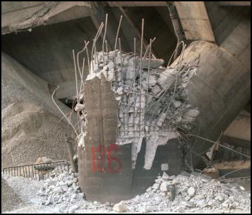
leaning building at Kobe in 1995 due
to liquification of soil
Most earthquakes occur along cracks in the earth called faults. Some fault are nice neat lines that are visible from planes and outer space. Other are more complex, resembling a shattered or cracked window. Faults visible from the sky easy to locate. Others are less obvious and require some defective work to locate.
The heaviest concentrations of faults are found in places where tectonic plates meet. Along major faults, tectonic plates moves at rate of about eight or nine feet a century, or 1.3 inches a year, which is roughly about the same speed as fingernail growth.
If the movement of tectonic plates or block of earth along faults was steady and smooth earthquakes would not occur. But that is not what happens. Friction keeps the plates together until enough pressure builds up to cause the plates to suddenly lurch. When this happens energy that causes earthquakes is released.
If a small segment of a tectonic plate moves an earthquake with a magnitude of less than 6 occurs. When a large segment, or several small segments rupture, a major earthquake over 7 often occurs. Similar process are taking place with blocks of earth along smaller fault in the general area of where the tectonic plates meet.
Many earthquakes occur along subduction zone, where oceanic plates meet continental plates. Here the denser ocean plate pushes beneath the continental plate. The constant movement and pressure causes earthquakes. Earthquakes also occur along extension zones, where the crust is stretched by subduction. They have also been caused by volcanic eruptions, atomic bob blasts and even dynamite blasted from geological exploration.
For centuries scholars and thinkers have speculated about their causes and mechanisms of earthquakes. Aristotle likened them to the Earth passing gas while the Japanese speculated they were caused by a giant fish wriggling under the Earth’s surface.
See Separate Articles EARTHQUAKES: GEOLOGY, FREQUENCY, TYPES, ENERGY AND RESEARCH factsanddetails.com ; EARTHQUAKE DAMAGE AND EARTHQUAKE-RESISTANT BUILDINGS factsanddetails.com ; EARTHQUAKE SAFETY AND SURVIVAL factsanddetails.com ; TSUNAMIS: CAUSES, PHYSICS AND DANGERS factsanddetails.com
Good Websites and Sources: U.S. Geological Survey (USGS) National Earthquake Information Center earthquake.usgs.gov ; Wikipedia article on Earthquakes Wikipedia ; Earthquake severity pubs.usgs.gov ; Collection of Images from Historic Earthquakes Pacific Earthquake Engineering Research Center, Jan Kozak Collection ; World Earthquake Map iris.edu/seismon Most Recent Earthquakes earthquake.usgs.gov ; Earthquake Pamphlet pubs.usgs.gov ; USGS Earthquakes for Kids earthquake.usgs.gov/learn/kids ; Earthquake Preparedness and Safety Surviving an Earthquake edu4hazards.org ; Earthquake Preparedness Guide earthquakepreparednessguide.com ; Earthquake Safety Site earthquakecountry.info
Efforts to Understand Earthquake Causes
“How does a rupture go from an inch a year to 3,000 miles per hour in a few seconds?” asks Ross S. Stein, a geophysicist at the United States Geological Survey. Kenneth Chang wrote in the New York Times: “ No one knows. This gap in knowledge makes earthquake prediction a frustrating and chancy exercise, and complicates the effort to calculate the risk that a human construction like a water reservoir or a geothermal power plant could inadvertently set off a deadly quake. [Source: Kenneth Chang, New York Times, April 13, 2009]
“Geologists do not know how the pieces of the Earth’s crust that usually squeeze together tightly with high friction slip past each other smoothly during a large earthquake, as if sandpaper suddenly changed to Teflon. “It looks like friction is more a complicated beast than anyone would have imagined,” Dr. Stein said.
“A core dug up from the San Andreas fault in California revealed the presence of talc, which could be acting as a lubricant during an earthquake. But from one core, scientists cannot tell whether this is typical of rocks around earthquake faults. At a meeting of the Seismological Society of America in Monterey, Calif. In 2009, a lively debate continued about whether big earthquakes are fundamentally different from small earthquakes or whether a big earthquake is just a small earthquake that did not stop. If big earthquakes are different, then it might be possible to detect them in the first few seconds of seismic waves and send out a warning. People would not have time to evacuate, but they might have enough time before the heaviest shaking to move to a safer location in a doorway or under a desk.
Tidal Forces and Rainwater May Trigger Earthquakes

Kobe 1995 Scientists at the National Research Institute for Earth Science in Japan have uncovered a correlation between the occurrences of earthquakes and lunar and solar tidal forces that occurred in Indonesia before the powerful 2004 earthquake and tsunami, suggesting that the pull of the sun or the moon could have provided just enough force to be the tipping factor that generated the powerful earthquake.
Brooks Hays of UPI wrote: After analyzing the sources and patterns of fluids flowing through the Alpine Fault in New Zealand's Southern Alps, researchers determined that rainwater may play a role in triggering fault slips and earthquake ruptures. "Large, continental-scale faults can cause catastrophic earthquakes, but the trigger mechanisms for major seismic events are not well known," lead researcher Catriona Menzies, an Earth and ocean scientist at the University of Southampton, said in a news release. "Geologists have long suspected that deep groundwaters may be important for the initiation of earthquakes as these fluids can weaken the fault zones by increasing pressures or through chemical reactions." [Source: Brooks Hays, UPI, April 27, 2016]
Chemical analysis of the flux of geothermal fluids and mineral veins along the Alpine Fault suggest both deep-lying fluids from the mantle and rainwater meet in the rocky channels. "Fluids are important in controlling the evolution of faults between earthquake ruptures," Menzies explained. "Chemical reactions may alter the strength and permeability of rocks, and if enough fluid is present at sufficiently high pressures they may aid earthquake rupture by 'pumping up' the fault zone."
Like California's San Andreas Fault, New Zealand's Alpine Fault is significant strike-slip fault capable of producing massive earthquakes. It hasn't ruptured since the year 1717, which means it's due rather soon. The latest research, detailed in the journal Earth and Planetary Science Letters, shows the fault serves as both a barrier to and an escape route for fluids. Lateral movement of precipitation and runoff down the mountain slopes is impeded by the fault line, while geothermal fluids from below use the fault as a vertical channel to rise toward the surface. When these two fluids meet, they can put extra strain on the fault.
Human Activity and Earthquakes
There us strong evidence that human activity can set off earthquakes. Reservoirs, for example, are believed to have induced some earthquakes. Kenneth Chang wrote in the New York Times: “Most seismologists believe that a magnitude 6.5 earthquake in India in 1967 that killed about 200 people was set off by the weight of water in a reservoir that had been filled a few years earlier. A reservoir cannot generate an earthquake by itself, but it can act as a trigger to release accumulated tectonic stresses and hasten an earthquake by years or centuries. [Source: Kenneth Chang, New York Times, April 13, 2009]
“More controversial is the assertion by some scientists that a magnitude 7.9 earthquake in Sichuan province in China last year that killed about 80,000 people was set off by the 320 million tons of water in a nearby reservoir. Leonardo Seeber, a research scientist at the Lamont-Doherty Earth Observatory at Columbia University, is not sure about the Sichuan earthquake, but he believes that scientists and officials need to take more account of the risk of induced earthquakes.
“For example, Dr. Seeber wonders whether a swarm of magnitude 4 earthquakes a couple of weeks ago around the Salton Sea in Southern California, close to one end of the San Andreas, might have been caused in part by a nearby geothermal power plant. Extraction of oil from the ground may have set off other earthquakes, Dr. Seeber said. In the coming years, the proposed strategy to reduce global warming by capturing carbon dioxide from power plants and pumping it into the ground could create new earthquake risks.”
Human-Made Earthquakes and Fracking

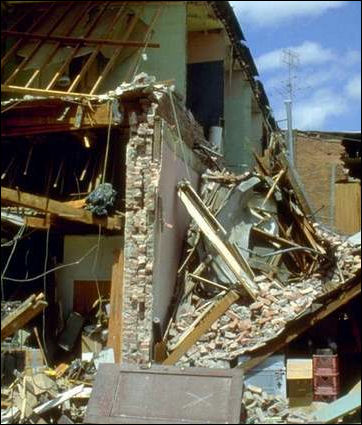
Adobe structure destroyed
by an earthquakeDeborah Zabarenko of Reuters wrote: “The number of earthquakes in the central United States rose "spectacularly" near where oil and gas drillers disposed of wastewater underground, a process that may have caused geologic faults to slip, U.S. government geologists report.The average number of earthquakes of magnitude 3 or greater in the U.S. midcontinent - an area that includes Arkansas, Colorado, Oklahoma, New Mexico and Texas - increased to six times the 20th century average last year, scientists at the U.S. Geological Survey said in an abstract of their research. [Source: Deborah Zabarenko, Reuters, April 17, 2012]
“The abstract does not explicitly link rising earthquake activity to fracking - known formally as hydraulic fracturing - that involves pumping water and chemicals into underground rock formations to extract natural gas and oil. But the wastewater generated by fracking and other extraction processes may play a role in causing geologic faults to slip, causing earthquakes, the report suggests. "A remarkable increase in the rate of (magnitude 3) and greater earthquakes is currently in progress," the authors wrote in a brief work summary to be discussed Wednesday at a San Diego meeting of the Seismological Society of America. "While the seismicity rate changes described here are almost certainly manmade, it remains to be determined how they are related to either changes in extraction methodologies or the rate of oil and gas production," the abstract said.
“From 1970 through 2000, the rate of magnitude 3 or greater quakes was 21 plus or minus 7.6 each year, according to USGS figures. Between 2001 and 2008, that increased to 29 plus or minus 3.5.But the next three years saw the numbers increase "much more spectacularly," said Arthur McGarr, of the geologic survey's Earthquake Science Center in California: 2009 had 50, 2010 had 87 and 2011 had 134 such events. "We don't know why, but we doubt that it's a natural process, because in nature, the only time you see such a big increase is during an aftershock sequence (with a series of quakes) or in a volcanic setting where you often get swarms of earthquakes due to magmatic activity," McGarr said by telephone.
“When swarms of quakes occurred in Colorado and Oklahoma last year, the U.S. Environmental Protection Agency asked the geologic survey to investigate possible links to energy extraction in the area.Among other sites, they examined an August 2011 earthquake centered around Trinidad, Colorado, near the New Mexico border, that registered a magnitude of 5.3, said McGarr, a co-author of the abstract. That quake "turned out to be really close to two of the highest injection volume waste water disposal wells in the field," McGarr said. "So that gives us quite a strong hint that these earthquakes are being triggered by these wastewater disposal facilities." There were different responses on either side of the Colorado-New Mexico line, he said. New Mexico, where the policy was to inject all wastewater underground, experienced more earthquakes than Colorado, where some wastewater is disposed at the surface.
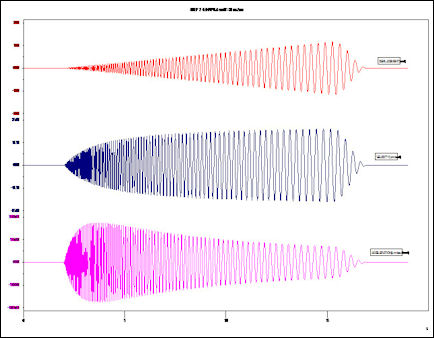
“The disposal of wastewater underground, called injection, has long been known to have the potential to cause earthquakes, the Interior Department said in a blog post here . What is new is the ability to precisely locate earthquakes of magnitude 3 or greater (magnitude 3 is recognized as the threshhold for detection) and a signature shape of the waves on a seismogram indicating a shallow quake, McGarr said. Human-induced quakes are typically quite shallow, he said.
Geothermal Energy Projects and Earthquakes
Kenneth Chang wrote in the New York Times: “While prediction remains elusive, scientists have learned that human activity can set off an earthquake. In December 2006, a geothermal energy project in Basel, Switzerland, started injecting water three miles into the ground. Some tiny tremors were expected, but the water was shut off when one of the quakes reached a still minor magnitude of 2.7. A few hours later, a larger quake, at magnitude 3.4, shook Basel, causing minor damage to buildings.[Source: Kenneth Chang, New York Times, April 13, 2009]
“A couple of months later, there were two more magnitude 3 earthquakes. Researchers at the Swiss Federal Institute of Technology in Zurich calculate that the area will experience a slightly greater number of small earthquakes over the next 20 to 40 years as a result of the brief geothermal project, which remains halted. The worry is that one of these small earthquakes could cascade into a big earthquake like the one that badly damaged Basel in 1356. Conversely, the small earthquakes could instead be relieving stress along a fault, reducing the likelihood of a larger quake. “With the current knowledge, I can’t really tell you,” said Jochen Woessner, one of the Swiss scientists. Around the same the U.S. Energy Department was “scrutinizing a project in Northern California run by AltaRock Energy to determine if it is safe.”
A geothermal energy project in the small Landau in Der Pfalz, Germany in August 2009 is widely believed to have set off an earthquake that shok buildings and frightening many residents. The New York Times reported: The geothermal plant, built by Geox, a German energy company, extracts heat by drilling deep into the earth. Advocates of the method say that it could greatly reduce the world’s dependence on fossil fuels by providing a vast supply of renewable energy.” [Source: Nicholas Kulish and James Glanz, New York Times, September 10, 2009]
“Like other earthquakes that have been attributed to geothermal plants, the Landau temblor was sudden and brief and was accompanied by a sound that in some cases has been likened to a sonic boom. There were no injuries and there was no known structural damage to buildings in the city. But the 2.7 magnitude quake has stoked fears and set off debate in the state Parliament, which subsidized the construction of the plant, about the method’s safety. The police logged as many as 200 calls after the quake, which struck shortly after 2 p.m. on Aug. 15. Stefanie Schuster was at the local supermarket when she heard a loud bang. She said she wavered unsteadily on her feet “like when you feel dizzy.” “My first thought was the geothermal plant,” said Mrs. Schuster, 48, a clerk in the city government. “I thought, There’s definitely a problem over there.”
Seismologists at the geological survey said that the larger Aug. 15 quake was also caused by the project. The epicenter was roughly 500 yards from a drill site at the plant and at about the same depth — 1.5 miles — as a steam bed that the plant was extracting heat from. “We are sure it’s from the geothermal plant,” said Harald Ehses, chairman of the geological survey.
The Landau plant, which cost $30 million, went into operation in 2007 and produces electricity for 6,000 homes by drawing heat from beneath the bedrock, nearly two miles beneath the earth’s surface. Geox said a coal-burning plant producing the same electricity would emit 30,000 tons of carbon dioxide annually. Not everyone in town was troubled by the quake. “It’s really not such a big deal,” said Volker Weisenburger, 43. “Gas has its own set of risks.” But other residents said they were skeptical about the new technology. “The engineers always say that they have everything under control, until something happens that they never expected,” said Sabine Hofmann, 47, who lives near the plant.
Earthquake Prediction

San Fransisco earthquake in 1906
Earthquakes are more likely to happen in seismically active areas that have not had an earthquake for a while. Geologists can predict with some accuracy that there is certain possibility that an earthquake will occur in a general area within a period of years of decades but can not say with any accuracy when and exactly where it will occur.
To anticipate, predict and prepare for earthquakes, scientist rely heavily on data from past events. Much of earthquakes forecasting involves taking elaborate maps of fault zones and make forecast of the probability of an earthquakes occurring in a certain place within a certain number of years.
Scientists in California and Japan have figured out ways to get a few seconds warning of an earthquake by detecting fast-moving P-waves before the destructive S-waves arrive. Sixty kilometers away from the epicenter this can translate to a 20 second warning, enough for people to take actions which could save their lives. The Japanese have developed a tremor-detection system that sends out data to the media and other sources once the P-waves have been detected.
Theoretically every major earthquake should be preceded by small "foreshocks," but these small shocks are usually so small they are difficult to distinguish from background seismic "noise." Plus, for every small tremor that is followed by a big quake, hundreds of others are not followed by any such thing. [Source: Time]
Efforts to Predict Earthquakes
As a rule efforts to predict earthquakes have been largely fruitless. It is not known whether they can be predicted. Comets have traditionally been regarded harbingers of earthquakes. Before earthquakes animals have burst out of barns and run out of houses. Some scientists may be due to the fact that they are sensitive to static electricity in the air.
A team led Vladimir Kellis-Borko, a geophysicist at UCLA, predicted earthquakes in San Simeoen and Hokkaido Japan in the second half of 2003 looking at chains of minor earthquakes and comparing them with the earthquake history of a specific area. By examining clusters of these quakes in a five year period he was able to predict the likelihood of a major earthquake in an area within five months.
Animals and Earthquake Prediction
The idea that animals can detect earthquakes before they happen dates back to ancient times, with references to unusual animal behavior before quakes as early as the 4th century B.C. USGS geologist Susan Hough wrote in Washington Post: Being generally squat, four-legged, close to the ground and inclined to sit still, an animal might feel an initial weak shaking that goes unnoticed by humans until stronger waves arrive. But also, it is an example of a natural human tendency to look back in time for anomalies, or precursors, that supposedly heralded the coming quake. Every pet owner understands that, say, cats and dogs sometimes behave strangely for no apparent reason; that’s what cats and dogs do. And if an earthquake had not subsequently struck, you can bet we would not be talking about strange animal behavior this week — because we wouldn’t have noticed anything out of the ordinary. As far as we understand, animals, like humans, have no ability to predict earthquakes. [Source: Susan Hough, Washington Post, August 26, 2011]
In July 2005, scientists wrote in the Geographic Society Bulletin that had found a shelled amoeba that can help predict earthquakes. Evidence based on examination of core samples from the time that major earthquakes took place suggests that the amoeba changes in certain shallow coastal areas five to 10 years before a megathrust earthquake takes place. The amoebas seemed to change in response to slight elevation and saltwater changes along the coast that took place years before the major earthquake.
Can Radon Releases Predict Earthquakes

Seismograms Kenneth Chang wrote in the New York Times: “In March 2009, Giampaolo Giuliani, a technician who works on a neutrino experiment at the Gran Sasso National Laboratory in Italy, issued an urgent warning that a large earthquake was about to strike the Abruzzo region. Kenneth Chang wrote in the New York Times: “The prediction was based on measurements he had made of high levels of radon gas, presumably released from rocks that were being ground up by the stresses of an incipient quake. On April 6, a magnitude 6.3 earthquake hit L’Aquila in central Italy, killing almost 300 people. Mr. Giuliani claimed vindication for his prediction, which had been discounted by officials. [Source: Kenneth Chang, New York Times, April 13, 2009]
“But earthquake experts like Dr. Stein are skeptical. Scientists studied radon as a possible earthquake warning signal as far back as the 1970s, and while they found convincing cases of radon releases before some earthquakes — for example, levels of radon in groundwater were 10 times normal before the earthquake that hit Kobe, Japan, in 1995 — the correlations were not strong enough or clear enough for useful predictions.
“One instance of confusing radon signals occurred in 1979. Two detectors in Southern California, 20 miles apart, measured unusually high levels of radon beginning in the summer. The radon levels then decreased in October, shortly before three earthquakes struck. One earthquake, of magnitude 6.6, occurred 180 miles to the southeast, and the two smaller ones, of magnitudes 4.1 and 4.2, were 40 miles away. In addition, a radon detector close to one of the smaller quakes did not observe high radon levels, although it did observe a radon drop a few days earlier.
“That left scientists puzzled about how they could construct a prediction out of the rising and falling radon levels. Data on other gases like carbon dioxide and on electromagnetic emissions that have sometimes been detected before earthquakes are also confusing. “You can’t hang your hat on it unless it’s a reliable precursor and it happens before most earthquakes and it doesn’t happen at other times,” said Susan Hough, a seismologist at the geological survey.
To complicate matters, Mr. Giuliani’s prediction was off in time and place. He had predicted that the quake would hit a week earlier in a town 30 miles away. Had officials acted on his prediction, said Richard M. Allen, a professor of geophysics at the University of California, Berkeley, “you would have evacuated the wrong town and you would have evacuated the wrong town at the wrong time.”
Image Sources: Mostly Earthquake Research Institute, University of Tokyo (Japan pictures), USGS (non-Japan pictures) except Tokyo 1923 (J.B. Macelwane Archives, St. Louis University) and Kobe 1995 (Kobe University). Also Wikimedia Commons
Text Sources: New York Times, Washington Post, Los Angeles Times, Daily Yomiuri, Times of London, Japan National Tourist Organization (JNTO), National Geographic, The New Yorker, Time, Newsweek, Reuters, AP, Lonely Planet Guides, Compton’s Encyclopedia and various books and other publications.
Last updated April 2022
