YANGTZE RIVER
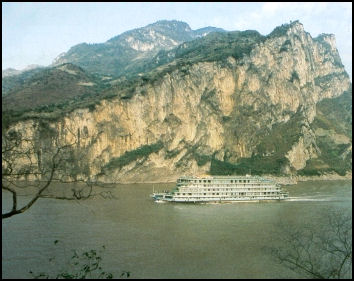
The Yangtze River is the longest and busiest river in Asia, the longest river in the world that flows entirely within one country. and the third longest river in the world after the Nile and the Amazon. Extending for 6,380 kilometers (3,964 miles), it is the sixth-largest river in the world in terms of the amount of water discharged into the sea (behind the Amazon, Congo, Ganges-Padma, Orinoco and Madiera. The Yangtze releases 8 million gallons into the East China Sea every second. The average discharge is 30,166 cubic meters a second (1,065,300 cubic feet a second) with a minimum of 2,000 cubic meters a second (71,000 cubic feet a second) and a maximum of 110,000 cubic meters a second (3,900,000 cubic feet a second )
Rising on the Tibetan Plateau, it flows through the heart of the country, draining an area of 1.8 million square kilometers before emptying into the East China Sea. The people who live along its middle and lower reaches cultivate a great rice- and wheat-producing area. The Chinese call the Yangtze by the names Chang Liang ("Long River") and Jinsha Jiang ("Gold Sands River") and use the name Yangtze only to describe the Lower Yangtze or the section of the river near the mouth. Yangtze (also spelled Yangzi) means "child of the ocean." The name likely comes from an ancient ferry crossing called Yangzi or Yangzijin. Europeans who arrived in the Yangtze River Delta region used Yangtze thinking the name applied to the whole river.
More than 250 million people live along or near the Yangtze itself. Some of the people that live on the river itself get around on one of the 250 different kind or river craft ply the Yangtze's waters, including sampans (three-plankers), wubans (five plankers) and junks. In the old days, floating restaurants and hotels and luxury junks outfit with stages gave acrobatic and opera performances in towns along the river. Sichuan boatmen used to travel downriver in disposable boats that were dismantled and sold as building material, making the treacherous run journey upriver unnecessary.
Websites: Wikipedia Wikipedia Books : Single Pebble by Jon Hersey and River Town: Two Years on the Yangtze by Peter Hessler (HarperCollins, 2001).
Importance of the Yangtze River
The Yangtze is China's most important waterway. It is navigable over much of its length and has a vast hydroelectric potential.According to Bloomberg:The Yangtze River Economic Belt is home to more than 40 percent of China’s population (about 600 million people) and accounts for almost 50 percent of export value and 45 percent of gross domestic product, according to China Water Risk. [Source: Anjani Trivedi, Bloomberg, August 28, 2020]
The Yangtze River Watershed encompasses 700,000 square miles (20 percent of China's total land area), encompasses 700 tributaries and accounts for 35 percent of China's total fresh water resources. It carries three-fourths of China's internal waterway commercial, irrigates more than a third of China's agricultural output and produces 40 percent of the nation grain, 25 percent of its rice, 30 percent of its cotton, 48 percent of its freshwater fish and 40 percent of China's total industrial output. Flooded fields produce as many as three crops a year (two of rice and one of wheat) and every bit of land is used. Even the narrow dikes that divide the rice paddies are planted with sugarcane and mulberry trees.
Around 200 million more people live in the Yangtze watershed than live in the entire United States. Put another way, it represents 35 percent of all Chinese, or nearly 8 percent of all the people in the world. On its own, the region could be the third-largest economy in the world.
Route of the Yangtze River
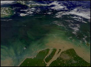
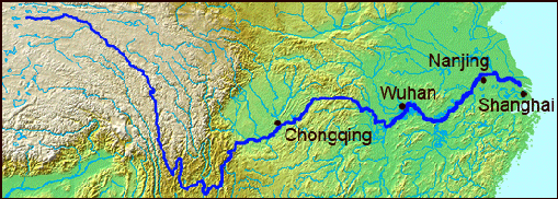
The Yangtze flows 6,380 kilometers (3,964 miles) from its source, 21,700 feet up in the Kunlun mountains on the Tibetan Plateau, to the East China Sea near Shanghai. It drops spectacularly off the Tibetan plateau, and descends almost 3,050 meters in its first 1,000 kilometers, separated by massive ridges from the Mekong and Salween Rivers.
The Yangtze generally flows in an easterly direction across central and eastern China to the East China Sea. After it drops it drops from the Tibetan plateau, the river passes through five spectacular canyons, nine province, literally dividing China in half between north and south. The headwaters of the Yangtze are situated at an elevation of about 4,900 meters (16,100 feet). In its descent to sea level, the river falls to an altitude of 305 meters (1,001 feet) at Yibin, Sichuan, the head of navigation for riverboats, and to 192 meters (630 feet) at Chongqing (Chungking). Between Chongqing and Yichang (I-ch'ang), at an altitude of 40 meters (130 feet) and a distance of about 320 kilometers (200 miles), it passes through the spectacular Yangtze Gorges, which are noted for their natural beauty but are dangerous to shipping.
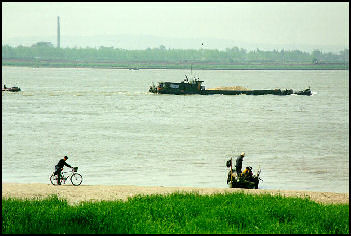
After reaching the large city of Chongqing, the Yangtze wanders through a massive alluvial plain and is navigable by large ships. Wuhan, 1,000 kilometers (600 miles) inland, is one of the river's major ports. Hankow, Hanyang and Wuchang are also important ports. The mouth at Yangtze Kiang, where the Yangtze empties into the sea, is 48 to 64 kilometers (30 to 40 miles wide). Nanjing lies on the edge of the Yangtze delta. Suzhou Creek, which connects the Yangtze to Shanghai, is 20 kilometers (12 miles upstream from the mouth. In this area the river is filled with passenger and cargo ships, fishing vessels, huge timber rafts, junks and sampans. A network of canals, including the Grand Canal, links the Yangtze to Beijing and other major Chinese cities.
Ancient Lower Yangtze Cultures
Archaeologists now believe that the Yangtze River region was just as much of a birthplace of Chinese culture and civilization as the Yellow River basin. Various cultures flourished in the regions surrounding the mouth of the Yangze River, where later the states of Wu and Yue would thrive. These culture progressed through a number of stages. The latest phase, called the Liangzhu culture, and is dated to 3500-2000. [Source: Robert Eno, Indiana University indiana.edu /+/ ]
Along the Yangtze archeologists have discovered thousands of items of pottery, porcelain, polished stone tools and axes, elaborately carved jade rings, bracelets and necklaces that date back to at least 6000 B.C. Neolthic residents of the Lower Yangtze are said to have differed physically from inhabitants of the Yellow River sites to the north. Scholars view the Hemudu Culture as a source of the proto-Austronesian cultures. [Source: Wikipedia +]
The main Lower Kuahuqiao sites (minimum number of sites, distribution area, approximate date BP and B.C.): 1) Shangshan (10, Upper Qiantang valley 11,000–8500 B.P. 9050–6550 B.C." 2) Kuahuqiao (5, Upper to lower Qiantang valley, More than 8000–7000 BP, 6050–5050 B.C." 3) Hemudu and Majiabang (70 Hemudu sites concentrated in the Ningshao Plain; Majiabang sites distributed around Lake Tai. 7000–5800 BP, 5050–3850 B.C." 4) Songze (30, Mostly on the Hangjiahu Plain, 5700–5300 BP, 3750–3350 B.C." Liangzhu (300, mostly on the Hangjiahu Plain, 5200–4300 BP, 3250–2350 B.C.. [Source: “The Kuahuqiao Site and Culture” by Leping Jiang, A Companion to Chinese Archaeology, Edited by Anne P. Underhill, Blackwell Publishing Ltd., 2013 thirdworld.nl ~|~]
Human activity has been verified in the Three Gorges area of the Yangtze River as far back as 27,000 years ago, and by the 5th millennium B.C., the lower Yangtze was a major population center occupied by the Hemudu and Majiabang cultures, both among the earliest cultivators of rice. By the 3rd millennium B.C., the successor Liangzhu culture showed evidence of influence from the Longshan peoples of the North China Plain. A study of Liangzhu remains found a high prevalence of haplogroup O1, linking it to Austronesian and Daic populations. [Source: Wikipedia]
The climate in the Lower Yangtze 5000 to 4000 years ago was warm and humid, typical of a mid subtropical zone climate, with the temperature was two to three degrees higher than today. The land was covered by lush growth of evergreen chinquapin and big leave trees. Along with the expanding of the Yangtze River delta towards the sea, the area became farther from the seaside with many lakes and ponds. There many water plants and fruits on the trees all year around. Many big and medium mammals including tigers, elephants, alligators and rhinoceros, in the forests and swamps. Small animals, birds and fishes provided plentiful sources of food.
See Separate Articles: KUAHUQIAO AND SHANGSHAN: THE OLDEST LOWER YANGTZE CULTURES AND THE SOURCE OF THE WORLD’S FIRST DOMESTICATED RICE factsanddetails.com ; HEMUDU, LIANGZHU AND MAJIABANG: CHINA’S LOWER YANGTZE NEOLITHIC CULTURES factsanddetails.com
Route of Yangtze River
Marco Polo on Yangtze River Traffic
Marco Polo (1254-1324) was amazed at the boat traffic on the Yangtze River. He claimed to have seen no fewer than 15,000 vessels at one city on the river, and said other towns had even more: You must know that when you leave the city of Yanju, after going 15 miles south-east, you come to a city called SINJU, of no great size, but possessing a very great amount of shipping and trade... And you must know that this city stands on the greatest river in the world, the name of which is KIAN [Yangzi]... This it is that brings so much trade to the city we are speaking of; for on the waters of that river merchandize is perpetually coming and going, from and to the various parts of the world, enriching the city, and bringing a great revenue to the Great Kaan. [Source: Marco Polo and Rustichello of Pisa, “Book Second, Part III, Chapter LXXI: Concerning the City of Sinju and the Great River Kian," in “The Book of Ser Marco Polo: The Venetian Concerning Kingdoms and Marvels of the East," translated and edited by Colonel Sir Henry Yule, Volume 2 (London: John Murray, 1903). This book is in the public domain and can be read online at Project Gutenberg. Chapter LXXI begins on page 167 of this online text /]
“And I assure you this river flows so far and traverses so many countries and cities that in good sooth there pass and repass on its waters a great number of vessels, and more wealth and merchandize than on all the rivers and all the seas of Christendom put together! It seems indeed more like a Sea than a River. Messer Marco Polo said that he once beheld at that city 15,000 vessels at one time. And you may judge, if this city, of no great size, has such a number, how many must there be altogether, considering that on the banks of this river there are more than sixteen provinces and more than 200 great cities, besides towns and villages, all possessing vessels?” /
Trackers
Trackers were laborers that pulled boats through the gorges. Chinese junks are outfit with ropes and harnesses so that people on board the boat can pull it when the junk is traveling upstream or into a headwind. Children often perform this task as if they were mules. If a tailwind doesn't kick up they may have to do this for hours or even days. Up until the 8th century A.D. paddle wheel river boats were powered by human-powered cage wheels
Large boats used be pulled upstream on the Yangtze by teams of hundred of laborers known as trackers, who strapped to the boats with long ropes. In the Three Gorges you can still see footpaths used by trackers — until the 1950s, when engineers blasted treacherous rocks out of the river — to get through areas where the river is sided by steep cliffs.
Trackers still pull vessels up tributaries of the Yangtze. They often haul ropes far ahead of the boats and are given instructions by drum beats of varying rhythms. Large junks were are sometimes movers forward by 400 or more trackers, assisted by strong swimmers who loosen the ropes if they get caught on rocks.
The trackers were often whipped. "Often our men have to climb like monkeys," a Yangtze River traveler wrote, "and their backs are lashed by two chiefs to urge them to work at critical moments." Little wrote the one saw a tracker chief leap in the water and roll in the sand until a monstrous creature and then did a dance, howled and whipped his trackers."
Trackers In his book Through The Yoon Toon Gorge. English trader Archibald Little wrote: "The trackers mark time with their cry, swinging their arms to and fro at each short step, their bodies bent forward, so their finger almost touch the ground...Eighty or a hundred men make a tremendous noise at this work, almost drowning out the sound of the rapids, and so often a half a dozen junks' crews are towing like this, one behind the other. from this solemn stillness of the gorge to the lively commotion of a rapid, the contrast is most startling."
In his book A Single Pebble, John Hersey wrote: "I turned to watch the trackers...making many tons of cypress go uphill on a fiercely resisting roadway of water. It was a moving sight — horribly depressing to see more than 300 human beings reduced to the level of work animals, blind-folded asses and oxen; yet thrilling too, to see the inestimable force of their cooperation for the 350 cloth shoes of their each step up the slope were planted in the same moment, and the great sad trackers's cries 'Ayah!' were sung in great unison of agony and joy and the junks did move."
Describing barefoot trackers in the 1970s, Paul Theroux wrote, I saw "five men leaping onto the shore with tow lines around their waists. They ran ahead, then jerked like dogs on a leash, and immediately began towing the junk against the current...They strained, leaning forward, and almost imperceptively the sixty-foot junk begins to move upstream. There is no level footpath. The trackers are rock climbers; they scamper from boulder to boulder, moving higher until the boulders give out, and then dropping down, pulling and climbing until there is a stretch where the junk can sail. The only difference ...between trackers long ago and trackers today is that they are no longer whipped."
Yangtze River Pollution
According to report by the Chinese Academy of Science released in April 2007 the Yangtze is seriously and largely irreversibly polluted. More than 600 kilometers and almost 30 percent of the major tributaries are in critical condition. In 2002, Beijing announced it was going to spend US$5 billion to clean up the river but the river remains as polluted as ever.
The Yangtze River is polluted with 40 million tons of industrial and sewage waste. Half of China's 20,000 petrochemical factories lie on its banks. About 40 percent of all waste water produced in China — about 25 billion tons — flows into the Yangtze, of which only about 20 percent is treated beforehand.
The pollution has taken its toll on aquatic life. Deformities to fish such as one or no eyes and misshapen skeletons and decreasing numbers of rare wild Chinese sturgeon in the Yangtze have been blamed on a paint chemical widely used in Chinese industry. The Chinese sturgeon has been around for 140 million years. It grows very slowly and was among the first class of animals to be protected in China. Harvests of aquatic life from the river declined from 427,000 tons in the 1950s to 100,000 tons in the 1990s. The Yangtze is in danger of becoming a “dead river” unable to sustain marine life or provide drinking water.
See Separate Article ALLIGATORS, RIVER DOLPHINS, GIANT SALAMANDERS IN CHINA factsanddetails.com
Yangtze Floods
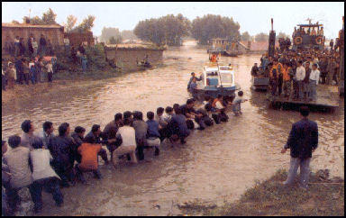
The Yangtze River frequently overflows its banks and fills huge plains with large amounts of water, causing catastrophic flooding. There are floods every year during the June-to-September monsoon season. On average at least several hundred people are killed in Yangtze River floods every year. Some years there are devastating floods.
The Yangtze is responsible for 70 to 75 percent of China's floods. Floods on the river in the 20th century alone have killed more than 300,000 people. There were catastrophic floods on the Yangtze in 1931, 1935 and 1954 and 1998. Over 2,000 are believed to have died in the flood of 1991. Some 4,100 died in the floods in 1998.
In 1931, 140,000 people were drowned when Yangtze dikes gave way. A Yangtze River flood in 1954 killed 30,000 people outright and perhaps an additional 200,000 through starvation and disease. One villager who lived through it told the Washington Post, "The corpses were put in coffins but they could not be buried. They were just stacked up." The Three Gorges Dam has reduced flood risks in the middle stretch of the river but the risks of flooding remains high on the lower stretches.
In 1996, there were large floods on the Huai River in Anhui province. Flood waters turned hilltop villages into islands; left pig and chickens on rooftops; and caused one lake to exceed its shore by five kilometers. A similar flood occurred in 1991. In the summer 1999, monsoon floods caused by the overflowing upper and middle Yangtze, left at least 400 dead and 1.84 million homeless. More than 66 million people were affected.
In the summer of 1998, the Yangtze experienced its worst floods in 44 years. More than 4,100 people were killed, 13.8 million were left homeless and 240 million people (a number equal to the entire population of the United States) were affected directly by the rising waters.
The floods submerged 21 million acres of land, affected 53 million acres and destroyed 11 million acres of crops. More than 5.8 million houses were destroyed. Dikes were blown up in Jianli County to save Wuhan, a city of seven million people 150 miles upstream. Even so waters reached waist level in downtown Wuhan.
Some people were evacuated on short notice and lost most of their possessions. Some tied their stuff in trees above the flood water because they couldn't carry them. Soldiers and police were called in to evacuate a half million people, keep order, prevent looting and stop the flooding. Dramatic footage was shown on Chinese television of soldiers risking their lives to reach from trees to pluck victims from the raging waters and working hard to shore up dikes with sandbags.
Severe rainfall was the main cause of the floods but man-induced factors included deforestation of erosion-subverting forests in the Yangtze river basin and other areas also contributed to the disaster. Rain water absorbed by forests and vegetation flows more slowly to rivers and streams, preventing flooding.
Other problems included the inhabitation of vulnerable flood plains by large numbers of people (550,000 people were evacuated from an area in which 170,000 were evacuated in 1954); the silting up and development of lakes that previously absorbed flood waters; and the neglect of dikes. In 1980, US$1.2 billion was earmarked for dike improvement. But by 1987, only US$48 million had been spent. Some of the money was diverted to the Three Gorges Dam project. After the 1998 floods, dikes were reinforced at considerable expense and hundreds of thousands of people that lived near the banks were forced to relocate.
Source of the Yangtze on the Tibet Plateau
The Tibetan Plateau is the source of several of the world's great rivers, including the Ganges, Indus, Brahmaputra, Mekong, Yangtze and Yellow River. In Tibet, the Yangtze river is known as the Jinsha. It marks the boundary between Tibet and Kham (a region of Tibet in Yunnan and Sichuan).
The Yangtze originates from several tributaries in the eastern part of the Tibetan Plateau, two of which are commonly referred to as the "source." Traditionally, the Chinese government has recognized the source as the Tuotuo tributary (33°25 44"N 91°10 57"E) at the base of a glacier lying on the west of Geladandong Mountain in the Tanggula Mountains. This is not the furthest source of the Yangtze, but is the highest source at 5,342 meters (17,526 feet) above sea level. [Source: Wikipedia]
The true source of the Yangtze — hydrologically the longest river distance from the sea — is at Jari Hill (32°36 14"N 94°30 44"E) at the head of the Dam Qu tributary, approximately 325 kilometers (202 miles) southeast of Geladandong. This source was only discovered in the late 20th century and lies in a wetlands area at and 5,170 meter (16,960 feet) above sea level just southeast of Chadan Township in Zadoi County, Yushu Prefecture, Qinghai. As the historical spiritual source of the Yangtze, the Geladandong source is still commonly referred to as the source of the Yangtze.
Other source tributaries include Tuotuo (Ulan Moron) River (33°23 40"N 90°53 46"E); Chumaer River (35°27 19"N 90°55 50"E); the Muluwusu River (33°22 13"N 91°10 29"E) and Bi Qu River (33°16 58"N 91°23 29"E). These tributaries join and the river then runs eastward through Qinghai (Tsinghai), turning southward down a deep valley at the border of Sichuan and Tibet to reach Yunnan. In the course of this valley, the river's elevation drops from above 5,000 meters (16,000 feet) to less than 1,000 meters (3,300 feet).The headwaters of the Yangtze are situated at an elevation of about 4,900 meters (16,100 feet).
Upper Yangtze and the Three Parallel Rivers in Yunnan
Upper Yangtze
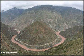
The Upper Yangtze flow through some of the roughest country in China, including some of the world's deepest valleys and gorges that are so steep and narrow, they funnel the Yangtze into a 200-meter-deep channel, making it the deepest river in the world. Many of the towns on the upper Yangtze are precipitously located on steep slopes. They have narrow streets that run parallel to the river and are connected by slick stone stairways that run perpendicular to the river. The Yangtze falls from an elevation of 5,200 meters to 2,500 meters in its first 1,000 kilometers.
Three Parallel Rivers in Yunnan was declared a UNESCO World Heritage Site in 2003. Here the upper reaches of three of Asia's mightiest rivers — the Yangtze, Mekong, and the Salween — flow parallel to one another within a 90-kilometer (55-mile) band, divided by high mountain ridges. The Yangtze river, known in this area as the Jinsha, marks the boundary between Tibet and Kham. The Mekong is known as the Lancang. The Salween is called the Nujiang or Nu. “Jiang” is the Chinese word for river. The area is stunningly beautiful but rarely visited because the terrain carved by the rivers is so severe and rugged.
See Three Parallel Rivers Under HIMALAYAN AND TIBETAN AREA OF YUNNAN factsanddetails.com ; CONTROVERSIAL DAMS IN TIBET, SICHUAN AND YUNNAN
Tiger Leaping Gorge and First Bend of Yangtze
Tiger Leaping Gorge (60 kilometers northwest of Lijiang) is one of the world's deepest gorges: the distance between the Yangtze River and the top of Jade Dragon Snow mountain above is 3,850 meters (12,000 feet). According to legend, a hunted tiger escaped certain death by leaping across the River of Golden Sands ("Jinsha Jiang"), wisely choosing the gorge's narrowest point. Hiking trails line the gorge, providing breathtaking views and awesome climbs. There is a popular two-or three-day, 28-kilometers in the gorge between the villages of Daju and Qiatou.
Most people do the hike in two days, walking 4-6 hours each day. There are upper, middle and lower sections to the hike. Hikers usually go as part of a tour or take the bus or get a group together for minibus to Qiatou (which is more difficult get back from than Daju) in the morning. They hike the first day to Walnut Grove, where there are a couple of small guesthouses, and then hike the next day to Daju, where you can catch a local bus or minibus to Lijiang. See the Lonely Plant guides for more details.
Tiger Leaping Gorge lies between the Jade Dragon Snow Mountain (Yulong Xueshan) and Haba Snow Mountain (Haba Xueshan). It is one of the deepest gorges in the world. A road has been carved into one side of Tiger Leaping Gorge for cars and buses. Work is being done on a road on the other side.
Travel Information: Best time to visit: May to July; Admission: 50 yuan for adults, 25 yuan for students
Website: Travel China Guide Travel China Guide ; Lonely Planet Lonely Planet
Shigu (60 kilometers from Lijiang) is located where the Yangtze makes a famous 90 degree turn. It is a charming town of mud brick and gray tile homes with towering slopes and mountains in the background. A drum-shaped white marble stele was erected in a hillock at the corner of the Jinsha River, hence the name Shigu(Stone Drum) Town. At the end of ancient Lianzi bridge is a small art gallery.
The Yangtze River runs across the Tibetan Plateau and enters Yunnan from its northwest, known as Jinsha River which flows through the high mountains and deep valleys of the Hengduan Mountains together with the Lancang River and Nujiang River. It takes a sharp turn northeastward at Shigu Town, Yulong County, Lijiang, forming a V-shape bend, known as the First Bend of the Yangtze River. The river in Shigu Ferry is wide and the water flows slowly good for boats across the river. It was a place of military strategic importance all through the ages. Boats leave twice a day for Tiger Leaping Gorge.
See Separate Article LIJIANG AND NORTHERN YUNNAN factsanddetails.com
Chongqing City and The Yangtze
Chongqing (on the Yangtze River, 1,600 kilometers west of Shanghai and 250 kilometers east-southeast of Chengdu) is dirty, industrial city of almost 16 million people. The starting point of many boat trips on the Yangtze River, it is located on the confluence of Jialing and Yangtze Rivers on the edge of the Three Gorges dam reservoir. It was the capital of Chiang Kai-shek's Nationalist government during World War II in part it was too far inland for Japanese bombers to reach. Even so it was heavily bombed.
Chongqing (known in the old days as Chungking) is listed as the third largest city in China after Shanghai and Beijing and ahead of Tianjin, Guangzhou, Shenzhen and Chengdu (the 4th, 5th, 6th and 7th largest cities in China). Chongqing is home to between 15.7 million to 18.4 million people depending on how the city is defined. Some say the urbanized area has a a population of only 7 or 8 million. The municipality is home to about 31 million people Chongqing is one of the nine national central cities in the People's Republic of China (PRC). Administratively, it is one of the PRC's four direct-controlled municipalities (the other three are Beijing, Shanghai and Tianjin), and the only such municipality in inland China. The core districts cover5,472.8 square kilometers (2,113.1 square miles).
The central urban area of Chongqing, or Chongqing proper, is unique for a city in that it has been built on mountains and is surrounded on three sides by the Yangtze and Jialing river, earning it the names "mountain city" and "city on rivers". At night it is quite spectacular when millions of lights in the city’s sloped are reflected in the rivers. Chonqing is famous for hot pot and is nicknamed the "furnace of the Yangtze".for its industrial activity and fiery food. it has an interesting old town with spectacular flights of stairs that wind up and down the mountains wedged between the two rivers. There are tall buildings, including one that looks the Chrysler building and a US$200 million opera house,
Chongqing city was built on a rock promontory at the confluence of the Yangtze and Chia-ling Rivers. It is situated at the transitional area between the Tibetan Plateau and the plain of the middle and lower reaches of the Yangtze River. Chongqing municipality slopes downward from north and south towards the Yangtze River valley, with sharp rises and falls. The Yangtze River runs through the whole area from west to east, covering 665 kilometers (413 miles) and piercing through the Wu Mountains. The Three Gorges of the Yangtze — Qutang, Wuxia and Xiling gorges — begins in Chongqing. The Jialing River joins the Yangtze in Chongqing after passing through the “Lesser Three Gorges."
Chongqing River Port is is one of the most important inland ports in China. Numerous luxury cruise ships and many not so luxurious ones depart from Chongqing, heading downstream along the Yangtze River to Yichang, Wuhan, Nanjing or Shanghai. There are also ones heading in the other direction. In the old days such boats were the primary mode of transportation. These days there are ordinary trains, fast trains and regular flights are river traffic has been greatly reduced or cancelled. Most of the river ferries and boats cater to tourists rather than provide transpor for locals. The construction of the Three Gorges Dam has made it easier for large boats to travel up the Yangtze as far as Chongqing and has allowed bulk transport of goods on the Yangtze River. Coal, raw minerals and containerized goods provide the majority of traffic plying this section of the river.
See Separate Article CHONGQING: THE YANGTZE, RED HISTORY AND FANTASTIC KARST SCENERY factsanddetails.com
Three Gorges
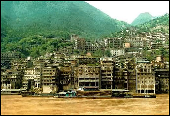
The Three Gorges (downriver from Chongqing between Fengjie, Sichuan and Yichang, Hubei) is one of China's five premier tourist sights along with the Great Wall, the Forbidden City, Xian and Guilin. The gorges have recently filled up with water and become part of the reservoir behind the Three Gorges Dam. The scenery is not as spectacular as it once was but is still pretty good.
Extending for almost 200 kilometers, the Three Rivers Gorge is a channel of rock cut through towering mountains by the Yangtze River. What makes the area so incredible is the height of the limestone mountains, the steepness of the cliffs, and the narrowness of the river. In some places the cliffs are 800 meters high. In other places, there are fantastic rock towers and crags with ferns, plants and trees growing on ledges and in cracks. In the distance are green mountains. Along the slopes are farmers tending small plots. Along some of the cliffs are waterfalls and 2000-year-old “hanging coffins." On the shores are some dirty industrial towns.
Through much of the gorges, there is no shore or place for a boat to go except down river. In the narrower portions of the gorges the water used to move with alarming speed but has now been smoothed out by the Three Gorges Dam. In other places, the water has always been calm and sailboats can actually be pushed upstream by powerful winds that gain force where the gorge narrows.
The most famous gorges are just below Bai De ("White King City") and the lesser gorges are just above Yichang. The Three Gorges themselves are: Wu (the deepest gorge), Xiling (the longest gorge) and Qutang (only five miles long but regarded the most beautiful of the three gorges). According to legend they were created by the goddess Yao Ji to redirect the Yangtze around the petrified remains of a dozen dragons she had slain for tormenting peasants.
Yangtze Gorges Scenic Spot: was nominated to be a UNESCO World Heritage site in. 2001. According to a report submitted to UNESCO: “According to a report submitted to UNESCO: The Yangtze Gorges is one of the first key national scenic spots (in 1982). They start at Baidicheng in Fengjie County, Chongqing and end at Nanjin Pass in Yichang, Hubei Province. The gorges themselves are 193 kilometers long and cover an area of 1208 square kilometers, including Wuxia gorge, Qutang gorge, Xiling gorge and some wide valleys between these gorges. Qutang Gorge is 8 kilometers long and is celebrated for its magnificent, peculiar and precipitous scenery in the world; Wuxia Gorge is 42 kilometers long and is serene and secluded and presents a panorama of lovely scenery; and Xiling Gorge is 66 kilometers long and is well-known for its dangerous rugged shoals and the turbulent waters. [Source: National Commission of the People's Republic of China]
“ The history of the scenic spots and historical sites in the Three Gorges area can go back to ancient times and it recorded many stirring historical deeds. The mountains and water in Three Gorges are in various postures and are a mysterious natural gallery. The Three Gorges has become world-famous for its large and precipitous valleys and rich historical and cultural intentions. They can be for sightseeing, sport, exploration, archaeological studies and scientific investigation. In 1985 the Three Gorges Scenic Spot was appraised as one of China’s ten scenic spots, and in 1989, both the Three Gorges of Yangtze River and the Lesser Three Gorges of Daninghe River won the title of China’s 40 best scenic spots.”
See Separate Article THREE GORGES OF THE YANGTZE RIVER AND THREE GORGES DAM factsanddetails.com
Three Gorges Boat Trips
Three Gorges Boat Trips are how most tourists visit the Three Gorges area. Some of the boats are in good condition and tourist have had a wonderful time. Others have broken plumbing, sagging beds, shabby cabins, poor maintenance and rats, and tourists have an awful time. If you are worried about getting stuck on bad boat you are advised to make your travel arrangements with a reputable tour operator like Victoria Cruises (Tel: 1-800-348-8084), Viking River Cruises (Tel: 1-800-706-1483); and Uniworld Grand River Cruises (Tel: 1- 800-257-2407)
Most of the downstream cruises begin in Chongqing. Passengers usually disembark at Yichang or Wushan, but some continue downriver 1,500 miles to Shanghai. The high season months are April, May, September and October. The shoulder season months are March, June, July, August and November. During the winter, the views are often veiled by mists. The rates for trip with reputable tour company run between US$100 and US$150 a day.
The Three Gorges has been diminished by the dam but not affected too much. Boats that ran along the river expect to continue working on the lake. Mountains that towered 2,600 to 3,600 feet above the water will be 2,100 feet to 3,100 feet above the water instead. The cliffs are still impressive in many places but the once raging currents have been tamed and the water is now calm. Dizzing footpaths that had ben carved into the cliffs have been submerged. Websites: Travel China Guide Travel China Guide
Yangtze River Cruise Chinese-Style
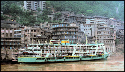
One traveler wrote in the China Daily: “There's a proverb that says, "You haven't been anywhere until you've traveled the Yangtze"... The river's largest port, in Chongqing, is the departure point for our trip.... We take a boat for domestic tourists rather than one of the swanky crafts favored by most foreigners. These include the recently launched MS Yangzi Explorer, which has all the facilities of a five-star hotel, including movie theater, espresso bar and fitness center. We reason this is a holiday away from the treadmill and there will be more local color on the good ship Hainei Guanguang 10. We are not disappointed. [Source: China Daily, May 14, 2009]
“After a bit of haggling near the city port, where the Jialing River flows into the Yangtze, we pay 580 yuan (US$85) each for a two days-and-nights cruise. This compares with US$3,900 for the Explorer. The boat is set to sail at 10:15pm and the agency boss arrives at our hotel with a "bang-bang man" to carry our luggage. These migrant workers earn a living by transporting heavy goods with just a bamboo pole. Our porter is gaunt and short but carries our luggage at a clip and arrives by the quayside before we do. Guilt makes us generous and we pay him 50 yuan (US$7). Not bad for 15 minutes of work.
“Our second-class accommodation is sparse but reasonably clean, with four bunk beds and a large window, the sort fitted in old-style Beijing apartments. No amount of perfume can disguise the smell emanating from the hole that passes as a toilet, despite my mother's best efforts. There are four decks above water and a couple below, where the accommodations are decidedly spartan and close to the ship's engines.
“On time, we slip our moorings, drift into the shipping lane and watch the dazzling nightlights of Chongqing fade into a memory. Meanwhile, our ship's captain creates a kind of son et lumiere experience by shining a searchlight on the far bank and sounding his foghorn.Early next morning we are between Fengdu and Zhongxian. The scenery has changed from industrial to post-industrial (beached, rusting ships) and farmland. There's no fan or air conditioning and although the cabin window is open as far as it can go the atmosphere is muggy, which drives everyone up for air onto the decks. The mist clears and there's a scent of honeysuckle, which is grown for its medicinal properties. Families stake out territories by sitting in a circle on the prow and pass around steamed buns for breakfast. Someone commandeers a small plastic chair and scans the bank with binoculars. Most passengers seem content to enjoy the scenery, talk or read.
“Though the ferry picks up and deposits passengers en route we do not have time for sight-seeing. This might have been a mistake. There is an abundance of interesting stopover points, we are told, among them the "ghost city" of Fengdu; Wanxian's night market; historic temples in Fengjie; and the Qu Yuan Shrine in Zigui. We stop for a couple of hours in one port and an army of surveyors comes on board with tape measures. We halt again at a floating station for gasoline. Nevertheless, we're content and there's plenty to see not just from the boat, but also on it. We take the occasional stroll below-decks where, in the absence of organized entertainment, there are long games of cards in smoky cabins. Relaxation is key. The majority of our fellow travelers wear flip-flops, pajamas and T-shirts rolled up to expose belly buttons. As for dining, it's best to take your own supplies, otherwise you'll be buying pot noodles at the shop, or experiencing galley food, a diet of rice and vegetables seasoned with pickles and washed down with beer.
“After another night we're in the Three Gorges, an approximately 192 kilometers stretch of scenic beauty comprising Qutang, Wu and Xiling gorges. There's fresh excitement at this juncture and every other passenger becomes a photographer-even if all they have is a phone. They snap towering limestone cliffs and point out the famous peaks. The river here is sometimes more like a lake, with islands in the middle inhabited by farmers. They tend orange groves, herb gardens and golden rape fields. The blossoms of spring and the falling leaves of autumn makes these the ideal seasons for a cruise. Summer is too hot and winter, too cold. We arrive early afternoon in Yichang, which used to be known as "Gateway to the Gorge", but is now as much a stopping off point for visits to the Three Gorges Dam. We could go further, downstream to Wuhan, scene of the Battle of Red Cliffs, to Nanjing and Shanghai. But we have had enough of adventure and it's good to be back on terra firma.”
Three Gorges Dam
The Three Gorges Dam (near Yichang in Hubei Province) has been called China's most ambitious project since the Great Wall and the world's largest construction job. Comprised of one massive dam and several smaller dams, it is the world's largest hydroelectric project and is named after the Three Gorges of the Yangtze River, one of China's great natural wonders, which the reservoirs behind the dams will partly submerge. [Source: Arthur Zich, National Geographic, September 1997]
The Three Gorges Dam is a cement dam that is 186 meters (610 feet) high and runs for 1.3 miles (2.3 kilometers) across the Yangtze River. It contains twenty-six 400-ton turbines, the world's largest. The reservoir produced by dam is 370 miles long (600 kilometers), about the same length as Lake Superior. A total of 200 miles of canyons with spectacular limestone formations were submerged when the Three Gorges Dam is completed in 2009. Three Gorges Dam is five times wider than Hoover dam and is as tall as a 60 story building. Large ships bypass the dam via two five-stage locks that raise or lower the ships 500 feet. Smaller vessels will be moved up and down on a ship elevator.
Three Gorges is the world's largest dam in terms of water displacement, flood control; and power generation. There are higher and wider dams but none come close to producing as much electricity — 18,200 megawatts, enough energy to supply 10 percent of China's electricity needs and the equivalent of the electricity produced by 18 nuclear power plants. The electrical generating capacity of the world's next four largest dams are 12,600 megawatts by Itaipú in Brazil, 10,300 megawatts by Guri in Venezuela, 6,809 by Grand Coulee in the U.S., and 6,400 in Sayano-Shushensk in Russia.
The Three Gorges Dam project may be the world's last such project because big dams are becoming increasingly unpopular. Most Chinese support the project as a way of bringing development and progress to China. Many international groups have opposed it on environmental and humanitarian grounds. The World Bank was originally supposed to provide loans to help finance the project and relocate people but changed its policy due to pressure from the United States and environmental and human rights groups.
Three Gorges Dam is not only the world's largest but also the costliest hydropower project ever undertaken. When it was approved in 1992, its cost was estimated at $8.3 billion. According to official figures, the venture cost China about $23 billion, but outside experts estimate it may have cost double that amount. Some have said it may have cost as much $88 billion. Most put the coast at around $30 billion.
The Three Gorges Dam may be the world's largest producer of renewable energy. It holds back, 10.3 trillion gallons of water. It has a capacity of 18,200 megawatts of electricity. The huge dam is meeting the government's goal of producing pollution-free electric power, the government said, generating 84 billion kilowatt-hours of electricity in 2010. But in the process of its construction 1,350 villages were submerged and 1.3 million people displaced from their homes.
In November 2009 the there were plans to fill the reservoir behind Three Gorges Dam to maximum height of 175 meters, representing the completion of the project but when the water level reached 171 meters filling the reservoir was abruptly stopped, according to the Chinese government, because of lack of water coming from upstream and worries about droughts downstream. The magazine Caijing reported the stoppage may also had something to do with warnings that rising waters were increasing landslide pressures as the soil around the dam became saturated and unsettled.
See Separate Article THREE GORGES DAM: BENIFITS, PROBLEMS AND COSTS factsanddetails.com
Yangtze After Three River Gorge
Yangtze After Three River Gorge is only 12 meters feet above sea level. Here the river broadens in some areas to a width of over a mile and becomes one of the world's busiest waterways. The pollution here is terrible, and it is not unusual to see corpses floating down the river. Before the river finally reaches the East China Sea, near Shanghai, it passes the Grand Canal. In this area many canals are linked to the Yangtze.
Yichang (down river from the Three Gorges Dam in Hubei Province) is the terminus of many Three Gorges river trips and the closest city to the Three Gorges Dam. It boasts a new bridge over the Yangtze.
Hanging Coffins (in Zigui Count, 30 kilometers west of Yichang) are an ancient funeral custom of some ethnic groups, especially the Bo people of southern China. Coffins of various shapes were mostly carved from one whole piece of wood. Hanging coffins either lie on beams projecting outward from vertical faces such as mountains, are placed in caves in the face of cliffs, or sit on natural rock projections on mountain faces. It was said that the hanging coffins could prevent bodies from being taken by beasts and also bless the soul eternally. Spiritually, the Bo people viewed the mountain cliffs as a stairway to heaven and believed that by placing the coffins up high the deceased would be closer to heaven. A practical reason for placing the coffins on cliffs includes isolation, so that they are hard for animals to reach and less vulnerable to destruction.” [Source: Wikipedia]
Yangtze in Wuhan
Yangtze at Wuhan
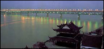
The two major river of Hubei Province — the Yangtze (Jiang River) and its left tributary Hanshui — meet in Wuhan. The Yangtze River enters Hubei from the west from via the Three Gorges. The Hanshui enters the province from the northwest. After crossing most of the province, the two great rivers meet at Wuhan. The Wuhan metropolitan area consists of three parts — Wuchang, Hankou, and Hanyang — which face each other across the rivers and are linked by bridges. Linking Snake Hill to Wuhan is the mile-long Yangtze River Bridge, the first steel bridge built across the mighty Yangtze. This is one of the first modern bridges in China and is known as the "First Bridge".
One traveler wrote for Xinhua: “The Yangtze River is one of Wuhan's most well-known hallmarks and has lured travelers for centuries....With the Yangtze River's mystique, visitors often imagine a picturesque and serene river flowing rapidly by, but they may be disappointed by the slow moving river... Revered as the cradle of Chinese civilization, one can almost feel the mighty river's history as it meanders through the city just as it has for thousands of years. Locals will tell you that there are two ways to experience the river's greatness, walking its banks or crossing its broad body by ferry. I chose the latter. Feeling the breeze through my hair, smelling the freshness of the waters, I looked toward the horizon where the sky and the waters seem to meet, dreaming of one day swimming in the river. [Source: Xinhua, May 13, 2009]
Another traveler wrote in the China Daily: “On my second night in Wuhan, we took a boat trip on the Yangtze River. As we cruised the river, a thick fog fell over it. With the banks blocked from sight, I felt like we were floating on a sea. I looked up and was taken aback to see some twinkling red objects floating across the sky. My first thought: UFOs? [Source: China Daily April 30, 2009]
“ In fact, they were hot-air balloons named Kongming Lanterns, my tour guide told me. This also has a colorful story behind it that dates to the Three Kingdom period. When the Chancellor of Shu Kingdom, Zhuge Kongming, the greatest strategist of those times, found himself surrounded by his enemy, he made a lantern and released it in a bid to seek help. Today, it has become a tradition for local people to write their wishes on the lanterns and release them into the sky, praying their dreams come true.
“As the fog cleared, the riverbanks came into plain view. The lights from the pubs and bars dotting the riverside twinkled in the night and young people walking in the riverside park let their lanterns soar into the sky. Feeling the cool breeze on board the ship, the romantic Wuhan spring night felt like a dreamlike wonderland.”
Wuhu (in Anhui Province, 60 kilometers up river from Nanjing) is the home Chery, the Chinese car maker with ambitions of making it big in the United States. The city had 700,000 people in the early 2000s but was growing fast as car parts suppliers and auto-related businesses have began sprouting up. Wuhu sits in the east bank of the Yangtze. In 1876 it was declared a city where the British could engage in trade. The British responded by quickly opening a opium processing plant. In 1992, during the Deng era, Wuhu was declared a free trade city, Web Sites: Travel China Guide Budget Accommodation: Check Lonely Planet books;
See Separate Article WUHAN AND HUBEI PROVINCE factsanddetails.com
Yangtze Delta
Yangtze at Nanjing
Yangtze Delta is 320 kilometers (200 miles) wide and covers an area of 358,000 square kilometers). It is laced with canals, streams and rivers and dotted with lakes and reservoirs. Shanghai is on the southern side of it and Nanjing is on the west side and kind of marks its beginning. The delta was originally a wetland then a rich agricultural area and now is being developed very quickly and is heavily industrialized. Some Chinese geographers claim that the Yangtze River Delta is the most productive agricultural land in the world, and getting more productive all the time as new paddy soil is created — or at least it was like that before the Three Gorges Dam deprived it of silt and causing it to shrink .
The Yangtze Delta — which is located primarily in Jiangsu and Zhejiang Provinces and Shanghai — is one of China's primary economic and industrial engines. People here are known for working hard, producing all kinds of products and making money. In recent years prosperity has begun to spread up river. On businessman in Chongqing, told the Wall Street Journal that "The Yangtze River area can be Asia's next dragon." The Yangtze corridor now has China's largest concentration of industry, accounting for more than a quarter of the country growth. Incomes are increasing at a rate of 20 percent a year.
Nanjing lies near the Yangtze delta. Suzhou Creek, which connects the Yangtze to Shanghai, is 12 miles upstream from the mouth. In this area the river is filled with passenger and cargo ships, fishing vessels, huge timber rafts, junks and sampans. A network of canals, including the Grand Canal, links the Yangtze to Beijing and other major Chinese cities.
Shanghai, the southern part of Jiangsu Province, the northern part of Zhejiang Province, the eastern part of Anhui Province, Nanjing, Wuxi, Changzhou, Suzhou, Nantong, Yangzhou, Zhenjiang, Yancheng, Taizhou, Jiangsu, Hangzhou, Ningbo, Wenzhou, Huzhou, Jiaxing, Shaoxing, Jinhua, Zhoushan, Taizhou, Hefei and Wuhu all lie within the Yangtze Delta. Since the fourth century, when the national capital was moved to Jiankang (present-day Nanjing) at the start of the Eastern Jin dynasty (A.D. 317–420), the Yangtze Delta has been a major cultural, economic, and political centre of China. Hangzhou served as the Chinese capital during the Southern Song dynasty (1127–1279), and Nanjing was the early capital of the Ming dynasty (1368–1644) before the Yongle Emperor moved the capital to Beijing in 1421.
The Yangtze delta has few protected areas left. In some places there are cities, In others there are factories. Places that have been urbanized or industrialized are full of fish farms and vegetable fields. Areas that are filled with reeds also have roads and trucks that are used to carry the reeds out. Since 2003, when the Three Gorges Dam began operating, the Yangtze River delta front has experienced severe erosion and significant sediment coarsening. Yangtze-River-derived sediments do not really disperse across the East China Sea continental shelf; rather they form elongated distal subaqueous mud wedge (up to 60 meters thick and about 800 kilometers long that extends from the Yangtze River mouth southward off the Zhejiang and Fujian coasts into the Taiwan Strait. Yancheng Reserve in the Yangtze Delta is home to red-crowned cranes, reed parrotbills. Oriental storks and the world's last 2,000 or so black-faced spoonbills. Web Site: Wikipedia Wikipedia
Cixi is a thriving municipality in the Yangtze Delta In 2007 it boasted exports of US$4 billion from 20,000 private companies and only one state-owned company. Jonathan Franzen wrote in The New Yorker, “So many locals own or manage factories that resident population is nearly equaled by the population of migrant workers who do the ordinary jobs." The “wetland parks” set up in a former area of reeds and swamps of the Yangtze Delta and largely devoid of bird life.
Water Towns of Jiangsu and Zhejiang Provinces
Roughly in between Suzhou in Jiangsu Province in the north and Hangzhou in Zhejiang Province in the south there are about 200 small towns in the the Yangtze Delta connected by a web of canals. The main products have traditionally been silk and grain that were moved around on the water. In towns such as Wuzen many people still live in traditional houses that face the water and are connected by small stone bridges that cross the canals and streets paved with stone slabs. People get around in car-size, bamboo-roofed boats powered by a single oar connected to a stick.
Many of the towns declined in te 20th century but have been revived in recent years in part to make them tourist attractions. Seven of the towns — including Wuzhen, Nanxun, Huzhou and Mudu — have been singled out for their beauty and charm. Nanxun is the home of Lius, a wealthy family that made their fortune in the silk trade and built a private library with 600,000 volumes, flanked by a lovely garden called “Little Lotus." Huzhou (near Naxun) is known for the East-meets-West architecture of the villas where the town's rich lived. Worth checking are the imported stained glass and the European-style dance hall.
See Separate Articles: WATER TOWNS OF JIANGSU AND ZHEJIANG PROVINCES factsanddetails.com JIANGSU PROVINCE factsanddetails.com ZHEJIANG PROVINCE factsanddetails.com
Image Sources: Wikimedia Commons
Text Sources: CNTO (China National Tourist Organization), China.org, UNESCO, reports submitted to UNESCO, Wikipedia, Lonely Planet guides, New York Times, Washington Post, Los Angeles Times, National Geographic, China Daily, Xinhua, Global Times, The New Yorker, Time, Newsweek, Bloomberg, Reuters, Associated Press, AFP, Compton's Encyclopedia and various books and other publications.
Updated in July 2020
