
TIBET, GLACIERS AND WATER
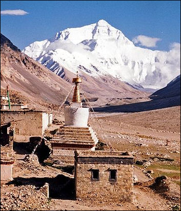
Everest from Rombok Gompa,Tibet With an average elevation of around 4,570 meters (15,000 feet), the Tibetan Plateau, is the world's highest and largest plateau, encompassing an area greater than western Europe. The vast amount of water stored in Tibetan and Himalayan glaciers play a crucial role in river flows, hydropower generation and agriculture in the Ganges, Yangtze, Mekong and Indus river systems in Asia and elsewhere.
Brook Larmer wrote in National Geographic, “With nearly 37,000 glaciers on the Chinese side alone, the Tibetan Plateau and its surrounding arc of mountains contain the largest volume of ice outside the polar regions. This ice gives birth to Asia's largest and most legendary rivers, from the Yangtze and the Yellow to the Mekong and the Ganges — rivers that over the course of history have nurtured civilizations, inspired religions, and sustained ecosystems. Today they are lifelines for some of Asia's most densely settled areas, from the arid plains of Pakistan to the thirsty metropolises of northern China 3,000 miles away. All told, some two billion people in more than a dozen countries — nearly a third of the world's population — depend on rivers fed by the snow and ice of the plateau region. [Source: Brook Larmer, National Geographic, April 2010]
“For thousands of years the glaciers have formed what Lonnie Thompson, a glaciologist at Ohio State University, calls "Asia's freshwater bank account" — an immense storehouse whose buildup of new ice and snow (deposits) has historically offset its annual runoff (withdrawals). Glacial melt plays its most vital role before and after the rainy season, when it supplies a greater portion of the flow in every river from the Yangtze (which irrigates more than half of China's rice) to the Ganges and the Indus (key to the agricultural heartlands of India and Pakistan).”
RELATED ARTICLES:
MOUNTAIN GLACIERS AND GLOBAL WARMING factsanddetails.com
CLIMATE CHANGE AND MELTING GLACIERS IN THE HIMALAYAS factsanddetails.com;
GLACIERS: TYPES, MECHANICS, TERMS factsanddetails.com
GLACIER COMPONENTS FEATURES AND LANDFORMSfactsanddetails.com
ALPINE GLACIERS: GEOLOGY, FEATURES AND IMPORTANCE OF THEIR WATER factsanddetails.com
ICE AGES AND ICE AGE GLACIERS factsanddetails.com
DANGEROUS AND DESTRUCTIVE GLACIAL EVENTS: TUYAS, FLOODS, SUDDEN OUTBURSTS factsanddetails.com
HIMALAYAN GLACIERS: IMPORTANCE, AVALANCHES AND DANGEROUS FLOODS factsanddetails.com;
AVALANCHES factsanddetails.com;
STUDYING GLACIERS: ICE CORES, TOUGH EXPEDITIONS AND SCIENTISTS factsanddetails.com
MOUNTAINS: TYPES, GEOLOGICAL FEATURES, FORMATION, MEASURING THEM factsanddetails.com;
HIMALAYAS: HISTORY, GEOLOGY AND HIGH PEAKS factsanddetails.com
Tibet and Climate Change
Brook Larmer wrote in National Geographic, “For all its seeming might and immutability, this geologic expanse is more vulnerable to climate change than almost anywhere else on Earth. The Tibetan Plateau as a whole is heating up twice as fast as the global average of 1.3̊F over the past century — and in some places even faster. These warming rates, unprecedented for at least two millennia, are merciless on the glaciers, whose rare confluence of high altitudes and low latitudes make them especially sensitive to shifts in climate.” [Source: Brook Larmer, National Geographic, April 2010]
“Natural mechanisms for sequestering atmospheric carbon dioxide are being overwhelmed by the burning of fossil fuels — coal, oil and natural gas. There is more carbon dioxide in the atmosphere today than at any time during at least the past 650,000 years, based on analyses of the chemical composition of air bubbles entrapped in Antarctic ice over that time. By the end of this century, carbon dioxide levels could easily double, and many scientists expect climate change to disrupt regional weather patterns — including the Asian monsoon.”
The China Meteorological Administration calculates that temperatures on the plateau have risen an average of 0.58 degrees Fahrenheit per decade, more than four times the average warming rate in China as a whole. "A plateau is almost like a frying pan in the sky. It has to do with the way the land interacts with the atmosphere. Everywhere in the world, the mountains are heating up faster than the lowlands," said Barry Baker, a climate change expert with the Nature Conservancy, who is also studying the glaciers in Yunnan province. [Source: Barbara Demick, Los Angeles Times, December 15, 2009]
Impact of Climate Change on Tibet
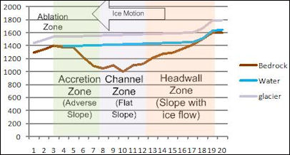
glacier overdeepening processClimate change is being blamed for unusual heat waves in Tibet. In 1998, Lhasa had its warmest June on record. The temperatures exceeded 77 degrees F for 23 days. People who live in the Himalayas say the sun is much stronger now than it used to be and say it snows less in the winter and the snow stays on the ground less time. By some estimates The plateau has lost 10 percent of its permafrost layer in the past decade.
The Qinghai-Tibet plateau has been warming faster than the global average with temperatures rising 0.16 degrees C per year. If the trend continues glaciers will recede significantly. The tjale — the 1.35 million square kilometer permafrost-like layer under the surface of the plateau — could thaw and be reduced by 60 percent by 2100. About 3,000 of the 4077 lakes in Qinghai Province’s Madoi County have disappeared. Large dune loom over some of the remaining ones.
There are indications that climate change could produce more precipitation in Tibet. In the past 40 years the average annual temperature in Nagqu prefecture — a 4,500-meter-high, 446,000 square kilometer on the Qinghai-Tibetan plateau that accounts for 37 percent of Tibet Autonomous Region — has risen 0.6 to 1.5 degrees C. Over the same period annual precipitation has nearly doubled from 78 millimeters to 150 millimeters.
In western Tibet-Qinghai there is a mysterious "ozone valley" that thus far scientists have been unable to explain.Brook Larmer wrote in National Geographic, “The grasslands are dying out, as decades of warming temperatures — exacerbated by overgrazing — turn prairie into desert. Watering holes are drying up, and now, instead of traveling a short distance to find summer grazing for their herds, Ba O and his family must trek more than 30 miles across the high plateau. Even there the grass is meager. "It used to grow so high you could lose a sheep in it," Ba O says. "Now it doesn't reach above their hooves." The family's herd has dwindled from 500 animals to 120. The next step seems inevitable: selling their remaining livestock and moving into a government resettlement camp.[Source: Brook Larmer, National Geographic, April 2010]
Melting Glaciers on the Tibetan Plateau
Glaciers in Tibet are disappearing at a rate of up to 7 percent a year. By some estimates in the past 50 years 82 percent of the Tibetan plateau’s glacier ice has melted. Brook Larmer wrote in National Geographic, “Of the 680 glaciers Chinese scientists monitor closely on the Tibetan Plateau, 95 percent are shedding more ice than they're adding, with the heaviest losses on its southern and eastern edges. "These glaciers are not simply retreating," Thompson says. "They're losing mass from the surface down." The ice cover in this portion of the plateau has shrunk more than 6 percent since the 1970s — and the damage is still greater in Tajikistan and northern India, with 35 percent and 20 percent declines respectively over the past five decades.” [Source: Brook Larmer, National Geographic, April 2010]
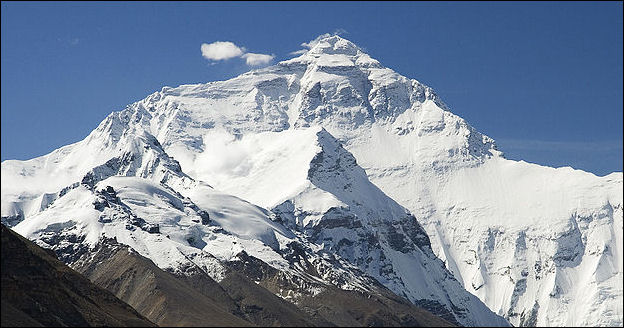
North Face of Everest toward Base Camp Tibet
Though scientists argue about the rate and cause of glacial retreat, most don't deny that it's happening. And they believe the worst may be yet to come. The more dark areas that are exposed by melting, the more sunlight is absorbed than reflected, causing temperatures to rise faster. (Some climatologists believe this warming feedback loop could intensify the Asian monsoon, triggering more violent storms and flooding in places such as Bangladesh and Myanmar.) If current trends hold, Chinese scientists believe that 40 percent of the plateau's glaciers could disappear by 2050. "Full-scale glacier shrinkage is inevitable," says Yao Tandong, a glaciologist at China's Institute of Tibetan Plateau Research. "And it will lead to ecological catastrophe."
Melting Himalayan Glaciers in China and Tibet
J. Madeleine Nash wrote in Smithsonian magazine, “In 2004, Chinese glaciologists published a survey of their country's 46,298 ice fields, the majority of which lie in Tibet. Compared with the 1960s, the area covered by glaciers shrank by more than 5 percent, and their volume by more than 7 percent, or more than 90 cubic miles. That much ice holds enough water to nearly fill Lake Erie. Moreover, the rate of ice loss is speeding up. Glaciers near 25,242-foot-high Naimona'nyi — the highest mountain in southwestern Tibet and the 34th highest in the world — are drawing back by eight million square feet per year, five times their rate of retraction in the 1970s”. [Source: J. Madeleine Nash, Smithsonian magazine, July 2007]
Barbara Demick wrote in the Los Angeles Times, “One of the fastest vanishing glaciers in the world is Mingyong glacier on Mt. Kawagebo, a sacred peak for Tibetan Buddhists. Out of religious sensitivity, scientists have not been permitted to work on the mountain. But through photographs they have observed that the tongue of the glacier — the farthest flung reach of snow — has retreated more than a mile and a half up the mountain.” [Source: Barbara Demick, Los Angeles Times, December 15, 2009]
Hiking up Kawagebo, Brook Larmer wrote in National Geographic, “A mile and a half up the gorge that Mingyong Glacier has carved into sacred Mount Kawagebo, looming 22,113 feet high in the clouds above. There's no sign of ice, just a river roiling with silt-laden melt. For more than a century, ever since its tongue lapped at the edge of Mingyong village, the glacier has retreated like a dying serpent recoiling into its lair. Its pace has accelerated over the past decade, to more than a football field every year — a distinctly unglacial rate for an ancient ice mass. [Source: Brook Larmer, National Geographic, April 2010]
"This all used to be ice ten years ago," Jia Son [a farmer] says, as he scrambles across the scree and brush. He points out a yak trail etched into the slope some 200 feet above the valley bottom. "The glacier sometimes used to cover that trail, so we had to lead our animals over the ice to get to the upper meadows." Around a bend in the river, the glacier's snout finally comes into view: It's a deathly shade of black, permeated with pulverized rock and dirt. The water from this ice, once so pure it served in rituals as a symbol of Buddha himself, is now too loaded with sediment for the villagers to drink. For nearly a mile the glacier's once smooth surface is ragged and cratered like the skin of a leper. There are glimpses of blue-green ice within the fissures, but the cracks themselves signal trouble. "The beast is sick and wasting away," Jia Son says. "If our sacred glacier cannot survive, how can we?"
Melting Himalayan Glaciers on Yulong Snow Mountain

Miao irrigation system “If you want to see a glacier melt with your bare eyes, try Yulong Snow Mountain, an 18,000-foot peak in southern China's Yunnan province,” Demick wrote. “On this early December morning, the mountain is etched against the technicolor sky in shades of gray — definitely more gray than white. Naked boulders of limestone and daubs of shrubbery protrude from the shallow snow cover. In the study of climate change, glaciers are sometimes likened to the canaries in the coal mine, and to many observers the condition of Yulong ("Jade Dragon") mountain is troubling. [Demick, Op. Cit]
He Yuanqing, one of China's leading glacier experts, found that the mountain's largest glacier, known as Baishui No. 1, has retreated about 275 yards since 1982. He told the Los Angeles Times, "At this rate, the glacier could disappear entirely over the next few decades," said He, who heads a team of scientists who have been studying Yulong mountain since 1999 for the Cold and Arid Regions Environmental and Engineering Research Institute, a government-run think tank.
When glaciers disappear, they don't necessarily go quietly. The ice becomes unstable; gentle slopes of snow erode into steep ridges that can collapse at unpredictable times. Yulong has had two such avalanches recently — one in 2004 and another over the summer. "There are so many cracks in the ice that it could become dangerous soon for us to continue our work on the mountain," said scientist Du, who is part of the team working at Yulong.
More than 1 million tourists, most of them Chinese, visit Yulong every year. Situated just outside the quaint tourist town of Lijiang and equipped with a cable car, Yulong has some of the most accessible glaciers in China. In the park leading to the mountain, administrators have put up signs aimed at educating the public about climate change. The scientific team studying the glacier also intends to build a research station near the mountain and to open an exhibit to help tourists understand why they should worry about melting glaciers.
"Of course I'm concerned that the glaciers are disappearing," said Ye Xiaochen, 47, a factory worker from Sichuan province who was wearing new hiking gear and carrying a Japanese camera on a tour of Lijiang. "It's not true that Chinese only care about the economy — the environment is equally important." To prove his point, he turned to a colleague and snapped, "Put out that cigarette — you're making more pollution."
Shrinking Glaciers in Xinjiang
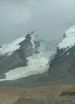
melting glacier in Xinjiang Glaciers in Xinjiang in far western China are shrinking at an alarming rate. About 80 percent of the glaciers in the Tian (Heaven) range have declined, though increased precipitation has also led a small number to expand. The 3,800-meter Urumqi No1 glacier, the first to be measured in China, has lost more than 20 percent of its volume since 1962, according to the Cold and Arid Regions Environmental and Engineering Research Institute (Careeri) in Lanzhou.[Source: Jonathan Watts, The Guardian, March 2, 2009]
“Xinjiang is particularly dependent on a steady supply of meltwater from glaciers, which act as solid reservoirs that store precipitation in the winter and release it in the summer,” Jonathan Watts, wrote in The Guardian, “Few city residents understand the problem because in recent years water supplies have surged thanks to the extra meltwater and increased rainfall. The excess supply has been used to water golf courses and make artificial snow for a ski slope in semi-desert Urumqi. But scientists say the glut is unsustainable because it comes from the release of water that has built up over thousands of years.”
“At the moment there is plenty of water in the big cities. But it is hard to say how long it will last,” He Yuanqing, a glaciologist at Careeri, told The Guardian. “On one hand, climate change is accelerating the melt. But on the other, it is increasing rainfall, so we need a way to store the extra water.”
Estimates of how long it will take Urumqi's glacial water supplies to start to decline range from 40 to 100 years. It is unclear, however, how long the water can be stored without replenishment. Experts have previously called for the reservoirs to be built underground so that the water does not evaporate in the summer, when Xinjiang has the highest average temperatures in China. Over-exploitation of river systems and oases has exacerbated the problem. The volume of water in the once vast Aibi lake in Xinjiang has decreased by two-thirds over the past 50 years, the Beijing News reported today.
Effects of Melting Glaciers and Climate Change on the Tibetan Plateau
Brook Larmer wrote in National Geographic, “The potential impacts extend far beyond the glaciers. On the Tibetan Plateau, especially its dry northern flank, people are already affected by a warmer climate. The grasslands and wetlands are deteriorating, and the permafrost that feeds them with spring and summer melt is retreating to higher elevations. Thousands of lakes have dried up. Desert now covers about one-sixth of the plateau, and in places sand dunes lap across the highlands like waves in a yellow sea. The herders who once thrived here are running out of options.” [Source: Brook Larmer, National Geographic, April 2010]
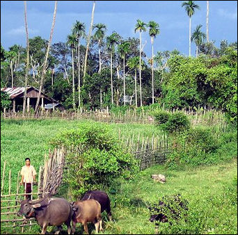
“Along the plateau's southern edge, by contrast, many communities are coping with too much water. In alpine villages like Mingyong, the glacial melt has swelled rivers, with welcome side effects: expanded croplands and longer growing seasons. But such benefits often hide deeper costs. In Mingyong, surging meltwater has carried away topsoil; elsewhere, excess runoff has been blamed for more frequent flooding and landslides. In the mountains from Pakistan to Bhutan, thousands of glacial lakes have formed, many potentially unstable. Among the more dangerous is Imja Tsho, at 16,400 feet on the trail to Nepal's Island Peak. Fifty years ago the lake didn't exist; today, swollen by melt, it is a mile long and 300 feet deep. If it ever burst through its loose wall of moraine, it would drown the Sherpa villages in the valley below.”
“This situation — too much water, too little water — captures, in miniature, the trajectory of the overall crisis. Even if melting glaciers provide an abundance of water in the short run, they portend a frightening endgame: the eventual depletion of Asia's greatest rivers. Nobody can predict exactly when the glacier retreat will translate into a sharp drop in runoff. Whether it happens in 10, 30, or 50 years depends on local conditions, but the collateral damage across the region could be devastating. Along with acute water and electricity shortages, experts predict a plunge in food production, widespread migration in the face of ecological changes, even conflicts between Asian powers.”
Artificial Glaciers, Rains Rockets and Capturing Water from Melting Glaciers
Beijing is using rockets and artillery to seed clouds with rain-inducing chemicals. In Madoi County in Qinghai Province the program is so intense during the summer that the blasts of artillery keep people awake at night. Authorities insist the program is working and increasing rain and replenishing glaciers. Locals say the rockets just anger the gods and perpetuate the drought.
Brook Larmer wrote in National Geographic, “In Ladakh, a bone-dry region in northern India and Pakistan that relies entirely on melting ice and snow, a retired civil engineer named Chewang Norphel has built "artificial glaciers"’simple stone embankments that trap and freeze glacial melt in the fall for use in the early spring growing season. Nepal is developing a remote monitoring system to gauge when glacial lakes are in danger of bursting, as well as the technology to drain them. Even in places facing destructive monsoonal flooding, such as Bangladesh, "floating schools" in the delta enable kids to continue their education — on boats.” [Source: Brook Larmer, National Geographic, April 2010]
“But nothing compares to the campaign in China, which has less water than Canada but 40 times more people. In the vast desert in the Xinjiang region, just north of the Tibetan Plateau, China aims to build 59 reservoirs to capture and save glacial runoff. Across Tibet, artillery batteries have been installed to launch rain-inducing silver iodide into the clouds. In Qinghai the government is blocking off degraded grasslands in hopes they can be nurtured back to health. In areas where grasslands have already turned to scrub desert, bales of wire fencing are rolled out over the last remnants of plant life to prevent them from blowing away.
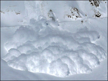
avalanche Rockets and artillery are used to seed clouds with rain-inducing chemicals. In Madoi County in Qinghai Province the program is so intense during the summer that the blasts of artillery keep people awake at night. Authorities insist the program is working and increasing rain and replenishing glaciers. Locals say the rockets just anger the gods and perpetuate the drought.
Due to concerns over the future water supply posed by climate change, China plans to create 59 reservoirs to collect meltwater from shrinking glaciers in Xinjiang province, home of some of the world’s highest peaks and widest ice fields. The 10-year engineering project, which aims to catch and store glacier run-off that might otherwise trickle away into the desert. [Source: Jonathan Watts, The Guardian, March 2, 2009] Behind the measure is a desire to adjust seasonal water levels and address longer-term concerns that downstream city residents will run out of drinking supplies once the glaciers in the Tian, Kunlun and Altai mountains disappear.
In the first phase, 29 reservoirs will be built with a combined capacity of 21.8 billion cubic meters of water, according to the Xinhua news agency. Funding of about $30 million a year for three years, staring in 2010, has been approved for the project. Wang Shijiang, director of Xinjiang Water Resource Department, told Xinhua that the mountain reservoir system was designed to “intercept” meltwater so that it could be used more efficiently for irrigation and to adjust for seasonal variations in rainfall.
Tibet's Permafrost Seems to Reduce CO2
In the Tibetan Plateau, climate change is increasing the carbon concentrations in the upper layers of permafrost soils, a study has shown. This represents a negative feedback to rising atmospheric CO2 concentrations, and could potentially slow the pace of climate change. According to the International Business Times: Permafrost soils are known to store large amounts of carbon. As temperature rise and permafrost thaws, some of this carbon is released into the atmosphere. However, the upper layers of the permafrost soils can also trap a certain amount of carbon. [Source: Léa Surugue, International Business Times, May 8, 2017]
"In these cold regions as it gets warmer, the vegetation grows more and that puts more carbon in the top layers of the soil. What we are concerned about is the carbon that is in the frozen permafrost, deeper in the soil. Whether or not you have a bigger emission of carbon depends on the balance between how much carbon is released from those deep soils when permafrost thaws versus how much enters at the top", permafrost expert Sarah Chadburn from the University of Exeter (who was not involved with the study) told IBTimes UK. "Our models tend to predict that more carbon is coming out but it is helpful to get precise measurements of carbon concentrations at the top of the soil to get a better idea of how the whole system affects climate change".
So far, the effects of warming on the balance of carbon uptake and loss in permafrost regions has remained unclear. More accurate measurements of carbon concentration in permafrost soils are needed. The study, published in the journal Nature Geoscience, is based on repeated soil carbon measurements at more than 100 sites in the Tibetan Plateau, taken in the early 2000s and early 2010s. "This study is particularly interesting because it's coming from an area that was underrepresented in the scientific literature in terms of studying the carbon balance associated with thawing permafrost", Vladimir Romanovsky, from the Permafrost Laboratory at the University of Alaska Fairbanks (who was not involved with the research) told IBTimes UK.
The study's authors report an accumulation of soil organic carbon in the uppermost 30cm of the permafrost soils over this decade – a period when temperatures kept rising in the Tibetan Plateau. The scientists hypothesise that this increase in carbon stocks is probably the result of climate change-related vegetation growth in the region. Their findings suggest that the upper layer of the permafrost represents a substantial regional carbon sink to rising atmospheric CO2 concentrations in a warning climate. As such, it could help offset carbon losses from the deeper thawing permafrost and slow the pace of climate change.
Its not clear whether the findings also apply to other regions. Chadburn commented: "The Tibetan Plateau is a bit different to other permafrost regions. Most regions are at higher latitudes, like the Arctic permafrost region, whereas the Tibet Plateau is Alpine mountain permafrost. It's much further south so it is a different kind of climate. We don't know if these findings could apply to other permafrost regions. But we need to do the same kind of studies in other areas because such measurements are really useful to understand the role of permafrost in furthering climate change".
Image Sources: Wikimedia Commons
Text Sources: New York Times, Washington Post, Los Angeles Times, Times of London, The Guardian, National Geographic, The New Yorker, Time, Newsweek, Reuters, AP, Lonely Planet Guides, Compton’s Encyclopedia and various books and other publications.
Last updated April 2022