HIGH MOUNTAINS IN THE EVEREST AREA
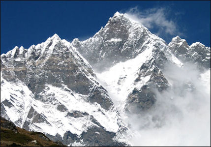
Lhotse, world's forth highest mountain
Nepal is home to eight of the world’s 10 highest mountains. There are more than 2,000 Himalayan peaks — 326 of them open to foreign climbers. Of the world’s 10 highest mountains, seven stand between Nepal and Tibet, including Mt. Everest. Altogether there are 13 peaks more than 8,000 meters (26,242 feet) high in Nepal. Eighteen exceed 7135 meters (24,000) feet, and more than 200 peaks exceed 6,400 meters (21,000 feet). This area often experiences intense geological activity, with nearly 50 major earthquakes between 1870 to 1996, and a devastating one in 2015..
Highest mountains in the world in the Himalayas on the Nepal-Tibet border:
1) Everest — 29,035 feet (8,850 meters). First climbed in 1953.
4) Lhotse I — 27,940 feet (8,516 meters). First climbed in 1956.
5) Makalu I — 27,766 feet (8,463 meters). First climbed in 1955.
6) Cho Oyu — 26,906 feet (8,201 meters). First climbed in 1954.
54) Gauri Sankar — 23,440 feet (7,145 meters).
The Mountain Region of Nepal (called Parbat in Nepali) is situated at 4,000 meters or more above sea level to the north of the Hill Region. The Mountain Region constitutes the central portion of the Himalayan range originating in the Pamirs, a high altitude region of Central Asia. Its natural landscape is legendary habitat of the mythical creature, the yeti, or abominable snowman.In general, the snow line occurs between 5,000 and 5,500 meters. The region is characterized by inclement climatic and rugged topographic conditions, and human habitation and economic activities are extremely limited and arduous. Indeed, the region is sparsely populated, and whatever farming activity exists is mostly confined to the low-lying valleys and the river basins, such as the upper Kali Gandaki Valley. [Source: Andrea Matles Savada, Library of Congress, 1991 *]
The Himalayan Region covers nearly 35 percent of the total of Nepal, and is formed by the Mahabharat, Churia, and Himalayan mountain ranges (from east to west), whose altitude increases as one moves north, culminating with at the Tibetan border with Mt. Everest. . In the early 1990s, pastoralism and trading were common economic activities among mountain dwellers. Because of their heavy dependence on herding and trading, transhumance was widely practiced. While the herders moved their goths (temporary animal shelters) in accordance with the seasonal climatic rhythms, traders also migrated seasonally between highlands and lowlands, buying and selling goods and commodities in order to generate muchneeded income and to secure food supplies.
The Mountain Region is one about 50 kilometers (30 miles) wide. Three principal rivers originate from glaciers and snow-fed lakes of the Himalayas. They flow southward through deep Himalayan gorges, and enter, respectively, the Karnali, Gandak, and Kosi basins. They eventually reach India, where they become tributaries — as is the case of all Nepalese rivers — of the Ganges.
Book: “Sivalaya” by Louis Baume, a book of facts about the world's 14 highest mountains.
Mahalangur Himal
Mt. Everest is located in the Mahalangur Himal sub-range of the Himalayas, which includes Mt. Everest, Lhotse, Makalu, and Cho Oyu — four of Earth's six highest peaks. On the Tibetan side the sub-range is drained by the Rongbuk and Kangshung Glaciers. On the Nepali side it is drained by Barun, Ngojumba and Khumbu Glaciers and a few others. All are tributaries to the Koshi River via the Arun River to the north and east, and Dudh Kosi to the south. The Koshi Rivers flows through Tibet, Nepal and India and winds near Kanchenjunga, the world’s third highest mountain through one of the deepest gorges in the world and eventually makes its way to rivers that empty into the Ganges. The Khumbu region of Nepal is the best known part of the Mahalangurs as it contains the most popular trekking and mountaineering (the South Col route) routes to Everest. [Source: Wikipedia]
The Mahalangur Himal can be divided into three subsections: 1) Makalu nearest the Arun River and along the Nepal-China border, with Makalu (8463 meters, 27,765 feet), Chomo Lonzo (7790 meters, 25,557 feet) south of the Kama valley in Tibet, Kangchungtse or Makalu II (7678 meters, 25,190 feet), Peak 7199 and some ten others over 6000 meters;
2) Barun inside Nepal and south of the Makalu section, with Chamlang (7319 meters, 24,012 feet) and Chamlang East (7235 meters, 23,736 feet), Peak 7316, Baruntse (7129 meters, 23,389 feet), Ama Dablam (6812 meters, 22349 feet) and about 17 others over 6000 meters;
3) Khumbu along the international border west of the Makalu section, with the Everest massif: Everest (8848 meters, 29,029 feet), Lhotse (8516 meters, 27,940 feet), Nuptse (7855 meters, 25,771 feet) and Changtse (7580 meters, 25,755 feet). West of Everest are Pumori (7161 meters, 23,494 feet) and Cho Oyu (8201 meters, 26,906 feet) with around 20 others over 7000 meters and 36 over 6000 meters.
Gyachung Kang is the world's 16th highest mountains. Just shy of being an eight-thousander, it is 7,897 meters ( 25,910 feet) tall. First climbed in 1964. Gyachung Kang is a mountain in the Mahalangur Himal section of the Himalayas, and is the highest peak between Cho Oyu and Mount Everest. It lies on the border between Nepal and China.
Himalayas
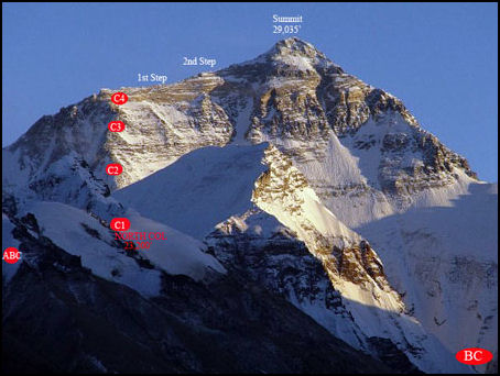
Climbing routes on Tibetan side The Himalayas as most everyone knows are the highest mountains in the world, with 30 peaks over 24,000 feet. The highest mountains in Europe, North and South America barely top 20,000 feet. The word Himalaya is Sanskrit for "abode of the snow" and a Himal is a massif of mountains. Technically Himalaya is the plural of Himal and there should be no such word as Himalayas.
The Himalayas stretch for 1,500 miles from eastern Tibet and China to a point where India, Pakistan, China and Afghanistan all come together. The mountain kingdoms of Sikkim, Bhutan and Nepal are all contained within the range. The southern side of the Himalayas are like a huge climatic wall. During the summer monsoon winds push massive rain clouds against the mountains squeezing out rain onto some of the wettest places on earth. On the leeward, rain-blocked side of the range, on the Tibetan plateau, are some of the driest and most barren places on the planet.
The Himalaya-Karakoram range contains nine of the world's top ten highest peaks and 96 of the world's 109 peaks over 24,000 feet. If the Karakorum, Pamir, Tian Shan and Hindu Kush ranges and Tibet — which are extensions of the Himalayas into Pakistan, China, Afghanistan and Central Asia — are including in the Himalayas then the 66 highest mountains in the world are in the Himalayas. The 67th highest is Aconcagua in Argentina and Chile
Several of the greatest rivers in the world — the Ganges, Indus, Brahmaputra, Mekong, Yangtze and Yellow rivers — originate in either the Himalayas or the Tibetan plateau. Some people live in valleys nestled between Himalayan ridges but few people actually live on the slopes of the mountains.
See Separate Article HIMALAYAS factsanddetails.com
Lhotse, Near Everest, the World’s Forth Highest Mountain
Lhotse near Everest is the world’s forth highest mountain after Mt. Everest, K2, and Kangchenjunga.. Lhotse I — the highest peak — is 8,516 meters (27,940 feet) high. Lhotse is part of the Everest massif and is connected to Everest via the South Col. Lhotse means “South Peak” in Tibetan. Smaller peaks on the mountains include Lhotse Middle (East) at 8,414 meters (27,605 feet), and Lhotse Shar at 8,383 meters (27,503 feet). The summit is on the border between Tibet of China and the Khumbu region of Nepal. [Source: Wikipedia]
According to NASA’s Earth Observatory: “Despite being the fourth tallest mountain in the world, Lhotse is often overshadowed by its taller neighbor Mount Everest, which lies just a few kilometers to the north. The two peaks are linked by the South Col, a vertical ridge that never drops below 8,000 meters. Lhotse is 610 meters (2,000 feet) above the lowest point on the South Col—just enough for it to be considered an independent mountain. If Lhotse’s topographic prominence were less than 500 meters, it would be considered a subsidiary peak of Everest.
Still, climbers often clump the two together. Lhotse is sometimes called Everest’s South Peak. A Swiss team made the first ascent of Lhotse in 1956, tackling the mountain on the same expedition that they logged the second-ever ascent of Everest. They followed a route from the South Col up Lhotse’s west face. [Source: earthobservatory.nasa.gov ]
“Far more challenging than getting to the summit of Lhotse is arriving via the south face. This requires ascending a 3,300-meter (11,000 foot) wall of rock that is vertical at times. It wasn’t until 1990 that climbers ascended the south face successfully, a feat accomplished by a team from the former Soviet Union. A year before, Jerzy Kukuczka, the second person to climb all of the eight-thousanders, died trying to find a route up Lhotse’s south face. There had been a 461 successful ascents of Lhotse as of March 2012, while just 13 climbers died trying—a fatality rate of about 3 percent.” Many of those who did do so in falls or avalanches.
The main summit of Lhotse was first climbed on May 18, 1956, by the Swiss climbers Ernst Reiss and Fritz Luchsinger. On May 12, 1970, Sepp Mayerl and Rolf Walter of Austria made the first ascent of Lhotse Shar. For a long time, Lhotse Middle was the highest unclimbed peak in the world. It was finally climbed on May 23, 2001 by Eugeny Vinogradsky, Sergei Timofeev, Alexei Bolotov and Petr Kuznetsov of Russia.
The standard climbing route to the Lhotse main summit follows the Everest South Col route as far as the Yellow Band beyond Camp 3. After the Yellow Band, the routes splits. Climbers heading to Everest take a left over the Geneva Spur up to the South Col, while Lhotse climbers take a right further up the Lhotse face. The last part to the summit leads through the narrow "Reiss couloir" until the Lhotse main peak is reached. As of December 2008 371 climbers had summitted Lhotse and 20 died during their attempt. Lhotse was not summited in 2014, 2015, or 2016 due to a series of incidents, however, it was summited again in May 2017. In 2016 Ang Furba Sherpa died from a fall while working on the mountain to set ropes.
According to Explorersweb.com “Bulgarian climber Ivan Tomov died in 2019 after reaching the summit. Tomov, 35, was climbing alongside Russian Nastya Runova, without Sherpa support or oxygen. He struggled during the descent and was given oxygen and Dexamethasone at Camp 4, where he spent the night. Although he managed to climb down a little further today, he perished somewhere close to Camp 4. Tomov had previously scaled Broad Peak and Manaslu without oxygen in 2014 and 2017; in 2013, he was at Camp 2 on Nanga Parbat when the terrorist attack hit Base Camp.
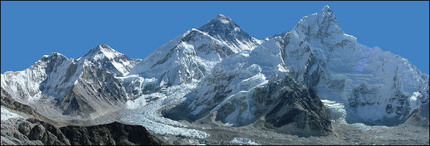
Everest and Nubtse
Nuptse
Nuptse is the world’s 19th highest mountain at 7,841 meters (25,726 feet). It is situated just two kilometers west-southwest of Mount Everest and is part of the Mahalangur Himal, along with four the world's six highest mountains, in the Khumbu region of the Nepalese Himalayas. Nubtse is Tibetan for "west peak". It is the western segment of the Lhotse-Nubtse massif. The summit of Nuptse (or Nubtse) is extremely dangerous due to loose snow with many hollows, and there are also weakly attached cornices of snow. This keeps most climber off the mountain. Nuptse was first climbed in 1961. [Source: Wikipedia]
The long east-west trending main ridge of Nubtse is punctuated by seven peaks:
Nubtse I: 7,861 meters (25,791 feet)The highest
Nubtse II: 7,827 meters (25,679 feet)
Nubtse Shar I: 7,804 meters (25,604 feet)
Nubtse Nup I: 7,784 meters (25,538 feet)
Nubtse Shar II: 7,776 meters (25,512 feet)
Nubtse Nup II: 7,742 meters (25,400 feet)
Nubtse Shar III: 7,695 meters ( 25,246 feet)
Nubtse is a dramatic peak when viewed from the south or west — which is where most trekkers view it — and it soars formidably above Everest Base Camp and South Col Everest Route, yet it is often not viewed as an independent peak. Its topographic prominence is only 319 meter (1,047 feet), which keeps it off the list of highest mountains, which requires that mountains have a prominence of 500 meters to be considered a separate mountain.
According to Summit Post: Nuptse shares in the glory of the Everest Massif and is the southern border of the Western Cwm. Viewed from the Thangboche Monastery it appears as a massive wall guarding the approach to Everest. It is joined on the right by Lhotse. Just southwest of Mount Everest and part of the Lhotse-Nuptse-massif, the main ridge is joined to Lhotse by a 7556-meter-high (24,790 foot) saddle made up of 7 peaks and goes west-northwest. Its steep west-face drops down more than 2300 meters (7546 feet) to the Khumbu-glacier. The south-face of Nuptse is 2500 meters (8000 feet) high and five kilometers wide. The north side is above the Western-Cwm valley with the upper part of the Khumbu-glacier above its famous icefall. [Source: Summit Post]
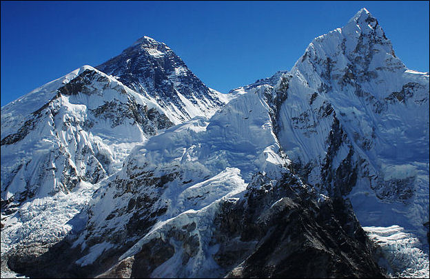
closer shot of Everest on the Nepal side with Nubtse
Climbing Nuptse
The main peak, Nubtse I, was first climbed on May 16, 1961 by Dennis Davis and Sherpa Tashi and the following day by Chris Bonington, Les Brown, James Swallow and Pemba Sherpa, members of a British expedition led by Joe Walmsley. This route they took is called the Scott route for the Nuptse mountain. After this it was climbed just twice between 1961 and 1996. A joint British/Nepalese Army team attempted the Scott Route in 1975 but sadly the summit team fell from the final couloir, probably having been knocked off by a stone fall or snow slide. [Source: Wikipedia]
Climbers avoided Nuptse after that disaster. In the 1990s and 2000s, Nuptse again became a goal of A-List mountaineers with important routes were forged on the west, south, and north faces. In 2013 Briton Kenton Cool summited Nuptse as part of the"Triple Crown" or "Everest Trilogy" climb, which he achieved that year. He summited Nuptse, Everest, and Lhotse in one season, supported by various climbers and using various climbing techniques. [1] During this climb, Cool tried to save the life of a climber that had come down with HACE after summiting Lhotse, but was not reachable for helicopter rescue.
According to Summit Post: “In October 1997, Slovenian climbing legend Janez Jeglic and fellow countrymen, Tomaz Humar ascended Nuptse's 8000 foot West Face. It turned to be Jeglic's last climb. Rushing to beat an impending storm, Humar arrived on Nuptse's summit fifteen minutes after his partner. Jeglic's tracks in the snow abruptly ended. Apparently, Jeglic had been blown off of the summit. With Jeglic was all of the duos protection. This forced Humar to descend terrain rated at WI 5 and 5.7 with little more than a 50 meter remnant of rope and his tools and crampons. [Source: Summit Post]
“The dramatic south face with 7000 feet of vertical relief boasts the South Pillar. A feature that captured the interests of climbers such as Jeff Lowe, and Mark Twight who once described the line as having the "elegance of a Halston dress and the abrubtness of of a metal-studded dog-collar." During spring 2002, an expedition led by Steve House attempted a line to the west of the South Pillar. Although joined by Canadian Barry Blanchard, Steven Koch, and Slovenian Marko Prezelj their attempt was dashed. An excellent article was published in issue 7 of The Alpinist regarding Nuptse in Winter 2003-04.”
On April 30, 2017, famed Swiss mountaineer and speed-climber Ueli Steck died in an accident near Camp 1 off the Western Cwm, whilst on an acclimatisation climb on the north face of the Nuptse Wall. Katie Mettler wrote in the Washington Post: Steck was considered the most accomplished mountaineer of his time. Before the climb the 40-year-old mountaineer told a Swiss newspaper: “Failure for me, would be to die and not come home.” So it came as a shock to the climbing world Sunday when Nepalese officials announced that Steck, a man nicknamed the “Swiss Machine” for his unparalleled athletic abilities, had died. Mingma Sherpa of Seven Summit Treks told the Associated Press that Steck died at Camp 1 of Mount Nuptse. He reportedly fell 3,280 feet down the mountain, which he had climbed to acclimate to the altitude before tackling Everest and Lhotse in May. Steck was alone because his trekking partner, Tenji Sherpa, had stayed behind at Everest Base Camp with a frostbitten hand, reported the New York Times.” [Source: Katie Mettler, Washington Post, May 1, 2017]
Makula
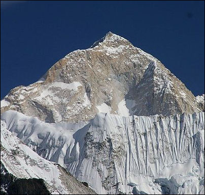
Makalu, world's fifth highest mountain
Makula is the world’s 5th highest mountain at 8,463 meters (27,824 feet). It lies in the Mahalangur Himalaya with along with Mt. Everest, Lhotse and Cho Oyu — three of Earth's six highest peaks When viewed from Everest, Makula lies to the east and has a has a massive, largely-iceless and snowless pyramid shape. Makalu II is the world’s 31st highest mountain at 25,120 feet (7,657 meters).
According to NASA’s Earth Observatory: There is a sharp difference—284 meters (932 feet)—between Makalu and Cho Oyu, the sixth tallest. Makalu’s classic pyramid shape is the product of bowl-shaped cirque glaciers grinding away at the summit on all sides. Erosion left thin ridges, known as arêtes, which meet at the summit and form a shape that looks like an X from above. In Tibetan, Makalu means “Great Black”—a reference to the oft-exposed granite that makes up the mountain’s summit. The isolated peak is known for the strong winds that whip frequently around it and scour the snow away. The western and southern faces appear particularly bare in this image. [Source: earthobservatory.nasa.gov ]
According to NASA’s Earth Observatory: Makalu proved difficult to conquer. The southeast face thwarted an American team in 1954. A New Zealand team led by Edmund Hillary—the first person to ascend Mount Everest—failed the same year. A French team succeeded in 1955, following a route up the north face. Nine members of that team made it to the summit—an unusual accomplishment. During first ascents of most eight-thousanders, just one or two members of a team generally reached the summit, while others provided logistical support. A total of 361 people had climbed Makalu successfully as of March 2012, while 31 had died trying—a fatality rate of about 9 percent. [Source: earthobservatory.nasa.gov ]
Makalu is located 19 kilometers (12 miles) southeast of Mt. Everest, on the border between Nepal and Tibet in China. One of the eight-thousanders, Makalu is an isolated peak whose shape is a four-sided pyramid. Makalu has two notable subsidiary peaks. Kangchungtse, or Makalu II (7,678 meters) lies about 3 kilometers (1.9 miles) north-northwest of the main summit. Rising about 5 kilometers (3.1 miles) north-northeast of the main summit across a broad plateau, and connected to Kangchungtse by a narrow, 7,200 meters saddle, is Chomo Lonzo (7,804 meters). [Source: Wikipedia]
Makalu has a prominence (height in relation to the land around it) of 2,386 meters (7,828 feet) and isolationof 17 kilometers (11 miles). It is one world’s 14 eight-thousander (peaks over 8000 meters) and is located in Province No. 1 (Khumbu), Nepal / Tibet Autonomous Region, China at Coordinates: 27°53 21"N 87°05 19"E
Climbing Makula
According to NASA’s Earth Observatory: Makalu proved difficult to conquer. The southeast face thwarted an American team in 1954. A New Zealand team led by Edmund Hillary—the first person to ascend Mount Everest—failed the same year. A French team succeeded in 1955, following a route up the north face. Nine members of that team made it to the summit—an unusual accomplishment. During first ascents of most eight-thousanders, just one or two members of a team generally reached the summit, while others provided logistical support. A total of 361 people had climbed Makalu successfully as of March 2012, while 31 had died trying—a fatality rate of about 9 percent. [Source: earthobservatory.nasa.gov ]
The first climb on Makalu was made by an American team led by Riley Keegan in the spring of 1954. The expedition was composed of Sierra Club members including Allen Steck, and was called the California Himalayan Expedition to Makalu. They attempted the southeast ridge but were turned back at 7,100 meters (23,300 feet) by a constant barrage of storms. A New Zealand team including Sir Edmund Hillary was also active in the spring, but did not get very high due to injury and illness. In the fall of 1954, a French reconnaissance expedition made the first ascents of the subsidiary summits Kangchungtse (October 22: Jean Franco, Lionel Terray, sirdar Gyalzen Norbu Sherpa and Pa Norbu) and Chomo Lonzo (October 30?: Jean Couzy and Terray). [Source: Wikipedia]
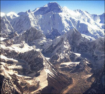
Cho Oyu, world's sixth highest mountain
Makalu was first summited on May 15, 1955 by Lionel Terray and Jean Couzy of a French expedition led by Jean Franco. Franco, Guido Magnone and Gyalzen Norbu Sherpa summitted the next day, followed by Jean Bouvier, Serge Coupé, Pierre Leroux and André Vialatte on the 17th. This was an amazing achievement at the time, to have the vast majority of expedition members summit, especially on such a difficult peak. Prior to this time, summits were reached by one to two expedition members at most, with the rest of teams providing logistical support before turning around and heading home. The French team climbed Makalu by the north face and northeast ridge, via the saddle between Makalu and Kangchungtse (the Makalu-La), establishing the standard route.
On average about one or two climbers die every year on Makalu. In 2019, four climbers died, including Nima Tshering Sherpa. Makalu. Narayan Singh, a member of the successful Indian Army expedition, died at 8,100 meters. The soldier developed high altitude sickness on his way down from the summit. Another Indian climber, Dipankar Ghos went missing at 7,300 meters and Sherpas were unable to find him. Experienced Peruvian climber Richard Hidalgo died on Makalu around the same time. [Source: AFP May 16, 2019; ]
Cho Oyu
Cho Oyu is the world’s 6th highest mountain at 8,188 meters (26,864 feet). It is located on the Nepal-Tibet border in the Mahalangur Himalaya home to four of Earth's six highest peaks. The other three are Mt. Everest, Lhotse (8,516 meters, 27,940 feet) and Makalu (8,463 meters, 27,766 feet). Cho Oyu means "Turquoise Goddess" in Tibetan. Located 20 kilometers west of Mt. Everest, it is the westernmost major peak of the Khumbu sub-section of the Mahalangur Himalaya.
Cho Oyu is just a few kilometers west of Nangpa La (5,716 meters, 18,753 feet), a glaciated pass that separates the Khumbu and Rolwaling Himalayas and has traditionally been the main trading route between the Tibetans and the Sherpas in the Khumbu region.. Due to its nearness to this pass and the generally moderate slopes of the standard northwest ridge route, Cho Oyu is considered the easiest 8,000 meter peak to climb. It is a popular destination of commercial climbs and is considered a good warm up for Everest.
Cho Oyu's height was originally measured at 26,750 feet (8,150 meters) and was considered the seventh highest mountain on earth, after Dhaulagiri at 8,167 meters (26,795 feet), the time of the first ascent. A 1984 estimate of 8,201 meters (26,906 feet) made it move up to sixth place. New measurements made in 1996 by the Government of Nepal Survey Department and the Finnish Meteorological Institute put the height at 8,188 meters, one nearly the same as the 26,867 feet (8,189 meters) height by Edmund Hillary in his 1955 book High Adventure.
Climbing Cho Oyu
According to NASA’s Earth Observatory: Despite its size, Cho Oyu is considered the safest of the eight-thousanders because of the gentle slope of its northwestern face. There are few technically challenging areas on this face and avalanche risk is minimal. An Austrian team reached the summit via the northwestern face in 1953. Cho Oyu is one of the most popular eight-thousanders. There had been 3,138 successful ascents as of March 2012, more than any other 8K peak except Everest. With a fatality rate of 1 percent, no other eight-thousander is safer. “I experienced a wonderful feeling, as one step took me into another world,” said Polish climber Jerzy Kukuczka, the second person to climb all 14 eight thousanders, upon reaching Cho Oyu’s summit. “The steep walls and the knife-edge ridges vanished. It was as if I had stepped out of a dark and dangerous canyon onto a plateau bathed in purple light.” [Source: earthobservatory.nasa.gov ]
Cho Oyu was first attempted in 1952 by a British expedition as preparation for an attempt on Mt. Everest the following year. The expedition was led by Eric Shipton and included Edmund Hillary, Tom Bourdillon and George Lowe. Hillary, Bourdillon and Lowe were all the team that successfully summitted Everest for the first time in 1953. Shipton was originally supposed to lead that team but was axed for his unsafe methods. An advance on Cho Oyu by Hillary and Lowe was stopped due to technical difficulties and avalanche danger at an ice cliff above 6,650 meters (21,820 feet). The presence of Chinese troops a short distance across the border influenced Shipton to retreat from the mountain rather than continue to attempt to summit. [Source: Wikipedia]
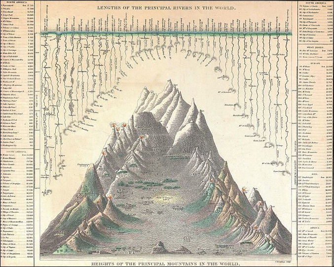
Mitchell's Chart of the World's High Mountains and Rivers, 1850
Cho Oyu was first climbed on October 19, 1954, via the north-west ridge by Austrians Herbert Tichy and Joseph Jöchler and Sherpa Pasang Dawa Lama. Cho Oyu was the fifth 8000 meter peak to be climbed, after Annapurna, Mt. Everest, Nanga Parbat and K2. Until the ascent of Mt. Everest by Reinhold Messner and Peter Habeler in 1978, this was the highest peak climbed without supplemental oxygen. Cho Oyu has lowest death-summit ratio of all the eight-thousander (1∕25th of Annapurna's) It is has over four times the ascents of the third most popular eight-thousander, Gasherbrum II. It is marketed as a "trekking peak", achievable for climbers relatively low mountaineering skills but good fitness. The mountains has a broad, flat summit plateau with no cairn, which can be a source of confusion to where the actual summit is. The prayer flags on the summit plateau do not mark the "technical" summit.
Image Sources: Wikimedia Commons
Text Sources: New York Times, Washington Post, Los Angeles Times, Lonely Planet Guides, Library of Congress, Nepal Tourism Board (ntb.gov.np), Nepal Government National Portal (nepal.gov.np), The Guardian, National Geographic, Smithsonian magazine, The New Yorker, Time, Reuters, Associated Press, AFP, Wikipedia and various books, websites and other publications.
Last updated February 2022
