SURABAYA
Surabaya is Indonesia’s second largest city and the second most important commercial and industrial center after Jakarta. It is home to three million people, a large port and Indonesia’s navy. The old city is situated around Jembatan Merah (Red Bridge) and Kota train station. The city center and major top-end hotel area is around J. Pemuda. The airport is 15 kilometers outside of town. There are good train connection to Jakarta, Yogyakarta and a ferry to Bali. Most travelers don’t stay here any longer than they have to: often until they can the next plane or train out.
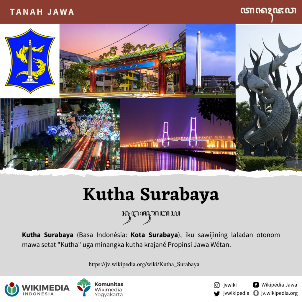
Surabaya is a big, crowded thriving city and the provincial capital of East Java. Home to many of the nation’s fiercest independence fighters, the city is known to locals as Kota Pahlawan (City of Heroes) and around the city you will see statues commemorating many heroes of the independence movement. Historically this city was a trading hub for the inland empires of Java, that included Majapahit, Singosari and Kediri. Situated on the mouth of the Brantas river, Surabaya was officially founded in 1293 on the site of a legendary battle between a shark (sura) and crocodile (baya).
According to “Cities of the World”: “At the turn of the century, Surabaya was the leading port of the Dutch Indies. The city exported rubber, tobacco, teak, kapok, sugar, and fibers. Despite the impact of World Wars, the 1930s depression, the 1945-49 resolution, and subsequent periods of civil turbulence, Surabaya remains a major agricultural-industrial center and is Indonesia's second largest port. Since 1968 Surabaya has progressed rapidly. It is the commercial hub for the second largest market in the country, and the province of East Java has one of the best development records in Indonesia.” [Source: Cities of the World, Gale Group Inc., 2002, adapted from a 2001 U.S. State Department report]
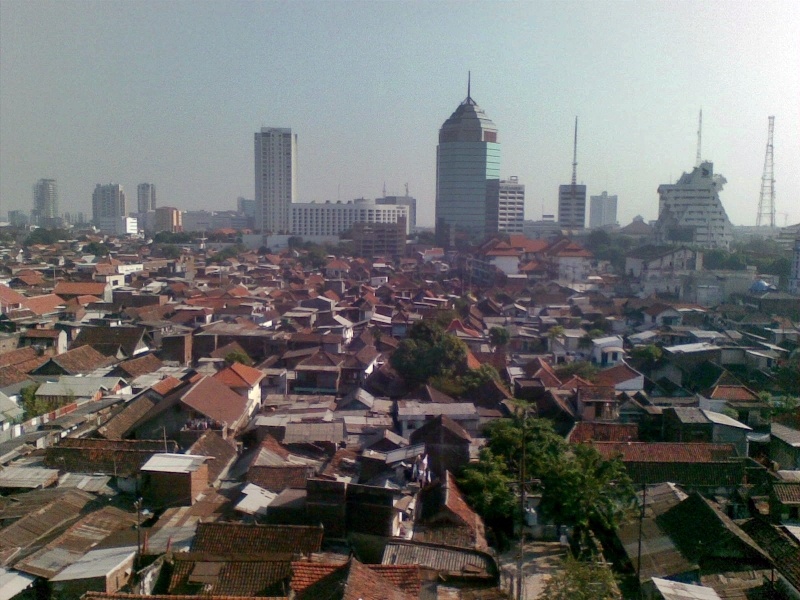
Today Surabaya is a modern industrial city and the home of Indonesia’s navy. It has shopping malls, colonial-era buildings and high-rise office buildings and apartments. It attracts people from a variety of ethnic groups from all over the archipelago and a melting pot of Javanese culture with other cultures of Indonesia and modern industrial development. Most residents Javanese and Madurese. There is a small but visible ethnic Chinese community. Foreigmers include an ethnic Indian community of perhaps a thousand as well as Japanese, Koreans, Europeans and Americans. Maybe 200 Americans live in the greater Surabaya area. They are primarily engaged in business.
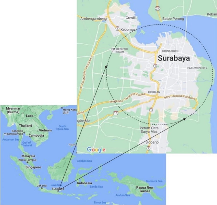
Surabaya is on the northeastern coast of Java opposite the nearby Island of Madura. The city itself is densely settled along the Brantas River Estuary. The area around the city to the west and south is a marshy, coastal plain. In recent years, rice fields in the south hves given way to steady industrial development. The southern plain gradually rises to a range of volcanic mountains, with nearest relatively large ones about 50 kilometers south of the city. Most sections of the city are only three to six meters above sea level. Flooding is widespread during exceptionally high tides, heavy rains or ocean storms. [Source: Cities of the World, Gale Group Inc., 2002, adapted from a 2001 U.S. State Department report]
Food, Entertainment and Restaurants in Surabaya
Surabaya offers a wide variety of restaurants, including Western, Indonesian, and other Asian (Chinese, Indian, Japanese, Korean, etc.) cuisine. East Javanese people love to eat and you can enjoy various dishes while you're around. From sea food variety to beef and chicken, each dish is cooked lovingly and with great care. Make sure to try soto Madura (chicken soup Maduran style) and sate Madura (roasted skewered chicken with tasty peanut sauce) and avoid the sambal or chili if you're not into spicy food.
According to “Cities of the World”: “An increasing number of Western-style supermarkets ease the grocery shopping experience in Surabaya. And though you can generally get everything on your list (from olive oil to Swiss Miss instant cocoa), you may have to visit two or more stores and/or wait a matter of weeks for that hard to find item to turn up again on the shelves. A wide variety of local seafood, chicken, beef (often tough and dry), pork (including bacon) and mutton are available. In addition, sausages, lamb and a better quality beef are imported from neighboring New Zealand and Australia but are more expensive. Most dairy products are also imported: cheddar, mozzarella, Edam, Gouda, Parmesan, Camembert, Brie, and feta cheeses are available.” [Source: Cities of the World, Gale Group Inc., 2002, adapted from a 2001 U.S. State Department report]
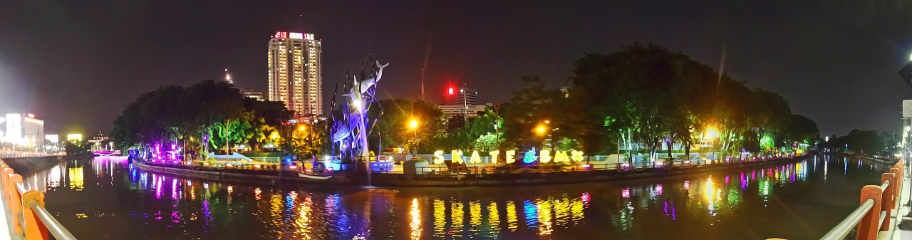
“Surabaya also has several nightclubs and discos. Film is available locally. Local printing and developing service is inexpensive and satisfactory. Surabaya has several air-conditioned theater complexes that show subtitled American films, including first-run movies. The video system in this country is PAL, and the format in Surabaya is primarily VCD, followed by DVD. VHS choices are extremely limited. Social life in Surabaya is centered around the home and generally informal. Dinner parties at home and at hotel restaurants are the most common forms of entertainment.”
Surabaya Sights
Among the sights in Surabaya are the Mpu Tantular Museum and an old traditional harbor filled traditional schooners with big colorful sails called "pinisis" that were partly responsible for extending East Javanese culture in historical times. Mpu Tantular located at Sidoarjo, about an hour drive from the city center. It is housed in the new building with contemporary Javanese architecture style. The collections are varied from the prehistoric era through the colonial era, so it offered many interest to different visitors. Unfortunately the interior is quiet hot. At 2nd floor you will find many science props which unfortunately not well-maintained. It is actually good for family or for those who travels with kids so they wont get bored with many interactive science props. Also outside of Surubaya are the remains of the Majapahit capital of Trowulan. At the Trowulan. Tourism Office: Jl. Wisata Menanggal, Surabaya 60241, Tel. (62-31) 853114-6, 8531820-1, fax: (62-31) 8531822, E mail: eastjava@indosat.net.id, Website: central-java-tourism.com
For visitors, highlights of the city include it’s zoological gardens, the immaculately presented Sampoerna museum or a visit to the island of Madura where you can experience the excitement and thrill of a local bull race. Surabaya was home to many of the nation’s fiercest independence fighters. Around the city you will see statues commemorating many heroes of the independence movement. An original statue of king Kertanegara — the fifth king of 13th century Singosari kingdom (see Below) — stands in the center of the city of Surabaya, affectionately known as Joko Dolog, or the Fat Boy.
Surabaya zoo is relatively large and has Komodo dragons, a nocturnal animal exhibit, outstanding bird and ape collections, and an excellent aquarium of tropical fish. The Taman Remaja Amusement Park, open daily, has several rides and games for small children. The city is also an ideal base to explore the other attractions of East Java including Mt Bromo, the cool mountain retreats of Malang and the natural beauty of Ijen Plateau.
Getting Around and to Surabaya
Taxi’s, buses and bemo all operate in Surabaya. The city’s extensive bus network is the most popular way to get around. Bemo (minibuses) operate on different routes which are labelled A, B, C etc. Taxis and buses have yellow license plates. Taxis are plentiful. Use well-known companies’ taxis, such as Blue Bird Group, Silver and Express. Ask the driver to use the meter. Wait for another taxi if he refuses. Bluebird’s call center in Surabaya is: +62 31 3721234, website: bluebirdgroup,com Rental cars are available. When traveling a long distance, renting a car and hiring a driver may cost less than taxi fare. Your hotel can generally help you organize a car with a driver.
According to ASIRT: “Buses are often overcrowded. Minibuses (Bemos, Angkots and Mikrolets) provide door-to- door transport to main destinations on Java. Routes are confusing. Fares are higher than public bus fares. Book in advance. Some taxi drivers take longer routes than needed. Becaks are not permitted on major roads.Commuter train service is limited. [Source: Association for Safe International Road Travel (ASIRT): PDF, 2008]
“Traffic is congested. Traffic lights often do not work. Most main roads are one-way and have few intersections with secondary roads. One-way roads reduce time needed to get through the city but force both drivers of motorized and non- motorized vehicles to use main roads or go longer distances to complete local trips.
Increase numbers of non-motorized vehicles in the traffic mix. Inadequate provision is made for non-motorized traffic. One-way roads are often 6 lanes wide and do not have pedestrian islands. There are few pedestrian overpasses. Sidewalks are often lacking, poorly designed or inadequately maintained. Vendor stands, trees, telephone booths or pedestrian bridges obstruct many sidewalks. Some high traffic areas have secure cycle parking facilities. Many drivers regard cyclists, becaks drivers and pedestrians as lower class road users and generally fail to yield to them and sometimes harass them.”
Surabaya is served by domestic and international air routes. Many domestic routes use Surabaya airport as a transit point. For example if you to fly from Sulawesi or Kalimantan to Yogyakarta who will probably have to fly through Surabaya and kill a few hours at the airport there. Airlines operating to and out of Surabaya include: Garuda Indonesia, Batavia Air, Lion Air, Air Asia, Sriwijaya Air and Citilink Juanda International Airport is 20 kilometers from the city. Airport Bus service provides transport to Bungurasih (main bus station), about 10 kilometers south of the city. The "Prima Taxi" stand in the airport sells fixed- fare taxi coupons.
Intercity buses provide transport to East Java and main cities in other areas of Java. Buses operate between Surabaya and Jakarta, Malang, Probolinggo, Banyuwangi, Solo and Yogyakarta. Boats operate from Tanjung Perak Harbour. Pelni operate connections to Sulawesi and Kalimantan. Fast trains travel between Jakarta and Surabaya via Semarang and Yogyakarta. From Surabaya most trains going to Jakarta depart from Pasar Turi train station and depart multiple times a day.
Near Surabaya and in East Java
Thirty miles south of Surabaya is the Candra Wilwatika open air theater in Padaan which presents classical East Javanese ballet performances on each full moon night from June to November. Pandaan Safari Park in east Java has some orangutans. Six miles from Padaan is Tretes which is one of the most beautiful mountain resorts in East Java. On the road from Surabaya to Bali is Pasir Putih Beach, near the town of Situbondo. It is good beach to stop at if you are the to somewhere not to make a special trip to see.
Selecta (115 kilometers or 2½ hours from Surabaya), a tourist resort constructed in 1928, sits on the slopes of Mount Welirang and Mount Arjuna, and is a favorite laid back resort since the Dutch colonial era. Here visitors can enjoy the lush green landscape, flower gardens, and a large lido. Nearby are the Songgoriti Hot Springs and Cangar Hot Spring. Cuban Rondo, Cuban Rais, and Cuban Talun are beautiful waterfalls.
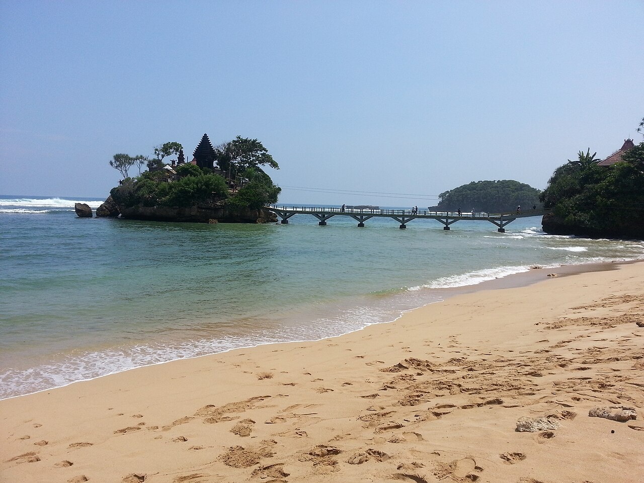
Balekambang Beach (70 Kilometers south of of Malang, or 170 Kilometers Surabaya) features : an exotic temple on rock overlooking the vast white sandy beach. Somewhat difficult to get to, the beach is highlighted with three rocky islands named after the characters in the shadow puppets stories: Anoman Island, Wisanggeni Island, and Ismoyo Island. Wisanggeni Island is connected to the shore and to Ismoyo Island by a 100 meters concrete bridge. Sitting dramatically on the Ismoyo Island is the Amerta Jati Temple or also simply known as Ismoyo Temple. Bearing distinct Hindu characteristic similar to those in Bali, the temple on the rock and its connecting bridge creates a picturesque scenery overlooking the vast blue ocean.
The white sandy beach stretches almost endlessly for two kilometers. In the shallow water near the shores, visitors can swim, however, swimming beyond the marked red flags is not allowed for this beach is notorious for its swirling currents. The beach is lined with trees offering shelter from the scorching sun. Despite its secluded location, Balekambang Beach has a range of facilities: toilets, showers, snacks and food stalls, restaurants, lifeguards, souvenirs shops and modest inns.
Mount Kawi Fortune Hunting (200 kilometers from Surabaya) is the odd name given to a sage's grave where thousands of pilgrims go to make offerings in return for good fortune. Most of the pilgrims are Chinese, yet the place itself has an intensely Javanese atmosphere with frequent wayang puppet shows and gamelan performances. The grave itself is on a hill top, along side the stairs that lead up to it are sacred springs, Chinese worship houses and souvenir stalls.
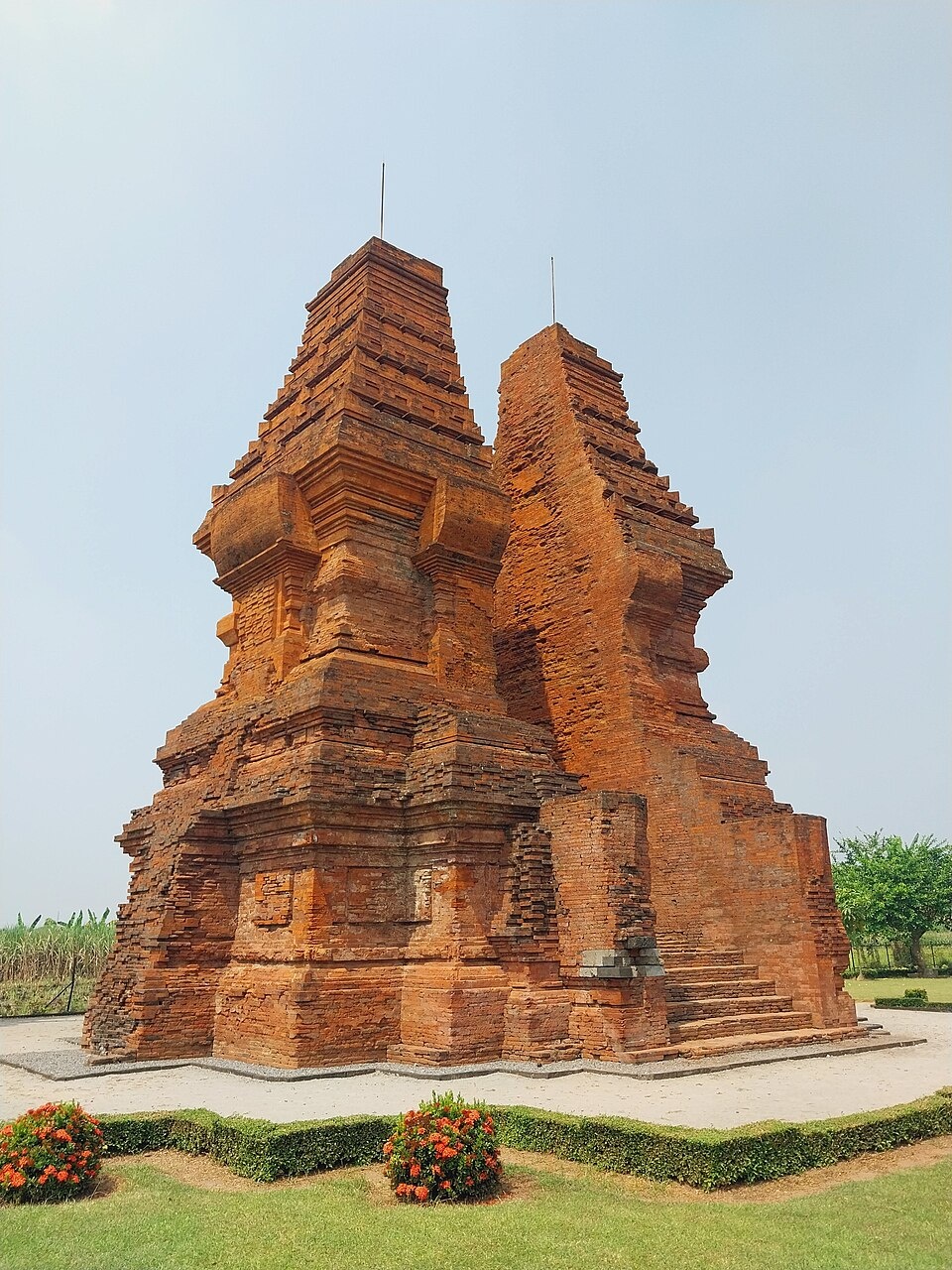
Panataran (near Blitar 5 hours from Surubaya) contains the largest intact Majapahit temples and the finest examples of East Javanese architecture. The main temple was built between 1200 and 1450, It is mostly in ruins but features some interesting reliefs addressing the gluttony of meat eating and the benefits of a vegetarian diet.
Pacitan (near Blitar) is a small town situated on a horseshoe bay ringed by cliffs. Nearby are some beaches, often with rough surf, and some fairly impressive caves. One of the caves, Gua Tabuhan (“Musical Cave”), is said to have been used as a hideout by Prince Diponengoro. Short concerts are held inside in which gamelan music is played by striking different pitched stalactites with stones.
Trowulan: Capital of Majapahit Kingdom
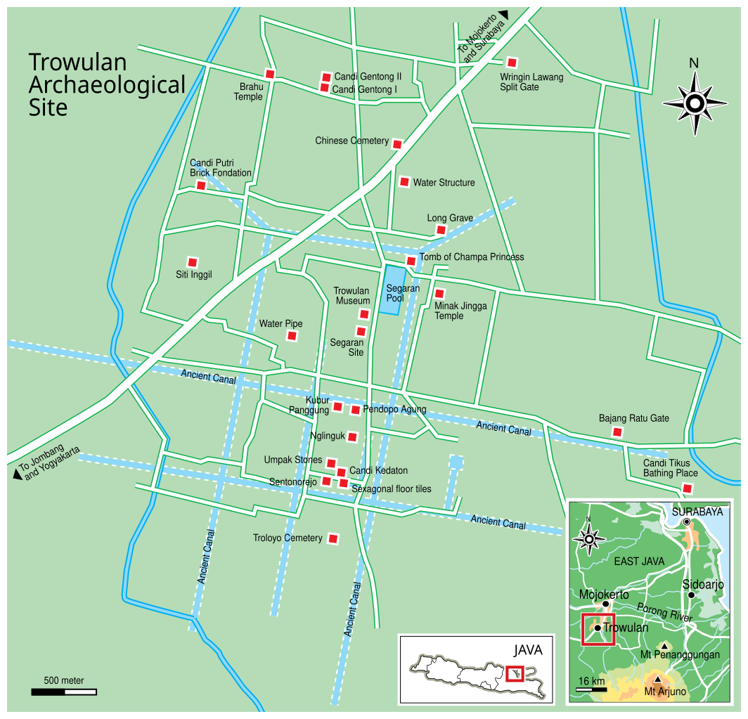
Trowulan (50 kilometers southeast of Surabaya) was capital city of Majapahit Kingdom. It was nominated to become a UNESCO World Heritage site in June, 2009. According to a report submitted to UNESCO: “The Trowulan site is the only city site of the Hindu-Budha classical age in Indonesia that can still be found. The site covers an area of 11 km x 9 km, which includes the Districts of Trowulan and Sooko within the Regency of Mojokerto and the Districts of Mojoagung and Mojowarno under the Jombang Regency. The site of the former capital city of the Majapahit Kingdom was built on flat terrains at the foot of three mountains, namely the Penanggungan, Welirang, and Anjasmara Mountain. Geographically, the Trowulan area was suitable for human settlement since it was supported by plane topography with relatively shallow ground water. Hundreds of thousands of archaeological remnants of the old city in the Trowulan Site were found buried underground as well as on the surface in the form of: artifacts, eco-facts, and features. [Source: Ministry of Culture and Tourism of the Republic of Indonesia]
“Thousands of artifacts from the Trowulan Site have been discovered and preserved. Most of these artifacts discovered by experts and those found by the local community are maintained at the Majapahit Information Centre or known as Pusat Informasi Majapahit (PIM). The Majapahit artifacts are classified based on the material substance of the artifacts: A) Terracotta Artifacts (made from earthenware clay) consist of: 1) Sculptures/Statues or human statues (featuring different races such as Chinese, Indian, Arabic); 2) Domestic appliances such as water carafe, water tubs, piggy-banks; 3) Production tools, among others: statue molds, kowi (mold of metal good, made from clay); and 4) Elements of buildings and housings such as miniature houses, pillars as a maquette, roof tiles, peaks, water pipes, and jaladwara (temple's water channel). B) Ceramic artifacts (made from ceramics) such as plates, bowls, vases, spoons either locally made or from foreign origins. C) Metal artifacts (made from metal) among others: coins both locally made and from foreign origins, tools used for ceremonies such as bells, mirrors, zodiac baker, incense burning. D) Stone artifacts (made from andesite or tuff) such as relief, statues and stone tablets.
“Based on the scattered heritage findings both in the forms of the remains of ancient buildings and human settlements as well as individual artifacts, Nurhadi Rangkuti then proposed a hypothesis that the area of the capital city of Majapahit in Trowulan covered an area of 9 x 11 square km. This hypothesis applies the analogy of the city pattern in the Islamic Mataram age that designates a mosque as the landmark for the borders of the kingdom. Assuming that culture is a process of continued diffusion, the city of the Majapahit Kingdom must have been based on a city planning concept that may be similar to that of the Mataram Kingdom. The results from this extensive research in The Trowulan Site evidently shows that the Trowulan Site is the location of the remains of the capital city of the Majapahit Kingdom for more than 200 years between the 13th - 15th century AD
From the archaeological evidence found in that site, it can be concluded that the capital city of the Majapahit Kingdom in the Trowulan Site was built through a process of deliberation and done by thorough planning with detailed and modern architecture that promotes local wisdom in caring for the environment. This provides proof of the accumulation of knowledge and ideas from a sophisticated civilization of the ancestors of Indonesians in the 12th and 14th century AD.
Several experts studied the Trowulan Site to interpret the various possible reasons for choosing this area as the capital city for the Majapahit Kingdom in the past. The following are some of the considerations:
a. This region is a very fertile area since there were volcanic quarter sediments containing sand or gravel pyroc clastica. These materials originated from the volcano in the southern part of the area that is known as the Arjuna Complex consisting of the volcanic mountains of Anjasmoro, Welirang, and Penanggunangan. The Anjasmoro Mountain is the oldest volcano in the area that has shifted. Being unstable, the rocks of the mountain may move. These moving rocks become volcanic mud flow when rain hits the area and develops into a fan-shaped fluvio volcanic sediments. From this analysis, it can be concluded that the Trowulan area is located at the tip of the fluvio volcanic fan. Furthermore, supported by the water shed of the Ginting River and the Brangkal River and having a flat topography that is rich with fluvio volcanic sediments, this area provides stable and fertile resources to sustain the livelihood of the people.
b. Having close proximity to the water sheds of the Brantas River and other smaller rivers, the Trowulan area has easy access with other regions.
c. The systematically built canals dissecting the city of Majapahit are the results from wise deliberation and advanced civilization showing concern for the environment. Earlier studies have shown that the climate in that age in the Trowulan area and its surrounding has not significantly changed compared to the present tropical rain climate that is categorized as an AW type. According to Koppen, under this type of climate, the high rain fall in the rainy months cannot compensate for the low rain fall in the dry season. (Sutikno, 1993). Under this condition, the Trowulan area and its surrounding may experience 4 to 6 months of drought in a year. Despite having two rivers - Gunting River and Brangkal River, in the dry season the volume of these two rivers may shrink and the opposite happens in the rainy season. Floods may occur and develop the fluvio volcanic fan (Sutikno, 1993). Therefore, the installment of a canal system is certainly justified.
See Separate Article: MAJAPAHIT KINGDOM: HISTORY, RULERS, CULTURE factsanddetails.com
Design, Building and Canals of Trowulan
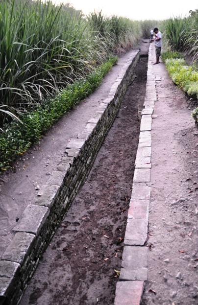
According to a report submitted to UNESCO: “With 20 to 40 meter-wide canals crossing the Majapahit region, the city was designed under an organized pattern with buildings situated in certain parts of the city. Having such a well-planned city, Majapahit evidently was the centre for the government. The network of canals in the Trowulan Site criss-crossed the city almost perpendicularly. Apparently Majapahit city was developed based on a pattern of a chess board that was shaped by the relatively straight and perpendicular canals stretching from the north to south and from the west to east. The course of the canals was not necessarily parallel to the earth's north-south magnetic axis. The canals were slightly shifted -100 to the right, clockwise in the Cartesian quadran. It appears that the canals were adjusted to the geographical condition. Judging from the distance of the canal grids in the map, in the western part, the north-south canals were located relatively closer to each other compared to those built in the eastern part. This shows that in the zones where the canals were relatively close, this area was utlized for settlement, the city centre and the king's palace. Meanwhile, the east-west canals that were built straight and intersecting the central part of the canal system provided evidence that there was a link for socio-cultural activities connecting the eastern, western, northern and southern parts to the central part of the city. The canals were also linked to a network of roads that were built parallel to the canals either on one or both sides of the canals. [Source: Ministry of Culture and Tourism of the Republic of Indonesia]
“Research results show that the canal system and the water constructions built in the Majapahit era served as an irrigation facility for agriculture and were used to channel water into the reservoirs. Trowulan had five reservoirs namely the Baureno Dam, Kumitir Dam, Domas Dam, Temon Dam, Kraton Dam and the Kedung Wulan Dam. In addition to these dams, Trowulan had three man-made ponds closely positioned, namely the Balong Bunder, Balong Dowo, and the Segaran Pond. These dams functioned as water reservoirs, to control flood, and to manage the humidity of the area.
“In addition to the ancient settlements within the proximity of the temples, Indonesia has an archaeological site that clearly displays the remains of a human settlement in the scale of a city -the Trowulan Site- in Mojokerto, East Java. Having such wide area coverage, the Trowulan site houses a wealth of heritage in the form of temples, gateways, water structures, reservoirs, canal system, construction elements, thousands of terracotta and ceramic tools used for domestic purposes. Among these findings, there were many sites of the remains of human settlement that were also revealed. According to Soekmono, from the many Hindu-Buddhist Kingdoms in Indonesia that existed before the Islamic Kingdoms (prior to 1500 AD), only the Majapahit Kingdom (14th to 16th century AD) has provided relics of human settlement in the Trowulan Site. Yielding such a rich heritage, the Trowulan site is considered by many experts as very important and rare.”
Singosari
Singosari (between Surabaya and Malang) was the home of the once powerful 13th century East Java kingdom of Singosari. Not much remains today. Aan unfinished temple and two giant statues that once stood guard in front of the palace are the only traces left of this great kingdom. Located south of of Surabaya, Singosari can be reached by car or taxi from Surabaya or Tretes. Taxis and cars can be easily obtained in the city.
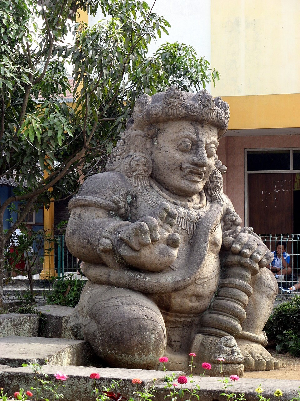
What remains of the palace of Singosari can be seen near the present-day town of Singosari, where the unfinished Singosari temple, built in 1304, can be found. In the courtyard are a collection of statues, while further down are two huge guardian statues known as dwarapala.
The beautiful Candi Jawi, with Mt. Penanggungan in the background, was built during the reign of Singosari. It is believed to be the funerary temple of the kingdom’s fifth and last king Kertanegara. Built in the 13th century, it is dedicated to a deity combining features of the Hindu god Siva with the Buddha. Candi Jawi is located 40 kilometers. south of Surabaya at Prigen on the way to Tretes.
Other temples built during the Singosari era are the Candi Jago built in 1268 located in Tumpang village, 6 kilometers. south of present day town of Singosari. It is dedicated to Singosari’s 4th king Visnusardahana; while Candi Kidal is 11 kilometers along the same road, built in 1260 and decorated with the mythical Garuda bird. Kidal is dedicated to Singosari’s 2nd king, Raja Anusapati. An original statue of King Kertanegara still stands in the center of the city of Surabaya, affectionately known as Joko Dolog, or the Fat Boy.
See Separate Article: SINGHASARI, KEDIRI, MARCO POLO AND THE MONGOL INVASION OF JAVA factsanddetails.com
Image Sources: Wikimedia Commons
Text Sources: Indonesia Tourism website ( indonesia.travel ), Indonesia government websites, UNESCO, Wikipedia, Lonely Planet guides, New York Times, Washington Post, Los Angeles Times, National Geographic, The New Yorker, Bloomberg, Reuters, Associated Press, AFP, Japan News, Yomiuri Shimbun, Compton's Encyclopedia and various books and other publications.
Last Updated in December 2025