XISHUANGBANNA

Dai village Xishuangbanna (740 kilometers south-southwest of Kunming) is a region in southern Yunnan, near Myanmar and the Golden Triangle opium-growing region, known for its tropical forests, green mountains, and ethnic minorities. About a quarter of the people are Dai, another quarter are Han Chinese and the remainder include members of the Miao, Zhuang, Hani, Jinou, Bulang, Lahu and Wa minorities.
Xishuangbanna (pronounced she-shuang-ban-naa and “banaa” for short) means “Twelve Thousand Fields” or “Twelve Principalities." The prefecture of Xishuangbanna is unique in China. For it's semi-tropical climate and abundance of flora and fauna, it enjoys special protection, as demonstrated by the declaration of numerous Nature Reserves and the development of a model of tourism that largely focuses on a respect for nature. Today almost one third of Xishuangbanna is protected forest. [Source: Ethnic China ethnic-china.com *]
Xishuangbanna Dai Autonomous Prefecture lies in the southernmost part of Yunnan Province of the People's Republic of China (PRC), roughly between 21°10 and 23°40 N and 99° 55 and 101°59 E. As in upper Myanmar and north Thailand, the year is divided into three seasons with the rains falling from about June to October.
Web Site: Lonely Planet Lonely Planet Travel China Guide (click Xishuangbanna) Travel China Guide Tourist Office : Xishuangbanna Tourism Administration, South Minzu Rd, 666100, Jinghong, Yunnan, China, tel. (0)- 88-382-3569 . For more detailed information on this region see the Lonely Planet Guide of Yunnan and China.
See Separate Article factsanddetails.com; MEKONG RIVER: ITS ROUTE, HISTORY AND TRANSPORT ON IT factsanddetails.com; MEKONG RIVER BIODIVERSITY: FRESHWATER DOLPHINS, GIANT CATFISH AND STINGRAYS AND NEWLY-DISCOVERED SPECIES factsanddetails.com; MEKONG RIVER PROBLEMS: DEVELOPMENT, CHINA, LAWLESSNESS AND POLLUTION factsanddetails.com; DAMS ON THE MEKONG RIVER AND ITS TRIBUTARIES factsanddetails.com; DAI MINORITY AND THEIR HISTORY factsanddetails.com; DAI RELIGION AND FESTIVALS factsanddetails.com ; DAI LIFE, HOUSES, FOOD, CUSTOMS AND MEDCINE factsanddetails.com ; DAI MARRIAGE, WEDDINGS, COURTING AND WOMEN factsanddetails.com; DAI MINORITY CULTURE: CLOTHES, ART AND DANCE factsanddetails.com ;BLANG MINORITY factsanddetails.com
History of Xishuangbanna
Xishuangbanna was once the center of a kingdom that stretched into Burma, Thailand and Laos. The extent of the kingdom varied over time, but in the precolonial period it included Muang Sing, now in Laos, and parts of the Tai-speaking areas of Myanmar (Burma). During World War II it was the site of some bombing raids and many of the tribal people fled into Burma, Thailand and Laos. When the Communist took over the region they ended the kingdom, and the king became an academic in Kunming. Large numbers of Han Chinese moved in to the area during the Korean War when there was an embargo on the sale of rubber to China and the region was used to grow rubber trees for the war effort.
Gehan Wijeyewardene wrote in the “Encyclopedia of World Cultures”: “Under the Mongol Yuan dynasty, Yunnan was incorporated into China, but control was little more than nominal until 1325 when a Lue (a Dai group) chieftain was appointed Chinese commander-in-chief based in Jing Hong. Suzerainty over Xishuangbanna fluctuated among the Ming emperors (fourteenth to seventeenth centuries), local rule, and the Toungoo dynasty of Burma. Ming control of Xishuangbanna was greater than that of the Mongols. They interfered with the hereditary succession of Lue chiefs and demanded silver tribute. Ming control was extended to the Mekong River and was mainly peaceful to the middle of the seventeenth century. The conquest and pacification of the southeastern region proceeded with much turbulence during the eighteenth and nineteenth centuries. The prizes sought were the region's tea and cotton. [Source: Gehan Wijeyewardene,“Encyclopedia of World Cultures Volume 5: East/Southeast Asia:” edited by Paul Hockings, 1993 |~|]
During the middle years of the nineteenth century much of Xishuangbanna was in revolt against Chinese attempts to impose land taxes and remove the powers of the Lue chieftains. In many parts of the country the outcome was joint authority vested in Chinese magistrates and Tai chiefs. The chief of Jing Hong was recognized as suzerain over the chiefdoms, which constituted the twelve panna. He had the title of cawphaendin, which is translated as "king." During World War II Yunnan suffered badly in the conflict between the Allies and the Japanese. Siam was then occupied and an ally of the Japanese, and Xishuangbanna was subject to rather indiscriminate bombing because of the alleged presence of Chinese troops. Many Lue fled to Burma and northern Thailand at this time. With the victory of the Communists and the establishment of a Communist administration in Xishuangbanna, the kingdom ceased to exist: the last king was an academic in Kunming in the 1990s. There was much movement out of Xishuangbanna. Among the nobility and elite many Tai had thrown in their lot with the Kuomintang and so most fled to Taiwan. There were divisions within the court on purely factional lines and this determined, to some extent, who stayed and who fled. Many, including both nobility and common people, also fled to Burma and Thailand.
The history of Xishuangbanna is a history of conflict—between heirs to high office, between meng, with conquerors coming out of Burma, Thailand, and Laos—as well as against the continuing push of the Chinese for suzerainty. In traditional times, in communities with recurrent warfare, where political authorities had constant recourse to armed might, control was tight in settled areas. But as the history of flight and migration shows, there was always a means of escape. The Communist conquest has brought an end to warfare, and since the early 1950s there appears to have been no significant movement to change the political status of the Tai Lue. Little, if anything, is known about the resolution of conflict within the general population.
During the hundreds of years that Chinese rule was being extended into Xishuangbanna, the region and the Lue also had cultural links, political alliances, and conflicts with Tai speakers in Burma, Thailand, and Laos. Sharing very similar languages with these peoples, the Lue developed similar forms of Theravada Buddhism, a common literary tradition, and much familial contact. The twentieth century has seen these lessen, although contacts improved during the 1980s. There has been much recent movement of population between China, Myanmar, and Thailand. At the elite level this movement has been by air between Bangkok and Kunming, but there is also a probably more important movement of ordinary people, by foot, motorcycle, boat, and pack animal. The reasons for this movement include trade, family visits, religious purposes, and professional pursuits.
Dai Autonomous Prefecture of Xishuangbanna

Xishuangbanna location in Yunnan and China
The Dai Autonomous Prefecture of Xishuangbanna is where over a dozen ethnic minorities live together, including Dai, Hani, Bulang, Jinuo, Lahu and Yao. During the Tang Dynasty and the Song Dynasty, this area was under the administration of local authorities under the Dail-based Nanzhao and Dali kingdoms. During the period of Chunxi of Song (1180 A.D.), a Dai leader named Bazhen established a local authority in Mengle called "Circle of Golden Hall in Jinglong", taking Jinghong as the centre. In the Yuan dynasty the central government set up a local government called Cheli Overall Ministration, which was changed into Cheli Xuanwei Department in the Ming and Qing Dynasties.
In the early 20 century at the time of the Republic of China, the Sipu Frontier Chief Office was established. The Dai Autonomous Region was established in 1953. It became the Dai Autonomous Prefecture in 1955. It embraces the counties of Jinghong, Menghai and Mengla, covering a land of 19, 220 square kilometers. [Source: Liu Jun, Museum of Nationalities, Central University for Nationalities, Science of China, China virtual museums, Computer Network Information Center of Chinese Academy of Sciences, kepu.net.cn ~]
According to a Dai legend, once there was a Dai leader named Payalawu. In order to catch a golden deer, he climbed 9,999 mountains and crossed 9,999 rivers, and at last arrived at a beautiful golden lake. The golden deer jumped into the lake, and immediately lotus flowers broke out on the water and hundreds of birds singing. Payalawu deeply fell in love with this "nice and mysterious land of happiness" — Mengbalanaxi, which is Xishuangbanna today. In the Dai language "Xishuang" means twelve, while "Banna" refers to a thousand fields. In the year 1570, the governor of Cheli, Dao Yingmeng, divided his region into twelve tax units called "Banna", on which he later set up twelve districts.
Xishuangbanna is charming and beautiful place, with abundant in natural resources. There are over 20,000 kinds of plants, and more than 200 species of rare birds and animals. At the same time, it is the original producing area of "Nanyao" (southern herbs) and "Pu'er Tea". Local products include rice, sugar cane, coffee, hemp, rubber, camphor and a wide variety of fruits. The dense forests produce large amounts of teak, sandalwood and medicinal plants, and are home to wild animals including elephants, tigers and peacocks.
According to the “Encyclopedia of World Cultures”: “There are markets everywhere and many local areas seem to rotate markets on a five-day cycle. Markets are not ethnically exclusive: there are Tai, Han, and other minorities selling a range of goods—cloth, shoes, and manufactured articles that have come up from Thailand through Myanmar; vegetables, meat, fish (often still alive), chickens, eggs, cooked food, and all kinds of forest produce. Whereas most Han traders are men, most Tai traders are women, though men may sell freshly butchered pork or beef. Not much is known of how the cross-boundary trade is organized, but it is clear that Tai Lue control a large part of it. It is also clear that there is some smuggling of jade and precious stones. [Source: Gehan Wijeyewardene, “Encyclopedia of World Cultures Volume 5: East/Southeast Asia:” edited by Paul Hockings, 1993|]
Dai Ethnic Group

Dai group The Dai are a relatively large and prosperous minority that live primarily in tropical and semitropical monsoon forests and valleys along the Burmese and Laos border in Yunnan Province. They have traditionally been valley-dwelling rice cultivators and are similar to the Thai, Lao, Shan and Ahom peoples who live valleys scattered throughout Southeast Asia and the Assam area of India. The Dai have their own distinct customs, cuisine, clothing and languages. They are most numerous in Xishuabgbanna Dai Autonomous Prefecture in southern Yunnan Province along the border with Laos. Large numbers also live in Dehong Dai and Jingpo Autonomous Prefecture.
The Dai are also known as the Baiyi, Beiyi, Boyi, Bitsu, La Sam, Mitro, Siam, Tai, Shan, Daija, Dailu, Taily, Daina, Han Baiyi, Han Dail, Shui Baiyi and Shui Dai. Dai means freedom. Before 1949, the Dai were known mainly as the Baiyu, which means “white clothing." According to where they live or which Dai subgroup they belong to they also use names like "Daili", "Daiya", "Daina", "Daibeng" and "Daiduan". After the founding of the People's
The Dai live mainly in lush subtropical southwest Yunnan Province in: 1) Xishuangbanna Dai Autonomous Prefecture, 2) Dehong Dai and Jingpo Autonomous Prefectures, and 3) several districts between them, including Dima, Menglian, Jinggu, Xinping, Jinping, Yuanjiang, and Shuangjiang. [Source: Liu Jun, Museum of Nationalities, Central University for Nationalities, Science of China, China virtual museums, Computer Network Information Center of Chinese Academy of Sciences, kepu.net.cn ~]
There are roughly roughly 1.26 million Dai living in China. However, the Dai of China belong to a larger family of Dai/ Tai ethnic groups that also exist in neighboring Myanmar, India, Laos, Thailand, and Vietnam. Dai population in China: 0.0946 percent of the total population; 1,261,311 in 2010 according to the 2010 Chinese census; 1,159,231 in 2000 according to the 2000 Chinese census; 1,025,128 in 1990 according to the 1990 Chinese census. [Sources: People's Republic of China censuses, Wikipedia]
See Separate Articles: DAI MINORITY AND THEIR HISTORY factsanddetails.com ; DAI RELIGION AND FESTIVALS factsanddetails.com ; DAI LIFE, HOUSES, FOOD AND MARRIAGE factsanddetails.com ; DAI MINORITY CULTURE: CLOTHES, ART AND DANCE factsanddetails.com
Place Names in the Dai Language
There are many place names like "Xishuangbanna" that are derived from the Dai language. But their meanings are different from the literal Chinese characters, and we cannot interpret them superficially without real understanding. "There is no 'long' (dragon) in Menglong and Feilong, no 'dao' (island) in Nongdao and Bingdao, neither is there 'jie' (sister) in Jiegao and Jiexiang, nor city of stone in Nanjing." [Source: Liu Jun, Museum of Nationalities, Central University for Nationalities, kepu.net.cn ~]

Dai House In Dai, "long " means big, so Menglong and Feilong means "big plain" and "big shade"; "dao" means lichen, so Nongdao and Bingdao means "the pool with lichen" and "the corner with lichen"; "jie" means town, so Jiegao and Jiexiang are respectively "old town" and "gem town". In Zhenyuan County, Yunnan Province, there is a Nanjing village and a Nanjing street, and in Ruili County a Nanjing Li. Actually in Dai, "Nan" is river or water resource, "Jing" means to eat or drink, and "Li" means good. Therefore, "Nanjing" is a place with drinking water, while "Nanjing Li" is a place with good drinking water. ~
Some other place names are related to natural resources and environment. Mannonghan in Gadong District, means "the Golden Lake Village": "Man" means village, "Nong" lake, and "Han" gold. As it is said, there used to be a lake, where golden red deer often came to drink water. Thus it got the name from that. And that reminds us of Payalawu chasing a golden deer to the mysterious Xishuangbanna. Maybe this is just the lake the deer had jumped into. Menghun, in Menghai County, means river having reversed its way. "Meng" means place while "Hun" means to reverse. There is a Nanhun River in Menghun County, which means river reversed its way. It is said that Nanhun River used to flow southeastward from Gelang River. When Sakyamuni travelled to the place, He pointed his staff to the west, and then the river reversed its flow to the west. So there are names of "Nanhun" and "Menghun". Besides, Mengla means a place producing tea; Menglun means a place producing soft stone; Mohei means "salt well", and Mozheng means "lead well".
Travel in Xishuangbanna
Lowell Bennett wrote for China Pictorial: Xishuangbanna “is not the easiest place to get to. Whether flying, or (way less recommended) traveling by car or bus, Kunming is the transit point. A few carriers fly the 740- kilometers hop, so after perhaps overnighting in Kunming, grab a mid-morning flight and about 90 minutes later you climb out of the taxi into a place like no other in China. [Source:Lowell Bennett, China Pictorial, June 8, 2009]
“If you are strictly accustomed to four and five-star accommodations and don't like the idea of sleeping in the open air on a mat spread across a rough wood deck, stay in town. Similarly, if you tire easily or if your feet are not capable of treading narrow, rocky, very steep and sometimes precarious mountain trails, do yourself and those who may otherwise accompany you a favor: Take a vehicle-based day tour to the nature reserve, have a look at the elephants, visit a local spa, get a massage, sip a few cold beers poolside back at the hotel.
“The Banna style of trekking is no walk in the park. Hikes between village stops are measured in the tens of kilometers, and level strolling is the exception. Having reasonably good stamina, I reached more than one peak at high altitude, only to be maxed out; my lungs heaving for oxygen. That warning issued — Getting all the way to Banna and not trekking would be like boating to the Great Barrier Reef and passing on the scuba diving. Following a qualified, multi-dialect local guide, you can trial-run the backcountry for an overnighter, or wander more remote areas for several days. During that time, expect no conveniences other than what you pack on your back. And don't make the mistake (like I did) of assuming plenty of bottled water will be had in the villages along the way. Stock up; carry all the H20 you can.
“Food, on the other hand, you don't have to worry about. Lunch and dinner will be waiting in villages along the way, as cooked over an open fire within a local's above-ground hut. The raw product, of course, will be completely fresh and organic, grown and raised in the immediate forested vicinity....Eat your fill of homegrown foods offered up by accommodating villagers far from gas stoves and electric ovens. Banna is known for its diverse cuisine and for its world-class trekking. So after hiking tropically-inclined forested mountain trails, crossing flowered high-altitude plains, passing through cool green corridors of bamboo, you'll drop into a remote and hyper-bucolic village to dine and doze.
“If you are an enthusiastic eater of pork, like roasted and added to fresh greens, you'll get a bonus on this trek. While it lasts, around here that particular raw product lives a pretty good life. Snoozing, slopping, snorting and generally messing around, the pigs happily wander free throughout the mountainous forest — on rare occasions perhaps pausing in their meandering patrol of the trail to sniff at the air and examine the odd smelling foreign human. Seemingly okay with their deal in and of life, at the end of the day they return home to flop beneath their owner's hut. There must be a certain ethnic ethic among the varying villages here, for none seem concerned that their particular swine may anonymously end up on a neighbor's dinner plate at the end of the day.
“Xishuangbanna is also well known for its many and diverse ethic groups. Besides the majority Dai, at about 30 percent of the population, there are more than 43 other unique peoples here, including the Hani, Yi, Lahu, Blang, Jino, Yao, Miao, Bai, Hui, Wa, and Zhuang. Most maintain their own customs, dialect, and colorful traditional garb and adornments. Besides visiting with them in the course of trekking, ethnic tours are easily booked, or, if you are more independent-minded and reasonably fit, grab a map, rent a mountain bike and hit the trail by the river, the Mekong.”

Xishuangbanna Primeval Park
Jinghong
Jihong (45 kilometers miles from Laos) is the center and prefectural capital of the Xishuangbanna Dai minority autonomous prefecture. Located on the Mekong River ( Lancang Jiang), it can be reached by bus or plane from Kunming, by boat from Laos and by plane from Bangkok. The bus journey takes one or two days. Jinghong is tropical town filled the fruits and Dai people. There is a bridge across the Mekong River.
Jing Hong (Ceng Hung) means "the city of the dawn"). "Jing" is town and "Hong" is dawn. It was said that when Sakyamuni (the Buddha) arrived there during his missionary traveling, it was at daybreak, with cocks crowing. So He gave the name "the Town of Dawn" to this place. Then Sakyamuni moved on, and came to today's Zhuanghong Lu in Jinghong when it was breakfast time. Thus the street gets its name — "Zhuanghong Lu," is a place name composed of both Chinese and Dai; Zhuanghong is from Dai, meaning the first meal or breakfast, while "Lu" is from Chinese, meaning road. Then Sakyamuni crossed Mengyang and climbed up to Manpo of Jinuo Mountain, where he looked behind and found out that there was still a small piece of land he had not trod. So He cried out surprisedly "Meng Yang Nan!"-still a small piece of land! Thus the place gets the name of Mengyang or Little Mengyang. "Meng" means place, "Yang" means remaining, and "Nan" means small. The place names above are all of Buddhist origin, from which we can see how the Dai people respect and worship Sakyamuni. [Source: Liu Jun, Museum of Nationalities, Central University for Nationalities]
Lowell Bennett wrote for China Pictorial: ““You sense it immediately. It's in the air — literally. No other town in this nation smells like it, in my experience. Wafting from the open-air restaurants, small cafes and food stalls is that distinctly commingled Southeast Asian blend of galangal root, curry, coriander, chili, cumin, lemon grass, turmeric, ginger, and what those spices go into — simmering dishes commonly encountered in places further south, like Chiang Rai, Luang Prabang, Bangkok and Hanoi. If your mouth waters just thinking about peppery som tom (spicy green papaya sal), satisfyingly-chewy pan-fried phad thai noodles, tangy coconut chicken soup and open-flame satay served with sweet chili and peanut sauce, along the streets of Jinghong you are always just a few steps away from complete gastronomic gratification. [Source: Lowell Bennett, China Pictorial, June 8, 2009]
Tourist Office: Xishuangbanna Tourism Administration, South Minzu Rd, 666100, Jinghong, Yunnan, China, tel. (0)- 88-382-3569 Web Sites: Travel China Guide Travel China Guide Budget Accommodation: Check Lonely Planet books; Getting There: Jinghong is accessible by plane or by a long, grueling but scenic and adventurous bus trip. Gasa International Airport, also known as Jinghong International Airport, is located in Jinghong's Gasa district. Local and inter-city bus service is available. China Guide (click transportation) Travel China Guide Lonely Planet (click Getting There) Lonely Planet
Sights in the Jinghong Area

Washing in the Mekong Xishuangbanna Tropical Botanical Garden of the Chinese Academy of Sciences harbors surprising biological diversity. Founded in 1959 and located on the Mekong River, the garden has more than 10,000 species of tropical plants and combines research, education and preservation of rare plant species; Admission: 80 yuan; Hours Open: 8:00am to 6:00pm Website: english.xtbg.cas.cn , Tel: +86-0691-8715071
Mengla Protected Nature Reserve (about a 100 kilometers east of Jianghong) is an 86-acre enclave with a 125-foot-high, 1,000-foot-long treetop path through a rain forest with mammoth dipterocarp trees, mouse deer, lorises, gibbons and hornbills. The path was built in 1990. Mengla is part of the larger Xishuangbanna Protected Reserve.
Manfeilong Tower Group (near Damenglong, 80 kilometers south of Jinhong) is also known as the Flying Dragon White Pagoda. Reminiscent of the stupas of Nepal, it consists of eight 30-foot stone-and-brick towers arranged in an octagon around a 50-foot-high central tower. The towers are white. The five foot high perimeter of the temple, however, is painted in bright colored stripes. At each of the eight corners there is small shrine with a pink Buddha inside.
Manjinglan Dai Nationality Village (10 kilometers from the Xishuangbanna airport) contains 179 Dai houses, which are made completely of bamboo. Each house also has a bamboo fence that surrounds a fruit tree garden. The Dai ethnic minority entertains visitors with Dai food and Dai dances. A fun time to visit is during their Water Splashing festival.
Xishuangbanna Dai Ethnic Group Garden
Xishuangbanna Dai Ethnic Group Garden (28 kilometers southeast of Jinghong City) consists of five Dai villages. Known as "the first ecological village in China", it demonstrates the history, culture, religion, sports, architecture, food and life-style of Dai ethnic group. Places of interest include the Tower package tree, Princess Well, Peacock Walled grave heart, and mother and son. Among the scenic spots, Mansongman Ancient Buddhist Temple is the most famous. This temple has over 1400 years of history, showing the culture of Buddhism. The temple is known for its amazing appearance and beautiful legends. There are also performances, events and off course food. You can visit the Zhulou (Bamboo Houses) and taste the delicious local foods. In addition, in the folk music performing area, you can enjoy the local instruments performances which include cucurbit flute performance, bawu performance and Zanha show. In the folk custom area, you can be part of the local festivals of Dai ethnic group, such as the Water-Sprinkling Festival and dragon-boat racing.
One traveler wrote in China Daily: “I thought Dai Park would be a version of Disneyland but not so. It is just a cluster of five villages where their ethnic architecture and lifestyle are best preserved. You see house after house along palm tree-lined paths, many people using their tourist yuan to restore their bamboo abodes to their former glory. Nowadays it's not always bamboo that is used to build the houses but the look and feel remain authentic. Visitors come here not to take a ride-there's none unless you count the one on the elephant-but to live like a Dai for a day or two. You can drop in and stay at any of the 326 households. They all provide food and lodging. Probably for the purpose of ventilation, the first floor is often left vacant and even the second floor is just one big floor where you can eat like a Dai. Along the walls are small rooms for which the rate goes as low as 20 yuan in the slow season and only 50 during the busy tourist season.” [Source: China Daily, June 11, 2009]
Travel Information: 1. Please don't be invasive; 2) Please take off your shoes before entering temples; 3) Don't enter the villages during the religious holidays; 4) The best time to visit the garden is from November to April. Hours Open: 8:00am-6:00pm; Admission: 50 yuan; Tel: +86-691-2504601/2504099, +86-691-96927 (for complaint) Location: Xishuangbanna Dai Nationality Garden, Olive Dam, Southeast of Jinghong Getting There: take a bus from Jinghong Bus Station to Menghan. It will take 40 minutes and costs 6.5 yuan.
Wild Elephant Valley Park

Wild Elephant Valley Park (near Mengman, 45 kilometers miles from Jinghong, near Laos and Myanmar) is the home of most famous elephant herd in China is in . The elephants are a big tourist attraction but otherwise they have an uneasy relation with the human population there who put up with gobbled up crops, smashed greenhouses and even laundry pulled off of clotheslines by the elephants. [Source: Barbara Demick and Nicole Liu, Los Angeles Times, April 19, 2010]
There are about 300 wild elephants in China, pretty much all of them in Yunnan. According to China Highlights: “This is an elephant viewing resort in the Mengyang Nature Reserve. The Wild Elephant Valley measures about 900 acres. There are about 70 or 100 elephants there. There are viewing platforms where people can see the elephants and other animals. There are hostels in the elephant park. Cabins on concrete poles near the riverbank are places where people can watch them bathe or drink in the morning or evening. There is also a trained elephant show. Kids especially like this park. Other features of the park include a peacock park, a butterfly park, and a netted bird aviary. People can feed the tamed elephants though the feeding food costs a lot. They get picked up for 10 RMB or 1.5 USD. The trained elephants also do tricks. Elephant Valley is a main host venue for Water Splashing Festival every year.”
See Elephants Under WILD ANIMALS IN CHINA: ELEPHANTS, DEER, SNAKES, INSECTS factsanddetails.com
MEKONG RIVER
The Mekong River is one of the world's great rivers. Originating in Tibet, not far from the source of the Yangtze River, it tumbles down through the Himalayas and southern China into Southeast Asia and flows along the borders of Laos, Burma and Thailand through the heart of the Golden Triangle into Cambodia, where it flows in one direction in the wet season and the opposite direction in the dry season. It finally empties into the South China Sea at the Mekong Delta in Vietnam. Its source in Tibet as not discovered until 1994.
The Mekong River goes by many names. It is known as Lancang Jiang (Turbulent River) or the Mengdong River in China, the Mae Nam Khing in Thailand, Myanmar and Laos, Tonle Than (Great Waters) in Cambodia and Cuu Long (Nine Dragons) in Vietnam. It is also known as River of Stone, Dragon Running River, Mother River Khong, and Big Water.
The Mekong is the longest river in Southeast Asia, the 12th longest in the world and the 10th largest in terns of volume. With about half of its length in China, it flows for 4,880 kilometers (2,600 miles) and provides food and water for 60 million people and disgorges 475 billion cubic meters of water each year into the South China Sea.
The Mekong basin cover an area the size of France and Germany. More than 80 percent of the people that live in the Mekong River basis in rely on the river for agriculture or fishing. More than 41 percent of the land in the heavily populated Lower Mekong basin is used for agriculture, which accounts for 90 percent of all water use.
The Mekong River is one of the wildest rivers in he world and is surprisingly undeveloped for such a large river. There are no large cities or industrial zones along its banks. It is not dammed. Until 1994 there were note even bridges across the lower stretches of it. For the most part the it is brown and muddy and still wild and free. The Upper Mekong features turbulent rapids, steep gorges and long section with no people. Often the only way to cross it is on cables strung between cliffs. The Lower Mekong River is calmer and more placid and incredibly wide in some places.
See Separate Articles MEKONG RIVER: ITS ROUTE, HISTORY AND TRANSPORT ON IT factsanddetails.com MEKONG RIVER BIODIVERSITY: DOLPHINS, GIANT FISH AND NEW SPECIES factsanddetails.com
Ruili

Wa in the 1900s
Ruili (on the Myanmar border) is a vibrant, anything-goes border with high-rise hotels, neon lights, stores with loudspeakers blasting pop and illegal casinos and gambling operations.. It is quite a contrast from Myanmar. Prostitutes cruise the streets and restaurants and knock on the hotel room doors of foreign visitors. The restaurants, massage parlors and tea house often stay open all night.
Ruili was Little more than a cluster of huts in 1949. It expanded a military town, positioned on China's southern flank. A new six-lane highway connects Ruili with Kunming. Much of it parallels the Burma Road, which is twisty and little used. Web Site: Lonely Planet Lonely Planet
At the Nanguhe Panning Ground, you can pan for jade like a prospector looking for gold. The panning area covers of 600,000 square meters and is built along the banks of Nanguhe River of Nongdao, a metallogenetic belt with abundant gem ore. Here, visitor can use tools regulated by the ground administration to look for jade stones. They can hand gems they find to Myanmar processors for appraisal. These genuine pieces can be processed into rings, necklaces or bracelet.
Wa Ethnic Group
The Wa are a mountain people that live in southwest Yunnan along the border with Myanmar. They live in a well defined homeland called A Wa Shan, in the southern part of the rugged, wet Nu Shan Mountains between the Lancang Liang River and the Salween River. The Wa call themselves the Va, Pa rauk, and A va’all of which mean “a people who reside in the mountain." Wa “means “people of the cave," a reference to their legendary place of origin.
The Wa are also known as the Va, Avo, Benren, Da ka va, Ka va, La, Le va, Pa rauk, Xiao ka va, Awa, Kawa, Lawa and Lua. They call themselves "Wa", "Baraoke", "Buraoke", "Awa", "Awo", "Awalai", "Lewa". Others call them "La", "Ben people", "Awa", "Kawa". They were called "Hala", "Hawa", and "Kawa" in history, which means "people living in mountains". The name "Wa" was fixed by the Chinese government in 1962. Most Wa in China live in the two Wa Autonomous counties of Ximen and Cangyuan in the Ava Mountains in western Yunnan Province. There are around 1 million Wa living in Myanmar, residing mostly in the Wa Hills in northeast Myanmar across the border from China's Yunnan province.
The Wa are known for their animal sacrifice ceremonies, their handwoven clothes and unique cooking methods. They hunted heads until a few decades ago and sometimes placed the heads of their victims in their rice fields as offerings to their rice god. They speak a Southeast Asian Mon-Khmer language that is similar to the language spoken by the De’angs and Bulang but different from the Tibetan-Burman languages spoken by most of the southern Chinese ethnic groups.
The Wa had no written language until the Communist government gave them one after 1949. The still do not have a script for their own language. Some Wa keep records by cutting notches in sticks and convey messages by showing different objects. A chicken feather for example expresses urgency. Bananas, sugarcane and salt are offered to visitors as an expression of friendliness.
See Separate Article WA MINORITY: HISTORY RELIGION AND FESTIVALS factsanddetails.com WA LIFE AND CULTURE factsanddetails.com
Cangyuan Cliff Painting

Cangyuan Cliff Painting
Cangyuan Cliff Paintings (400 kilometers south-southwest of Dali and 600 kilometers southwest of Kunming), said to have been produced by the ancestors of the Wa, are located mainly in the valleys of the Mengdonghe River among Ruliang Mountain, Bamboo Mountain and Gongnong Mountain in Congyuan county of Yunnan Province. Since 1962, eleven painting spots have been discovered in Menglai, Dinglai, Mankan, Heping, Mangyang, Mengxing in the mid-northern Cangyuan County. Most of them were painted on pieces of vertical cliffs tens of meters above the ground. [Source: Liu Jun, Museum of Nationalities, Central University for Nationalities, kepu.net.cn ~]
The main subjects of the cliff paintings are: human images, animal images, pictures of village, and pictures of hunting, offering sacrifice and dancing. The style is simple and unsophisticated and the images provide clues to the lifestyle of people that created them. The human body is expressed by triangles without facial features, but the limbs were painted with different postures, often expressing movement and action. Activities such as dancing can be figured out from the different postures of the limbs. Animals have vague body and head features but their identify can be determined by things like the shape and size of horns, tails, feet and ears. Most of the paintings are reddish brown in color. The pigments of the painting are a mix of red iron ore, shellac and blood of animals. According to preliminary study and analysis of experts, oldest works date back to Neolithic Stone Age, and are more than 3000 years old. ~
According to China Pictorial: “Most of the primordial cliff paintings were imprinted on the vertical mountain cliffs. At the foot of the mountains are the Wa villages. The thatched cottages of times past have been replaced by tile-roofed houses. Spinulose tree ferns dating back to prehistoric times can still be seen here. The path leading to the cliff paintings have been laid with stones. Along the path, on a vertical cliff, I saw a young Wa hunter with long hair and body tattoos, holding a crossbow in hand. [Source: China Pictorial /=]
“It was in 1965 that for the first time Wang Ningsheng, a scholar studying ethnic groups, discovered the existence of the cliff paintings. Painted with red iron ore mixed with animal blood and tree gum, formed of simple lines the cliff paintings mainly depict human figures and animals. The condition of the limestone on the cliff paintings revealed to Wang and other experts that the cliff paintings date back 3,000 to 3,500 years. According to Wang, those people who drew the cliff paintings are culturally related to Wa people, perhaps sharing customs, ideology and way of expression. Of course, the Wa have a more accurate understanding of the cliff paintings than outsiders. They can quickly realize the content of the paintings, like figures holding shields, persons with feathered on headdresses, and different types of animals." /=\
Visiting Wa Country on the China-Myanmar Border
Lincang (400 kilometers south-southwest of Dali and 600 kilometers southwest of Kunming) is the home of the Wa, who were headhunters until the 1970s. Reporting from Lincang in Yunnan Province, PBS reported: :We rolled into a small Wa village. Wa men have long jet-black hair and the women exotic Burmese faces and beautiful almond shaped eyes. The straw thatched huts of their villages remind you more of Africa than of China. Tribal members communicate by cutting small, but precise slits into these sticks, which they always carry with them. The carvings and the way the sticks are arranged provide a wide, but exact range of meanings, from “I love you” to “I detest you and want to kill you." Many Wa villages are teaming with water buffalo, a sacred animal in their culture. Buffalo reliefs are embroidered into men's jackets, and the skulls of sacrificed animals hang in the houses of the village chiefs and shamans. [Source: Frontline, pbs.org, February 10, 2006]
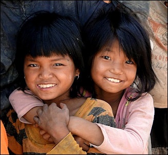
Wa kids
Along the China-Myanmar Border, “Police checkpoints were everywhere, searching vehicles for drugs. Even though security was tight, we found numerous spots along the border fence where wide holes had been cut, and like many border crossings, there were plenty of brothels and cheap hotels to choose from...The region's tourism director, Yunjiang He, informs us that Wa women are famous across China for their “great beauty and loose sexuality." Some of this reputation comes from a ritual they perform, where two women sit on a man's lap and force-feed him gasoline-strength rice wine. Our driver, Zhongyue Cao, offered to take part as long as we promised not to tell his wife and 12-year-old daughter.
“He confided later that the ritual had changed. In the past, the women would feel under your shirt and you were allowed to do the same in return. These women, he said, do not wear bras. Not surprisingly, this activity has been exploited into a lurid tourist attraction. The ritual we were invited to was still rowdy, with much drinking but little else. Those looking for more are pointed to the nearest city of Nansan, where there are sex parlors and hotels, lit in neon red, catering to the sex trade. Our driver also told us that in the nearby “Golden Triangle," where the borders of Myanmar, Thailand and Laos meet, he was once attacked by a group of prostitutes. They carried him down a back alley and proceeded to molest him."
See Separate Articles: WA ETHNIC MINORITY factsanddetails.com; WA LIFE AND SOCIETY factsanddetails.com ; WA INSURGENCY, DRUGS AND THE UNITED WAS STATE ARMY factsanddetails.com
Visiting a Wa Tourist Village for “Pulling of the Drum”
Describing a visit to the small Wa village of Wengding near the Cangyuan cliff paintings, in Congyuan county of Yunnan Province, China Pictorial reported: “Wengding Village is one of the few to retain their primitive habits. The villagers choose to preserve their thatched cottages because of government subsidies. The primitive villages attract visitors and thus the local economy is promoted. Located in mountainous terrain, Wengding Village is surrounded by green trees, bamboo, and terraced fields of rice paddies. The thatched cottages in the village are usually comprise two levels. The upper floor is for family accommodations while the ground floor is reserved for livestock. [Source: China Pictorial /=]
“Facing visitors"cameras, villagers are not nervous. After allowing photos, they hospitably invite visitors to have a rest at their home. Xiao Ega, 40, led us to his home. We walked up 10 wooden steps and entered. The single window of the cottage allowed in just a wisp of sunlight. Hearing someone arrive home, small birds chattered at the side of the window. Xiao Ega put food out for them, and the little birds rivaled with their fellows as they opened their red mouths. Xiao has two children who are both students. Turning on the light in the room, we could see a big roll of bedclothes. They unfold these at night, and then the sitting-room becomes a big bed. Wood was already burning in the fire pit, for the temperature is low at night in the mountains. /=\

Wa textiles
“The ceremony of "pulling wooden drums"was about to begin. We parted from the villagers and walked to the entrance of the village. Many people had already gathered at the meeting place under the big tree. The sacrificial offering ceremony of wooden drums of the Wa people includes activities such as pulling wooden drums and butchering oxen. Only elders of more than 70 years of age can still recount the connotations of the sacrificial offering. In recent times, it has gradually evolved into a sort of performance. In the old days, after autumn harvest the wooden drums sacrifice offering would be held. All the villagers put on their splendid attire. They cut wood in the forest and carry it into the village. Holding a leaf in hand, the main sacrifice officiator leads in singing the song of pulling wooden drums. The oxen butcher stood on the trunk with an iron lance in hand. He danced and waved the lance to the rhythm of the song. With the song and battle cries of the surrounding villagers, the butcher stabbed the ox to death with the lance. Then he cut off the head and tied it to the trunk as a sacrifice to gods. These days the sacrificial offering ceremony is less ardent and the village appears more serene. /=\
“Our last activity in Cangyuan was the monihei."Monihei"in Wa dialect has different meanings, such as "Okay"and That's it."According to legend, if the Wa sacred medicine niangbuluo"is rubbed onto girls"faces, they become increasingly beautiful; onto elders"faces, they will be healthy and long-lived; onto children's faces, they will be safe and lucky. The Wa carnival of monihei"is derived from legend. In this sunny afternoon, lightly dressed people poured into the Wenti Square from all quarters. The delighted crowd sang and danced joyously on the square, where a cheerful atmosphere prevailed. At the beginning, they only rubbed the biangbuluo"in their hands onto friends"faces. But as the gaiety spread, strangers began to daub each other's faces. People laughed and played happily. The sacred medicine biangbuluo"was everywhere: on everyone's face, clothes, cars and even shop windows, but nobody haggled. Although the carnival has a long history, the cheerfulness it brings is vivid and long-lasting. Cangyuan is a charming place. The radiant smiles of the villagers are sincere and can leave visitors with deep memories. Today, with modernization, it is rare and commendable that such rich and abundant local ethnic cultures are still well preserved. The word nolorful"is far from sufficient to describe the wonderfulness of Cangyuan." /=\
Image Sources: Wikimedia Commons
Text Sources: CNTO (China National Tourist Organization), China.org, UNESCO, reports submitted to UNESCO, Wikipedia, Lonely Planet guides, New York Times, Washington Post, Los Angeles Times, National Geographic, China Daily, Xinhua, Global Times, The New Yorker, Time, Newsweek, Bloomberg, Reuters, Associated Press, AFP, Compton's Encyclopedia and various books and other publications.
Updated in October 2022