HIKING AND MOUNTAINEERING IN CHINA
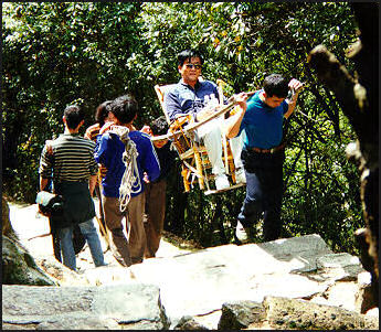
Hiking Chinese-style
China has some of the greatest mountain ranges in the world and scores of national parks with hundreds of miles trails and paths. Hikes vary from easy strolls through the forest to challenging mountain treks. There are also towering cliffs and a few glaciers for the experienced mountaineers. The choices are endless but getting to the trail heads is sometimes a problem. If worse comes to worse you may have to spend $20.00 or so for a taxi. In some places there are huts and lodges you can sleep in, but as a rule it is a good idea to bring a tent along for overnight trips.
The Chinese like hiking but many take their time going up mountains. They like to walk up a few flights of stairs that are found on China's most well-known mountains and rest, take some pictures and enjoy the view and then hike up a few more flights and repeat the same process.
Chinese hikers like to carry walking sticks and often hike in huge groups that begin their hike at 3:00am so they can catch the sunrise from the summit of a mountain. Some people choose to be carried up mountains rattan sedan chairs by two men with holding two 15-foot-long bamboo poles. This methods is employed on trails on dangerous cliffs. See Trekking
The Lonely Planet guides have good hiking nad trekking information. Maps and directions may be (but not likely) obtained from local tourist offices. The best time for hiking is June through October, but conditions vary greatly from place to place. The spring is nice because the mountains are still covered with snow. In the early summer and late spring wild flowers are in bloom. In later summer the high passes are clear of snow but the weather can be hot. Web Sites: Hiking Club in China threewweb.ad Most of the listing that come up when you google “Hiking in China” are for travel companies. Probably the best source of information are the Lonely Planet guides on China. See Trekking Below and google specific places you want to hike such as “Hiking the Great Wall” or “Hikes in the Guilin area.”
Hikes in the Beijing Area
Beijing is surrounded by a horseshoe of mountains, with many peaks more than a mile high, not to mention numerous sections of the Great Wall, offering almost limitless hiking possibilities, The village of Fanzpai is a good jumping off point to mountains with relics form the Yuan period and rock engraved with Sanskrit and Tibetan, most likely left by traveling monks.
Beijing Hikers depart from Starbucks at the Holiday Inn Lido, every Sunday morning at 8:00am. For more details check the group’s web site: Beijing Hikers
Great Wall Hike Between Simatai and Jinshanling
Great Wall Hike Between Simatai and Jinshanling is one of the better outing that one can do will staying in Beijing. The ten kilometer hike is almost completely on the wall itself. There are some steep ups and downs but nothing that is too difficult or too scary for vertigo sufferers. The hike can be done either way but most people start in Jinshanling and finish in Simatai, with their tour bus dropping them off and picking them up.
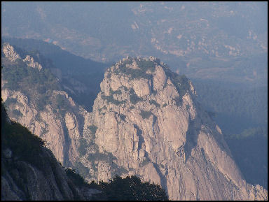
Taishan The walls are mostly ruins, especially on the Simatai side. Around Jinshanling sections of the wall and towers have been carefully restored. There is even a souvenir shop and guesthouse in one of the towers. There are many peasant farmer touts. Some are quite persistent and won’t leave you alone until you buy something. Those that sell cold drinks on hot days offer some welcome relief.
You can reach Simitai and Jinshanling by catching a minibus at Dongzhimen stadium. Many of those who do this hike do so as part of a tour organized by the hostels in Beijing, with a bus picking everybody up in the morning and drops them at Jinshanling after a drive of three hours or so. The hikers hiker to Simatai, where they are picked up and taken back to Beijing and dropped around dinner time.
Guilin Hiking: You can't really climb or hike on the formations in Guilin. They main way to enjoy them is to look at them As for hiking routes, just start walking in the direction of some nice rock formation and remember how to get back. There are plenty of guides that will take you to the scenic spots. They roam around with photo albums. A good base and place to start is Yangshuo.
Taishan
Taishan (near Qufu in Shandong Province, about ten hours form Beijing) is China's most sacred mountain and one of China's most popular tourist sites. Revered by Taoists and Confucians, it covers an area of 426 square kilometers and is 4,700 feet high. Many emperors came here to make offerings and pray to heaven. Poets and philosophers drew inspiration from it. Pilgrims prayed on an alter said to be the highest in China.
Confucius is said to have climbed the mountain and proclaimed “I feel the world is much smaller” when he reached the top. The Emperor Wu Di ascended it in his quest for immortality; the great 16th century historian Zhang Dai wrote how he was besieged by souvenir sellers when he made the trip. When Mao reached the summit for sunrise, the story goes, he commented that the "East is Red."
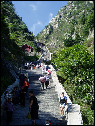
Stairs up Taishan
Taishan means “big mountain” or “exalted mountain” It is the eastern peak among the five holy mountains associated with the cult of Confucius. The five peaks represent the directions — north, south, east, west and central — and Taishan is considered the holiest because it is in the east, the direction from which the sun rises. For many Chinese it is like Mecca. Climbing it is as much a nationalist and spiritual experience as a recreational one.
Taishan is a UNESCO World Heritage Site. Stone steps lead almost all the way to the summit, where there is a hotel, noodle stands and souvenir shops. Many people stay at lodge and rise early to catch the sunrise and splendid views of the North China Plain before the mists and clouds arrive. Many leave disappointed. The weather often doesn’t cooperate. It is often cloudy even at sunrise.
People hiking at a leisurely pace can climb the 6,600 steps to reach the summit in about six hours. Just after the Pavilion That Reaches the Sky, the stairway becomes noticeable steeper. One has to negotiate 18 tortuous turns to reach the South Gate of Heaven.
Along the trails are lepers begging for coins; vendors using cell phones and lap top computers; and stones with poems and landmarks with poetic names like Bridge Where One Greets the Fairies and Spring Where the Dragon Meditates. At the summit elderly women tie red strings around trees in hopes of bringing a grandson. For those who don’t want make the climb on foot there is cable car that was added in the 1980s
Huangshan Mountain
Huangshan Mountain (320 kilometers southwest of Shanghai and 150 miles southwest of Nanking) is considered one of the most beautiful spots in China. Located in a 154-square-kilometer national park by the same name, it embraces five of China's most famous mountains — Mount Tai, Mount Hua, Mount Lu, Mount Emei and Mount Heng — whose misty, rocky crags have been the subject of some of China's most famous landscape paintings.
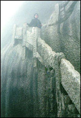
Trail on Huangshan Huangshan is usually translated to mean Yellow Mountain but actually it is named after the legendary Yellow Emperor who is said to have lived around 2200 B.C.. The name was given to it by the great, 8th century, Tang Dynasty poet Li Bo and been the inspiration for poets and even warriors as well as artists..
Designated as a UNESCO World Heritage Site, Huangshan has 72 peaks and covers 100 square kilometers. There are numerous different routes up different peaks. On one overlook people lock “longevity locks” — small, gold-colored padlocks on which lovers etch their names — to a railing as an expression of love and throw the keys over the edge,
The steep pathways and sets of stairs that serves as trails to the summits of Huangshan peaks are among of the most popular hiking routes in China. Many visitors hike up and stay at lodges near Lotus Peak and hike up to the summit early in the morning before the clouds come in. The Heavenly Sea, a wide, flat peak with dips in the rock, and the Brightness Peak are also popular. The park also contains waterfalls, graceful pine trees, unusual rock formations, hot springs and many spectacular views.
A road, often choked with tour buses and cars, leads about halfway up the mountain to the main trail head, where there are numerous hotels and guesthouses. Some trails are so popular they have been closed due to overuse. If you don't fancy walking, you can be carried up in a sedan chair by porters for $100. For $1.60 someone will carry your backpack. Three cable cars, including the longest in Asia, crisscross the mountains. It takes seven minutes to reach the upper reaches of the mountain take a cable car On foot the trip can take up to 10 hours. Some parts are so steep and narrow climbers must get down on all fours and cling to metal chains.
Around 1.1 million visitors visit Huangshan every year. President Jiang Zemin climbed Huangshan and wrote the poem, “Feelings on Climbing Huang Mountain”, which was published on the front page of the People's Daily, China's largest daily newspaper, and was included in student textbooks.
The park around Huangshan Mountain has recently been privatized. It is even listed on the Shanghai stock exchange and is 51.5 percent owned by Chinese and foreign shareholders. Profits come from entrance ticket sales and revenues from hotels, restaurants and gift shops.
Emeishan
Emeishan (eight kilometers 5 miles from Baoguo, which is 55 kilometers from Leshan in Sichian Province) is a major pilgrimage center and one of the four famous Buddhist mountains in China. Covering more than 300 square miles, it encompasses bamboo forests and undulating peaks and has been acclaimed as a "Beauty Under Heaven." The 100 monasteries and temples on the mountain include Ambushing Tiger Monastery, Thunder Sound Monastery and Pure Tone Tower. Among the natural scenic spots are Wash Elephant Pool, Fairy Peak and White Dragon Cave.
Mount Emei is a UNESCO World Heritage Site. The summit of the 10,000-foot-high sacred peak is called 10,000 Buddha Peak. The numerous hiking trail, some of which follow dizzying cliffs, are filled with pilgrims. Many of the temples are dominated by nasty rhesus monkeys who extort food from tourists and harass pilgrims. At the Emei monastery female tourists can hire young men to carry them to the top of the mountain on their backs.
Hiking in the Dali and Lijiang Area
In the last decade or so Dali has become a popular destination for budget travelers. Many come to relax but others come to explore beautiful, clear Lake Erhai, the 12,000-foot-high sometimes snow-capped mountains and ethnic minority villages which are nearby. There are good hiking opportunities in the area. Many of the people that live in Dali are members of the Bai minority.
North of Lijiang the eastern reaches of the Himalayas begin. Outside of town there are several Tibetan Red Hat monasteries that contain lovely ancient frescoes that unfortunately were destroyed during the Cultural Revolution. The best frescoes are said to be at Babaoji Hall in Baisha village.
About 10 miles north of Lijiang is the spectacular 17,000-foot Jade Dragon Snow Mountain. On the way to the mountain are some lovely villages that are nice to bicycle or hike through. The village of Yuhu is where the adventurer Joseph Rock lived. He describe it as “a charmingly situated, if not overclean, Naxi village on the slopes of the mighty Lijaing snow range.” Rock’s former courtyard house has been turned into a museum. The villages of Baisa and Nguluko are also associated with Rock. Baisa is a little touristy but nearby Shuhe is nice.
At Jade Dragon Snow Mountain you can enjoy cheesy carnival games and have you pictures dressed up in Naxi or Tibetan costumes. A new golf course, claims to be one of the world’s longest. The thin air makes it possible to build par five holes that are nearly a half a mile long.
Tiger Leaping Gorge
Tiger Leaping Gorge is one of the world's deepest gorges: the distance between the Yangtze River and the top of Jade Dragon Snow mountain above is 12,000 feet. There is a popular two- or three-day, 17-mile hike in the gorge between the villages of Daju and Qiatou.
Most people do the hike in two days. They take the bus or get a group together for minibus to Qiatou (which is more difficult get back from than Daju) in the morning. They hike the first day to Walnut Grove, where there are a couple of small guesthouses, and then hike the next day to Daju, where you can catch a local bus or minibus to Lijiang. See the Lonely Plant guides for more details. A road has been carved into one side of Leaping Tiger Gorge for cars and buses. Work is being done on a road on the other side.
Tibet, Yunnan, Sichuan and Xinjiang offer some of the best trekking, hiking and mountaineering in the world. See Trekking and Places.
Trekking
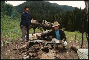
Trekking in western Sichuan
Trekking is a South African term that has come to mean hiking with someone or some animal carrying your bags. Technically a backpacker is someone who carries his own stuff. In this respect trekking is not as physically demanding as hiking with a backpack because you are not carrying anything really heavy. Moreover trekking is not like backpacking in the wilderness. As a rule there are villages, guesthouses and tea houses along the trekking routes and the routes themselves follow well-trodden trails used for centuries by local people, pilgrims, traders and caravans.
As rule trekkers hike for four or five hours a day. Porters do the bulk of the work. They carry food, tents, bags and backpacks, often in large wicker baskets strapped around their foreheads not their shoulder. The porters may look scrawny but don't underestimate their strength. Often times it seems the younger a porter is the more he has to carry. I once saw a boy, who must of been about 12 years-old, carrying a basket filled with five backpack for Western trekkers.
Yaks are used as pack animals above 4,000 meters. At elevations lower than that yaks feel uncomfortable. Below 13,000 feet dholpa — a neuter cross between a yak and cow — are often used. In some places horses, ponies, mules, donkeys, camels and even sheep are used. Trekkers are expect to look after the porters if they get sick and usually give them a tip at the end of the trek. Most don’t speak much English. Often a guide is necessary to help the trekkers communicate with the porters. Porters are usually arranged large towns or cities near the treeking route trail heads.
Arrangement for a trekking can be done one of three ways: 1) through an adventure travel organization in your home country ($75 to $150 a day); 2) through a trekking company in a large city ($30 to $60 a day); or 3) by making arrangements on your own (around $10 a day) near the start of the trekking route, with an additional $10 a day for a guide, $7 a day for porter. Many guides don't know much. .
The first choice can be very expensive but saves you some hassles and theoretically gets you better quality guides and porters than you could get on your own. Often you travel companies charge you over a US$100 a day for something that would cost US$5 or $10 if you did it on your. The main thing you are paying for is security and the camaraderie of being in a group of citizens from your country. Normally trekkers sleep in tents and the food is generally better than what you get in the guesthouses. These treks have their own cooks..
The second choice is basically the same except arrangements are made in China. These treks usually include transportation to trailhead and the all the supplies you need except for warming clothing and a sleeping bag, which if you don't have can be rented from shop or thr trekking company. Of course you have to bring personal items as well. Make sure to bring good boots that have already been broken in.
There really is no reason why you need a trekking company. There are plenty of teahouses with basic communal style sleeping for around $2 a night and guesthouses charging between $5 for a dormitory to $15 a night for a private room) along the trails which offer food and lodging. If these don’t exist villagers will often put you up for a small fee. The only thing you really need are a sleeping bag, warm clothes and personal supplies.
Arrangements for porters or pack can be made in any of the towns where the trails begin. Yak arrangements can be more difficult since you have to make plans in advance and sometimes the yaks aren’t there when they are supposed to be. As cruel as it may seems to hire a porter. They are usually anxious for the work. Web Sites: China Trekking China Trekking ; infohub infohub A number of other trekking companies come up if you google “trekking in China.” See Hiking
Trekking Conservation: Trekkers generally use up much more resources than local people. By one estimate a trekker needs five times as much fire wood per day as a local person and is mor likely to engage in activity that might pollute the water. Therefore trekkers are advised to 1) eat at places where food is cooked with kerosene or electricity rather than wood: 2) bring warm clothes so you don’t need a fire to stay warm; 3) eat when other people do so resources aren’t wasted to make a special meal you; 4) don’t take a hot shower a place where the water is heated with firewood; 5) treat water with iodine rather than insisting water be boiled; use latrines rather than flush toilet and stay away from water sources; 6) use phosphate free soap and shampoo; 7) burn paper trash and carry nonburnable trash.
Major Trekking Routes: The main trekking routes in China are in Tibet, Xinjiang, Sichuan, Qinhai and Yunnan. On trekking to minority villages see below.
Trekking in Sichuan
Kangding (on the road between Chengdu and Tibet) is small 2620-meter-high town in the shadow of 7556-meter-high Gongga Shan. The scenery is spectacular. Trekkers and pilgrims often begin their journey here. There are four lamaseries in the vicinity of the town and more are accessible by foot including one at the base of Gongga Shan.
These days Gongga Sahn is a pilgrimage, trekking and climbing destination. Pilgrims walk several hundred kilometers, circling the mountain and its 5,200-meter-high sister peak. Trekkers are sometimes disappointed because clouds often hide the view and many climbers have died tried to reach the summit. In 1981, eight Japanese climbers were buried in an avalanche. two Americans were killed in 1939 and six Chinese climbers died in 1957.
Hailuogou Glacier (near Gongga Shan) is the lowest glacier in Asia. The main glacier is 14 kilometers in length and covers an area of 25 square kilometers. It also only 1,600 years old. There are specular treks along the glacier, which can be reached from the town of Moxixang, which in turn can reached from Kangding. For details of the treks see the Lonely Planet Guide.
Songpan (10 hours by bus from Chengdu in northern Sichuan) is nestled in the Min mountains and attracts visitors who like horse trekking.. The town is shared by Tibetans, Hui Muslim and Han Chinese. In the Muslim part of town mutton and yak meat is widely eaten. In the Han Chinese sections pork is preferred.
Trekking from Dege has become popular in recent years. Destinations include the Babang Monastery, the lovely town of Ha La Maisu and Baiyu Monastery, which has some of the best preserved murals in Kham. One of the murals is 300 years old and 233 feet long. The Quick and Dirty Guide to Trekking in Dege is available on the Kham Aid Foundation website Khamaid )
There is no electricity in the area and most people get around on foot or on Mongolian ponies. Trekkers cover about 12 miles a day and walk at altitudes between 3,000 meters and 5,000 meters (at the passes). Travelers often spend the night and eat in the monasteries. Most meals consist if died yak meat, butter tea and tsampa (roasted barely flour) and tsampa dumplings.
Trekking in Shangri-La in Yunnan
Zhongdian (200 kilometers north of Lijiang) is a Tibetan village that once had a frontier atmosphere but recently has been developed for tourism. Located in a broad plain surrounded by snow-capped mountains, it was given permission by Beijing to be renamed Xianggelila (“Shangri-La” in Chinese) because, according to the Chinese government, it best fit the “ Lost Horizon” description of “verdant valley crowned by a Tibetan Buddhist lamasery and encompassed by snow-capped mountains.”
Mount Kagpo, also known as Meili Xueshan (Meili Snow Mountain), is also believed to be the model for mythical Mount Karakal in the novel “Lost Horizon”. It is 6,740 meter tall and accessible from Miyon village, located at 2,350 metes above sea level. A steep four-kilometer hike from the village leads one to the top of a glacier that stretches along a deep valley for 11½ kilometers.
Mount Jambeyang, a 5,958-meter-high peak also described by Rock, is another mountain suggested as a source for mythical Mount Karakal. It is located near Nyiden village in Dabpa county in the Gazne Tibetan Autonomous Prefecture along with Mount Chanadorge and 6,032-meter-high Mount Chenreisg. Treks on foot or the back so horses, or donkeys are offered in the area. All three mountains are regarded as holy to the local Tibetan people. In 2006, about 200,000 tourists showed up in the area.
Deqin (near Zhomgdian) is another town that vied for the Shangri-La name. It is prettier than Zhongdian and has more impressive mountains and lays claim to the Shangri-la myth because of the presence of a Roman Catholic Church and a Tibetan monastery.Most travelers to Deqin pass through Zhongdian first. In Dequin one can go on treks with the Shangri-La tour agency.
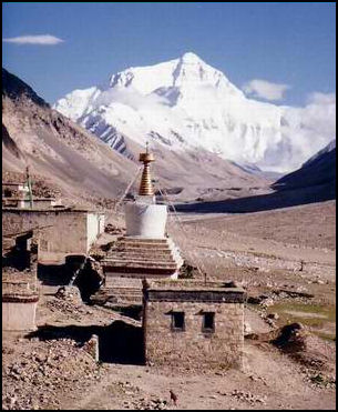
Mount Everest from Rombok Gompa
Trekking in Tibet
Trekking in Tibet is not as well-organized as in Nepal and other places. There is no emergency helicopter service. Supplies are often carried on the backs of Tibetan horses or yaks. Namtso (180 kilometers west of Lhasa) is the second largest salt lake in Tibet. Regarded as one of the most beautiful spots in the Nyenchen Tanla mountain range, it has long been a destination of pilgrims and monks, some of whom sought isolation in the area’s cave hermitages.
These days the lake is the center of a popular trekking area. Treks usually begin in Damxung (300 kilometers west of Lhasa). The first day of a week-long trek usually begin with a 3,000-foot climb along a dirt road to 17,000-foot Lanchen Pass. All around are 19,000-foot mountains and a barren landscape. Along the route are nomads with herd of yaks and sheep, birds and occasional ferrets and marmots. From Lanchen Pass it is a long descent to the lake. On the southern shore in the distance are the two holy mountains of Tashi Dorje.
Treks on the Tibetan Side of Mount Everest begin at the Rongbuk Monastery and lead to a glacier by the same name.The base camp below Rongbuk glacier has been described as a parking lot for a drive in movie. Expedition trucks filled with supplies can pull up right to the camp. Trekkers reach 17,200-foot-high "toe" of Rongbuk Glacier. There were plans to put in a 67-mile paved road to Mt. Everest base camp to make it easier to take the Olympic torch there. These plans were put on hold in July 2007.
It is an eight day round-trip trek from Kharta to the Kangshung Glacier where the American expedition began. Along this scenic route trekkers pass through rhododendron forests, alpine meadows with views of Makalu (the fifth highest mountain in the world) and Chomo Lonz. Everest doesn't reveal itself until you arrive at the glacier.
Pilgrimage Around Mt. Kailas: The 33-mile trek around Mount Kailas is one of the holiest acts for Buddhists, Hindus, Jains and Bonpos. Pilgrims from all four religions do the trek. Tibetan Buddhists believe that one trek around the mountain cleanses one of his or her sins and 108 circuits (an auspicious number to Tibetan Buddhists) will lead to nirvana in this life.
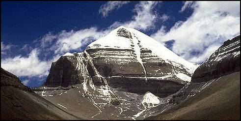
Mt. Kailas
Each year thousands of pilgrims complete the hike, known as the kora. Most of them follow the Buddhist custom and walk clockwise around the mountain. A few pilgrims walk counterclockwise. They are mostly followers of the animist Bon religion. The main pilgrimage season is in May. Many of them prostrate themselves at regular intervals. Along the route are discarded clothing and drops of blood left by pilgrims who cover the distance on their knees.
Those who prostrate themselves, take one step, make a Tibetan prayer gesture, raise their hands in prayer, and lay down on the ground, their arms extended in front of them. Then they stand up and place their fee where their fingertips had just touched and repeat the process again. Those that do this often wear knee pads, aprons and canvas shoes on their hands and take two three weeks to complete the journey. See Places for details of the trek.
Chang Tang is covered mainly with high pastures and is uninhabited except for a few nomadic yak headers. The average elevation in the reserve is between 15,000 and 17,000 feet. There are no trees or shrubs and the temperatures in the winter can drop below minus 40̊F. The reserve is designed to protect three species of animals: the Tibetan wild ass, the wild yak and the argali sheep (a still unstudied species). Between the turn of the century and 1988 no Westerners had set foot in this area.
Chang Tang means “northern plains” and is still largely unexplored. It is home to snow leopard, ibex, Tibetan antelope (“chiru”), Tibetan wild ass, bharal or blue sheep (“nawa na”), black necked crane, wild yak, lynx, wolves and very rare Tibetan brown bear. See National Geographic, April 2002.
Minority Treks
Minority Treks are offered mainly in Yunnan, Guizhou and Guangxi provinces. The 26 registered minorities in the Yunnan Province include the Achang, Bai, Benglong, Bonan, Bulang, Dai, De'ang, Drung, Dulong. Hani (Akha), Hui, Jinuo, Jingpo (Kachin in Burma), Lahu, Lisu, Miao (Hmong), Mongol, Naxi, Nu, Pumi, She, Tibetan, Wa, Yao, Yi, and Zhuang,
Minorities found in Guangxi Province include Dong, Jing (also found in Vietnam), Yi, Maonan, Miao, Miaai, Mulam, Mulao, Tujia, Yao, and Zhuang, Minorities that live in Guizhou province include the Miao, Bouyei, Dong, Yi, Shui, Hui, Zhuang, Bai, Tujiao and Gelao. These tribes celebrate over a 1,000 festivals a year.
Treks very a great deal in quality, so is worthwhile arranging one with a trekking company with a good reputation. Good treks are led by guides, fluent in English and the minority languages, and who introduce trekkers to the tribes in an intimate yet unobtrusive fashion.
Bad treks are led by guides, who don't speak English or the minority languages, and who take visitors to villages not far away, where the people quickly throw on their costumes before minibuses arrive at their appointed time, pose for snapshots, and then take the costumes off when the "trekkers" are hustled back into the departing minibuses.
Finding a descent trekking group can sometimes be a hassle but it is worthwhile investing the time to find a good one. Because recommendations in guidebooks quickly go out of date, you are best off asking travelers who have just returned from a trek for their thoughts and recommendations. There are many trekking groups.
The treks range in length from one day to several weeks. The longer treks allow visitors to reach the most beautiful spots and unspoiled villages. Most travelers go on three-day-two-night treks or five-day-two-night treks. Trekking on your own is not recommend. You might get lost or stumble accidently on some drug smugglers.
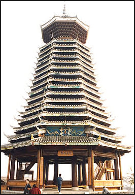
Dong Tower
A typical $50-per-person, three-day two-night trek usually begins with breakfast at a hotel, followed by a four-hour minibus ride to the trail head and a three or hour walk to the village, where the trekkers spend the night. One the second day the trekkers walk to a village, ride on elephants for a couple of hours, and walk some more to another village to spend the second night. The third day often features a raft ride on a river to the pick up point.
The treks usually stop at villages of two or three minorities. Each tribe has a distinct language and a distinct costume. The nights are usually spent in minority village huts and the meals are prepared by the villagers. Porters that accompany the trekkers carry anything that is heavy and most trekkers only carry a small day pack. Before you set out, it is probably a good idea to make sure everyone in your group trek is fit. There is nothing worse than getting stuck with a bunch of complainers.
The one- and two-day treks tend to touristy. A $12 one-day trip usually involves a drive to a waterfall and a minority village.
The best time for trekking is dry season between November and May, when the rivers are calm enough for raft trips. During the wet season between June to October, the rivers are often too swift for raft trips and the remote jungle trails have lots of leeches. Remember that trekking areas are at higher elevation than other parts of China. In December, January and February it can get quite cold, especially at night. By the same token, when the weather is hot in the plains, the temperatures are reasonably comfortable in the mountains.
Minority Etiquette: 1) Many minorities fear photography. Don’t photograph anyone or anything without permission first. 2) Show respect towards religious objects and structures. Don’t touch anything or enter or walk through any religious structure unless you are sure it is okay. If in doubt ask. 3) Don’t interfere in rituals in any way. 4) Don’t enter a village house without permission or an invitation. 5) Error on the side of restraint when giving gifts. Gifts of medicine may undermine confidence in traditional medicines. Gift of clothes may encourage them to abandon their traditional clothes.
Minority Trekking Areas
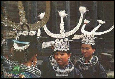
Miao girls
Minority Trekking Areas in Yunnan include Dali, the home of Bai people, and Lijiang, the home of the Naxi. Lugo Lake (20 hours on public buses or 9 hours in a jeep from Lijiang) is the home of the Mosuo, a unusual matriarchal culture that practices a unique custom, known as "walking "walking marriage," in which men live at home with their mothers and visit the homes of their partners in the evening and then leave in the morning. Yi tribesmen live near Kunming and the mountains near Tibet.
Xishuangbanna is a region in southern Yunnan, near Burma and the Golden Triangle opium-growing region, known for its tropical forests, green mountains, and ethnic minorities. About a quarter of the people are Dai, another quarter are Han Chinese and the remainder include members of the Miao, Zhuang, Aini, Jinou, Bulang, Lahu and Wa minorities. For more detailed information on this region see the Lonely Planet Guide of Yunnan and China.
Jinghong (45 kilometers miles from Laos) is the capital of the Xishuangbanna region. It can be reached by bus or plane from Kunming, by boat from Laos and by plane from Bangkok. . The bus journey takes one or two days. Jinghong is tropical town filled the fruits and Dai people. There is a bridge across the Mekong River.
Manjinglan Dai Nationality Village (10 kilometers from the Xishuangbanna airport) contains 179 Dai houses, which are made completely of bamboo. Each house also has a bamboo fence that surrounds a fruit tree garden. The Dai ethnic minority entertains visitors with Dai food and Dai dances. A fun time to visit is during their Water Splashing festival.
Minority Trekking Areas in Guizhou and Guizhou: Huaxi Ethnic Scenic Spot (16 kilometers from Guiyang City in Guizhou Province) is dotted with Miao, Bouyi and Dong villages. The ethnic groups entertain tourists with singing and dancing at touristy Lusheng parties. The best way to see the area is trek around with a guide. Huaxi Park is a nature reserve with underground caves with clear rivers and stalactites. Also in the area is the ancient city of Qingyan, known for its nine monasteries, eight temples and four towers which are placed on a plateau.
Longsheng (in Guanxi Province near the border of Guizhou Province, three hours northwest of Guilin) is the home of Dong, Dao and Miao minorities. The town of Longsheng isn't so nice but the countryside around is filled with stunning rice terraces and minority villages. There are organized tours to Longsheng from Guilin. Many travelers do two or three treks in the area.
White Water Rafting: Wujiang River (near Shaoguan, between Pingshi and Luochang) in Guangdong Province is a popular place to go white water rafting. In this 30 mile section of river there are nine difficult rapids and 18 shoals. The most difficult stretch is near Luochang gorge where the river rushes through two vertical walls of rock. Web Sites: If you google “Whitewater rafting in China” different companies with different trips around China pop up.
Wildlife and Animals: The best place to spot animals is in the national parks and reserves and the markets in Guangzhou.
Wolong Nature Reserve (120 kilometers northwest of Chengdu, two hour by bus from Chengdu before the earthquake) in Sichuan Province is the panda reserve most visited by Western scientists and tourists. The terrain is rugged and the bamboo forest are so dense that likelihood of seeing a panda in the wild is rare.
Set up in 1963, Wolong Reserve covers 500,000 acres (800 square miles) and is home to about 150 pandas as well 20 kinds of reptile, 280 species of bird and 4,000 species of plant . Among the 96 mammal species are endangered golden monkeys, which travel in groups up to 300 animals; takin, a strange looking animal related to the musk ox; and tufted deer, which have odd-looking, protruding canine teeth.
Yunnan Province is a land of rain forests, snow-capped Himalayan peaks, the Shangri-La lifestyle, minority rushing mountain rivers and some of the world’s most spectacular scenery and unusual culture. Cover about 240,000 suare kilometers, it contains half of China's plant and animal species, including 7,000 endemic plant species and 30 endangered animal species, among them, including snow leopards, clouded leopards, Yunnan golden monkeys, red pandas., a handful of tigers and about 200 wild elephants,.
Mengla Protected Nature Reserve (about a 100 kilometers east of Jianghong) is an 86-acre enclave with a 125-foot-high, 1,000-foot-long treetop path through a rain forest with mammoth dipterocarp trees, mouse deer, lorises, gibbons and hornbills. The path was built in 1990. Mengla is part of the larger Xishuangbanna Protected Reserve.
Chang Tang Reserve (northern Tibet) is a 247,120-square-kilometer (115,000-square-mile) conservation area in one of the remotest areas in the world.. Larger than Arizona, it is the second largest nature reserve in the world after Greenland National Park
Image Sources: Province maps from the Nolls China Web site. Photographs of places from 1) CNTO (China National Tourist Organization; 2) Nolls China Web site; 3) Perrochon photo site; 4) Beifan.com; 5) tourist and government offices linked with the place shown; 6) Mongabey.com; 7) University of Washington, Purdue University, Ohio State University; 8) UNESCO; 9) Wikipedia; 10) Julie Chao photo site; 11) Luca Galuzzi; 12) Alan Arnette
Text Sources: CNTO, New York Times, Washington Post, Los Angeles Times, Times of London, National Geographic, The New Yorker, Time, Newsweek, Reuters, AP, Lonely Planet Guides, Compton’s Encyclopedia and various books and other publications.
