TOHOKU (NORTHERN HONSHU)
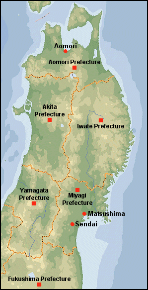
Northern Honshu NORTHERN HONSHU is one of one of the more isolated and unspoiled parts of Japan. Known to Japanese as Tohoku, it embraces Aomori, Iwate, Akita, Yamagata, Miyagi, and Fukushima prefectures and is known for heavy snows, strong winds, and scenic beauty. Most of the region is covered by mountains and large tracts of wilderness. There are three national parks, and seven quasi national parks but few large cities.
Population centers in Tohoku are found along the coastlines of the Pacific Ocean and the Sea of Japan, and in several basins. The Tohoku region has short summers and long winters, interspersed with beautiful spring and autumn seasons. Shirakami Sanchi, located in south Aomori Prefecture and Akita Prefecture, has a large-scale primeval forest of beech trees; it was registered as a World Heritage site in 1993. The Tohoku area is primarily agricultural: 65 percent of cultivated land is rice paddy fields, which account for almost a quarter of all the paddy fields throughout the country. However, it is not rare for a cool summer to damage the crops. Fishing and forestry are also important. Industrial activities include electrical appliances, chemical production, pulp processing, cement, and petroleum refining, with some production of petroleum and natural gas.
Sendai is the largest city. Matsushima, a group of more than 260 small islands in Miyagi Prefecture, is counted among the three most beautiful sights in Japan. Impact and damage in areas around Matsushima resulting from the tsunami caused by the Great East Japan Earthquake in 2011 was reduced thanks to the area’s unique geological features. Matsushima is about half an hour from Sendai by train. Three large, colorful festivals are held each summer in the Tohoku region. They are Nebuta Matsuri, held in Aomori and Hirosaki; Tanabata Matsuri, in Sendai; and Kanto Matsuri, in Akita.
Northern Honshu is also known for its interesting folk customs and festivals and large number of hot springs, some of which have traditionally been places where men and women bathed together. The people here are regarded as friendly but unsophisticated. Few non-Japanese travel around this area and foreign visitors should be prepared for few English speakers.
Getting There: The main shinakensen line in northern Japan runs between Tokyo, Sendai, Morioka, Aomori and Hakodate in Hokkaido. It was extended 97 kilometers northward from Morioka in Iwate Prefecture to Hachinohe in Aomori Prefecture in 2002 and finally reached Aomori City in 2010. From Shin-Aomori, the line continues to Shin-Hakodate through the world's longest undersea railway tunnel, the Seikan Tunnel. This section is 150 kilometers (93 miles) long and opened in 2016 under the name Hokkaido Shinkansen. The 211 kilometer (131 mile) section to Sapporo is due to open by 2030. It takes about 2 hours and 10 minutes from Tokyo to Morioka Station on the Tohoku Shinkansen line. To reach Akita there is a mini shinkansen line. Another Shinkansen line heads north from Tokyo and branches off at Fukushima to Yamagata. A good way to get to the cities in Tohoku from Tokyo is to take an overnight bus. Websites: Wikipedia Wikipedia ; Wikitravel Wikitravel Getting There: Lonely Planet Lonely Planet
Snow County in Japan
The northern Sea of Japan Coast of Japan is often called “Snow Country” because of the heavy snows it receives in the winter time. Snow country refers to an area between the Sea of Japan and the Japanese Alps. It is one of the snowiest regions in the world, with snow levels measured in meters rather than centimeters or inches. Precipitation-laden clouds coming in from the Sea of Japan bang up against the mountains and drop huge loads of snow. The town of Tsunan, which lies in the heart of snow country, was buried under seven meters of snow in 1945. Until these areas were regularly plowed starting in the 1960s, some places were virtually cut off from the rest of the world until the snow disappeared.
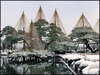
People in Snow Country use plow-like shovels which they push with two hands to remove snow from driveways, walkways and roofs. A resident in Tsunan told the New York Times, “It's a never-ending job!...After you've cleared the snow, the place is covered with snow again two days later.” Cars and houses are buried under snow. Towns became lumpy white blankets. Streets that are plowed are lined by walls of snow. Some people have to climb out of second-story widows onto three-meter-high walls of snow just to get out their house. Kids play jump rope by jumping over power lines.
Snow has to be cleared from roofs to keep them from collapsing. Typically the man of the house climbs a ladder to the roof to clear the snow while his wife waits below. These days many of the people who live in rural areas with lots of snow are people in their 70s and 80s. Many of them have gotten hurt or even died from falling off roofs or being knocked out or buried under falling snow. People have also died when heavy snow on roofs caused entire buildings to collapse. Some places with heavy snowfalls have sprinklers in the middle of the streets and electrical pumps that use mildly warm underground water to melt the snow. Some streets, especially those around the train stations, are heated. Large chunks of local budgets are spent on snow removal.
The heavy snows are caused by flow of cold air from Siberia and northern China that moves eastward across Japan and brings freezing temperatures and heavy snowfalls to the central mountain ranges facing the Sea of Japan, but clear skies to areas fronting on the Pacific. In regions bordering the Sea of Japan the winter monsoon, laden with snow, can be destructive. Snowfall is generally heavy along the western coast where it covers the ground for almost four months. Particularly heavy snowfalls in coastal areas along the Sea of Japan are due cold air masses 5,500 meters above Honshu that is sweeping over the main island with a core temperature of minus 33 degrees. Landslides occur during the heavy rains that fall in the monsoon season from mid June to mid July.
Aomori
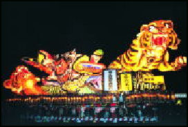
nebuta Aomori (northern tip of Honshu) is the main town in northern Honshu. Home to 288,000 people, it was heavily bombed in World War II and almost completely built from scratch after the war. It has the atmosphere of a large, sleepy fishing town despite its modern buildings. Aomori's main attraction is the Nebuta Festival held in early August when huge lit-up. paper-mache figures (“nebuta”) are drawn on floats through the streets at night.
At first glance Aomori doesn’t seem so extraordinary but with a little exploring you can uncover traditional sake houses with story tellers and shamisen players as well as craft shops that sell handed-painted samurai-head kites, wooden “kokeshi” dolls and traditional papier mâché carp. Central Aomori can be explored on foot. Bus service is available to outlying points of interest. Aomori has a temperate climate but receives over two meters of snow annually. Snow removal from streets and sidewalks can be an issue
Websites: Aomori official tourism site en-aomori.com; Aomori Prefecture site Aomori Prefectural government Aomori City site Aomori City ; Nebuta Festival Official Site Nebuta Festival ; Map:Download maps and brochures en-aomori.com; Maps of World mapsofworld.com/japan ; Ryokan and Minshuku Japanese Guest Houses Japanese Guest Houses Budget Accommodation: Japan Youth Hostels Japan Youth Hostels Check Lonely Planet books
Ferries, Tunnels and Getting to Aomori
Aomori is the transportation and distribution hub of northern Japan. It is accessible by air and by bus and by train. Ferries to Hokkaido leave daily. They take about 3¾ hours and cost ¥3,500. The daily hydrofoil tales 1¾ hours and cost ¥5,000 to ¥6,000. Aomori is also the jumping off point for Towada National Park, Mt. Hakkoda (popular with hikers and skiers, and Cape Tappizaki (with good views if Tsugaru Strait). Trains lines, ferry services, long-distance bus services and bus limousine service from the Aomori Airport are accessible at Aomori Station, which is located on the city’s west side. Lonely Planet Lonely Planet
The main shinakensen line in northern Japan runs between Tokyo, Sendai, Morioka, Aomori and Hakodate in Hokkaido. From Shin-Aomori, the line continues to Shin-Hakodate through the world's longest undersea railway tunnel, the Seikan Tunnel. This section is 150 kilometers (93 miles) long and opened in 2016 under the name Hokkaido Shinkansen. The limited express from Tokyo takes 10 hours. .A good way to get to the cities in Tohoku from Tokyo is to take an overnight bus.
Aomori Art Museum Seikan Rail Tunnel (between Tappi Saki Honshu and Fukushima Hokkaido) is the world's longest railway tunnel (33½ miles under the ocean). Opened in March 1988, it was bored 787 feet below sea level (lowest in the world) and 328 feet beneath the sea bed. The Chunnel between Britain and France has a longer undersea section but the overall length of the tunnel is less.
Tours of the tunnel are offered at the Yoshioka-katei station, located 145-meters below sea level, and Tappi-katei station. The tour includes walks through the maze of service tunnels and passages, and a look at some of the tunnel's machinery. To take the tour you need to take the rapid train (“kaisoku” ) The rapid express doesn't stop at the stations that offers the tour.
Websites: WikipediaWikipedia ; Seikan Tunnel Aomori Government ; Railway Technology railway-technology.com ; Japan Visitor Japan Visitor
Museums in Aomori
Aomori Museum of Art opened in July 2006. Designed by Jun Aoki, it is a modernist but understated structure with a permanent collection that includes works by Rembrandt and Kandinsky. The heart of the museum is the stunning Aleko Hall, which boast four large paintings — including “A Wheatfield in a Summer Afternoon” — that Marc Chagall created as backdrops for the 1942 ballet Aleko, choreographed by Massine and inspired by a Pushkin poem.
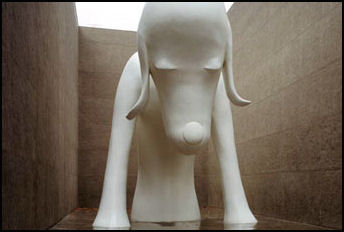
Aomori Museum of Art has numerous works by local artists and is designed to be a place, where people come and eat and drink and hang out as well as view art. One of the most popular objects at the museum is the three-story-high large sculpture of an Aomori dog by local artist Yoshitomo Nara. The Munakata Shiko Memorial Museum has an interesting collection ofwoodblock prints, paintings and calligraphy by Aomori artist Munakata Shiko. Website:
mixed sex bathAomori Museum of Art is situated next to the excavation site of the Sannai-Maruyama ruins from the Jomon Period (10,000-300 BC).. Architect Jun Aoki’s idea was to dig trenches as if they were from an excavation site. Works of domestic and international artists make up the permanent collection – among them Yoshitomo Nara, Shusaku Arakawa (spot #59), Marc Chagall, and Paul Klee. A theater, restaurant, and shop are also part of the four-story structure. Location: 185 Chikano, Yasuta, Aomori-shi, Aomori 038-0021 Tel: +81-17-783-3000 Aomori; Aomori Museum of Art Aomori Museum of Art
Towada Art Center occupying an entire block on the city’s main avenue and is comprised of 16 white cubes interconnected by glass hallways. The cubes, some themselves with walls of glass, allow for a dialogue between city and museum, between passersby looking in and museum goers looking out. Ryue Nishizawa’s unique design creates an open, inviting space that serves to highlight the museum’s 38 site-specific works including “Wish Tree for Towada” by Yoko Ono. Location: 10-9 Nishi-nibancho, Towada-shi, Aomori 034-0082 Tel: +81-176-20-1127.
Sannai Maruyama Jomon Site Center
Sannai Maruyama (southwest part of Aomori City) is the most famous of the large Jomon villages and contains several reconstructions of 7000-year-old dwellings. Aileen Kawagoe wrote: “700 pit dwellings, long houses with thatched roofs, raised-floor buildings (very likely these were storehouses), grave pits, burial jars and stone circles were found. However, this extremely large village, Sannai Maruyama, is an exception to the typically smaller villages seen throughout the land. Experts are almost certain from the many precious items such as lacquered and exotic goods like jade and amber ornaments found on the site, that Sannai Maruyama was a large trading center. [Source: Aileen Kawagoe, Heritage of Japan website, heritageofjapan.wordpress.com]
“Sannai Maruyama was located at head of Aomori Bay. Large numbers of people likely arrived from all over Japan and from across the seas to trade by pre-arrangement and at a pre-appointed time of the year. Despite its large size for a village, Sannai Maruyama is still thought to have been only a seasonal camp that was not occupied throughout the whole year."
Excavation work at Sannai-Maruyama archeological site has revealed a large prehistoric village that thrived nearly 7000 years ago. The Jomon inhabitants utilized a wide variety of forest and marine resources, but the staple of their diet was cultivated chestnuts, grown in extensive orchards. Chestnuts were one of the very first plants to be actively cultivated in Japan. Huge chestnut logs were also used as columns for building homes and ceremonial centers. One impressive structure is supported by six chestnut columns, each a full meter in diameter, and is thought to have stood three stories high. [Source: Kevin Short, Yomiuri Shimbun]
Kawagoe wrote: “During most of the Jomon era, people lived in small pit houses or dwellings no larger than 4 meters that were grouped in hamlets of about 5 pit houses. However, a few large settlements numbering up to 50 or 60 buildings have existed since Early Jomon days, as early as 9,000 B.C. In eastern Japan, the hunter-gatherer population peaked and the largest settlements appeared during the Middle Jomon era. But in western Japan, settlements began to increase in size only from the Middle to Late Jomon period.
Sannai Maruyama is from the middle of the Early Jomon period to the end of the Middle Jomon period (approx. 3,900 – 2,200 BC). It is located on a 20 meter high terrace on the right bank of the Okidate River, at the tip of a rolling hill extending from the Hakkoda mountain system. The site covers an area of 42 hectares, where the remains of pit dwellings and pillar-supported buildings, aligned pit graves, buried pottery, mounds, storage pits, roads and the remains of large buildings are systematically arranged. A great amount of earthenware and stoneware have been unearthed, including approximately 2,000 clay figures (the largest in Japan), animal and plant remains unearthed from low-lying areas that show the dietary life and the environment, and organic remains such as wood products, bones and antler objects, baskets and lacquerware, as well as jade and trading goods like obsidian from distant lands and asphalt. The analysis of food residues and lifestyles at that time has provided no evidence of agriculture and livestock farming. [Source: Jomon Archaeological Sites in Hokkaido and Northern Tohoku]
Jomon Archaeological Sites in Hokkaido and Northern Tohoku
Jômon Archaeological Sites in Hokkaidô, Northern Tôhoku, and other regions was nominated to be a UNESCO World Heritage site in 2009. According to a report submitted to UNESCO:This Jômon property is a group of unique archaeological sites representing a culture that continuously occupied the Japanese archipelago for nearly 10,000 years in the natural environment sustained by the humid temperate climate of the Holocene epoch, living in permanent settlements supported primarily by hunting, fishing, and gathering. This makes it distinct from Neolithic cultures in other regions of the earth which were established on agriculture and animal husbandry. The property possesses outstanding universal value as a testimony of a unique cultural tradition representing the way in which human beings coexisted with nature over an immense period of time in a specific geo-cultural region of our planet. [Source: Permanent Delegation of Japan to UNESCO]
“While Jômon culture spread throughout the Japanese archipelago, it displayed particularly noteworthy development in eastern Japan during the era in which broadleaf deciduous forests extended through much of the region, as stable food supplies and the evolution of the techniques used in securing them led to the expansion of areas of permanent settlement, larger communities, and a sudden increase in the number of earthen figurines and stone ritual implements.
“Especially in the region centering on Hokkaidô and northern Tôhoku, a number of the distinct cultural zones representative of the Jômon period flourished, now characterized by their pottery types, such as the Entô, Tokoshinai, and Kamegaoka cultures. The Kamegaoka pottery culture in particular spread its influence to distant areas, reaching the Kinki and Chûgoku regions of Honshû Island, and the islands of Shikoku and Kyûshû. The Jômon sites under consideration are located in a variety of different topographical areas from the seacoast to river watersheds and hill country, and include the remains of villages, shell mounds, stone circles, and archaeological sites remaind in wetlands and give dramatic evidence of the process of establishment of permanent settlements and the adaptation of these cultures to the abundant food resources of the broadleaf deciduous forests, the seacoast, and rivers and streams.
“Jômon culture is an exceptional example in world history of a Neolithic culture that flourished and matured over more than 10,000 years in permanent settlements sustained by a mode of production involving hunting, fishing, and gathering and the coexistence of human beings and nature in the humid temperature climate of the Holocene epoch. The group of archaeological sites that serves as material evidence of this cultural tradition is particularly evident in eastern Japan from the time that broadleaf deciduous forests became stably established throughout this region. These sites possess outstanding universal value as a representation of the way in which human beings coexisted with nature over an immense period of time in a specific geo-cultural region of our planet.”
Near Aomori
Aomori Prefecture covers 9,645.59 square kilometers (3,724 square miles), is home to about 1.3 million people and has a population density of 135.7 people per square kilometer., Aomori is the capital and largest city, with about 290,000 people. It is in Tohoku on northern Honshu island and has 8 districts and 40 municipalities.
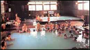
Sukayu Spa (near Aomori) is famous for its 1,000-person mixed-sex cedar bath where both men and women bath naked together. People who are shy about their bodies can hide their private parts with a towel. The atmosphere is very mellow and most people seem more interested in enjoying the soothing water than looking at the naked bodies around them. Many years ago, many baths in Japan were coed. Sukaya is one of the few remaining ones. It is fairly large and has special permission from the government to be coed. Website: Secret Japan Secret Japan ; Trip Advisor tripadvisor.com
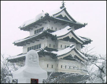
Hirosaki Castle Hirosaki (20 miles south of Aomori) is a charming town with a small but beautiful castle, samurai houses and a wealth of local handicrafts. The original castle was built in 1611 and rebuilt in the 19th century. It is surrounded by a stone wall and a moat filled with lily pads and part of a 49-acre park with 5,000 cherry trees. Overlooking the town is Mt. Iwaki, 1,625-meter-high sacred volcano popular with pilgrims and hikers.
Websites: Hirosaki Tourism and Convention Bureau Hirosaki Tourism and Convention Bureau Map: hirosaki-kanko.or Ryokan and Minshuku Japanese Guest Houses Japanese Guest Houses Budget Accommodation: Japan Youth Hostels Japan Youth Hostels Check Lonely Planet books Getting There: Hirosaki is accessible by air and by bus and by train. The limited express from Tokyo takes nine and a half hours. It takes about five and half hours total if you take the shinkansen as far north as it goes into Hachinohe in Aomori Prefecture and then switch to limited express. Lonely Planet Lonely Planet
Lake Towada (20 miles southeast of Hirosaki) is the third deepest lake in Japan. The main feature of Towada Hachimantai National Park. it is a crater lake encircled by wooded shorelines and steep cliffs. Because it so beautiful it attracts large crowds.
Yasumiya is the main accommodation center. Cruises on the lake between Nenokuchi and Yasumiya pass by the many pine-clad islets that dot the lake. Oirase Gorge, extending for nine miles on the eastern shore of the lake, is known for its autumn colors, waterfalls, boulder-strewn river, mountain scenery and good hiking trails.
Towada Hachimantai National Park is also the home of the Hachimantai Plateau, a large tableland covered by swamps, virgin forest and alpine plants. The plateau is also noted for its volcanic activity and hot springs.
Websites: Government National Park Site National Parks of Japan ; Japan Guide Japan-Guide Walking Map: towadako.or.jp; National Park Map: env.go.jp/park/towada/hachimantai/en/area Budget Accommodation: Japan Youth Hostels Japan Youth Hostels Check Lonely Planet books Getting There: Lake Towada is accessible by bus from Aomori and Hirosaki and other cities in northern Honshu. Lonely Planet Lonely Planet
Hotokenuma Wetland (near Misawa and Lake Ogawara in eastern Aomori Prefecture) is one of the best birdwatching spots in northern Japan. It is the breeding place of around 1,000 march warblers as well as Japanese reed bunting and Swinhoe’s yellow rail. Numerous other species of birds can be seen here.
Shimokita Peninsula

Lake Towada Shimokita Peninsula (northern tip of Honshu) is the northern most extension of Honshu. Here you can find feral horses, the world's northernmost wild monkeys, itako (blind female shamans) and some of Japan's last remaining wilderness. On the western side of the peninsula is Hotokegauru, a three-kilometer expanse of coastline with 100-meter-high cliffs.
Access to the area is through the town of Noheji. The main transportation hub and accommodation place is Mutsu. From there you can get buses to Ohata and from there to Yagen Onsen. Websites: Wikitravel Wikitravel ; Japan Guide Japan-Guide ; Getting There: Lonely Planet Lonely Planet
Osorezan (in the middle of Shimokita Peninsula) is a composite volcano with smoking vents and clear, yellowish crater lake fed by streams that run bright yellow with sulfur. Only one kind of fish can survive in the highly acidic water. Around the lake are hissing fumaroles and sulphur-coated rocks. The mountain was discovered in the 9th century by a Buddhist monk who had a vison of the mountain in a dream.
Mt. Osorezan is regarded as one of three holiest mountains in Japan along with Mt. Koya and. Mt. Hiei. The landscape is bleak and punctuated by strange rock formations. On the shore of the lake is a Buddhist temple, Entsuji, which hosts a festival in late July that features mediums who communicate with the dead. A red arched bridge marks the border between the real world and the realm of the dead.
Shaman at Osorezan
Entsuji, a Buddhist temple near the crater lake in Osorezan, a composite volcano in the middle of Shimokita Peninsula in Aomori Prefecture in northern Japan, hosts a four-day festival in late July that features itako who communicate with the dead.
“Itako” are shaman or mediums that have traditionally been blind or sight impaired old women that were called upon by bereaved family members to communicate with the dead. They embrace folk religion and animist traditions but also call upon Buddhist and Shinto gods for help. Each itako has her own gods that she calls upon. Some use aids such as beads and stringed bows to call the gods.
During the festival the women sit in blue tents and people who want to communicate with dead loved ones form lines to meet with the old women, who charge ¥3,000 per spirit per 30 minute session. Some work at shrines and others work at their homes outside the festival times. Some moonlight as fortunetellers.
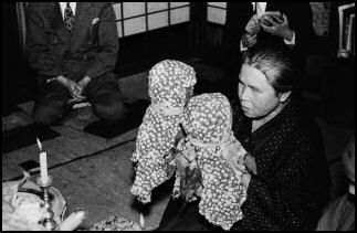
itako During a seance with an itako known as “Kuchiyose”, the itako receives the death date of deceased person and it relation to the customer. She than rattles prayer beads, goes into a trance and sings to call the spirit to possess her. The spirit usually thanks the petitioner, wishes god fortune and life and discusses personal matters. The itako usually claims that she doesnn’t t know what she said while in the trance. They say that while they are in a trance it feels like they have been grabbed by a powerful force and moved to someplace where they can watch themselves.
The seances last about 10 minutes. Through the medium, the spirit usually says something like, "I am very sorry for having died before my parents, but I am glad that you have come here. I am OK, and hope you are too." See Itako, History, Religion...; Folk Beliefs; Ki, Feng Shui, Shaman Websites: Japan Guide Japan-Guide ; Wikitravel Wikitravel
Shirakami-Sanchi: UNESCO World Heritage Site
Shirakami-Sanchi (between Aomori and Akita Prefectures) was designated a UNESCO World Heritage Site in 1993. Covering 130,000 hectares, it embraces unique beech tree forests, moss-covered rocks, Akita-sugi cedars and 1,086-meter-high Mt. Futatsumori, a popular hiking destination. The forests — which contain 400-year-old trees and is so dense the sun has difficulty penetrating through the canopy — was model for the forest in Hayao Miyazaki’s film “Mononke-hime”. Pine trees have been planted for protection from winds. Good sake is brewed in the area and stored in caves. Websites: UNESCO World Heritage site: JAL UNESCO website Aomori Prefecture site Aomori Prefectural Government ; Experience Shirakami experience-shirakami.com
According to UNESCO: “Situated in the mountains of northern Honshu, this trackless site includes the last virgin remains of the cool-temperate forest of Siebold's beech trees that once covered the hills and mountain slopes of northern Japan. The black bear, the serow and 87 species of birds can be found in this forest. Shirakami-Sanchi World Heritage Property is a wilderness area covering one third of Shirakami mountain range with the largest remaining virgin beech forest in East Asia. The property is located along the Sea of Japan in northern Honshu at an altitude ranging from 100 to 1,243 m above sea level. It is the remnant of the cool-temperate beech forests that have covered the hills and mountain slopes of northern Japan since eight to twelve thousand years ago. [Source: UNESCO]
“Shirakami-Sanchi is dominated by beech accompanied by diverse vegetation that escaped simplification during the earths’ glacial stages by shifting its distribution towards the south, resulting in a virtually undisturbed, pristine climax wilderness forest. The property covers approximately one third of the Shirakami mountain range and comprises a maze of steep sided hills and summits. The undisturbed wilderness condition of the area is wild and rare in eastern Asia with no other protected area in Japan containing a large unmodified beech forest like that found in the property. The extent of its pristine forest without extrinsic development sets the property apart in densely populated, long-inhabited Japan and across Asia.
Shirakami-Sanchi Ecosystem
According to UNESCO: The property is the last and best relic of the cool-temperate beech forests that once covered northern Japan. A member of the genus dominant in cool-temperate forests in the northern hemisphere, Siebold’s beech (Fagus crenata) comprises the mono-specific canopy and the forest contains the main species of the ecosystem including black woodpecker (Dryocopus martius), Japanese serow (Capricornis crispus), Japanese black bear (Ursus thibetanus japonicas), Japanese macaque (Macaca fuscata) and dwarf bamboo (Sasa kurilensis).. The forest ecosystem reflects the history of global climate changes and the heavy-snow environment, and is an outstanding example of ongoing processes in the development and succession of communities of plants together with the animal groups that depend on them. The property is thus very important for studies on terrestrial cool-temperate ecology, particularly on Eurasian beech forest ecosystem processes, and for long-term monitoring of the climate and vegetation changes. [Source: UNESCO]
“Beech (Fagus) forests are distributed across North America, Europe, and East Asia. Thought to have originated from circumpolar vegetation prior to the Last Glacial Stage, beech forests shifted their distribution from the circumpolar region to the south in the Last Glacial Stage, but in many places mountainous areas stretching east to west blocked the shifts and the vegetation became simplified. However, in Japan, the vegetation retreated to southern Japan maintaining the original diversity of the circumpolar region and re-colonized after the most recent glacial stage. The beech forest of Shirakami-Sanchi is a climax forest established in this manner and maintains various elements of Arcto-Tertiary Geoflora.
“Reflecting the distinct heavy-snow environment of the inland areas along the Sea of Japan, a rare climatic condition in the world, Shirakami-Sanchi has forests of monodominant Fagus crenata, a species endemic to Japan. A unique plant community with diverse flora, including undergrowth dominated by evergreen Sasa kurilensis, it is also a habitat for rare bird species such as the black woodpecker (Dryocopus martius), and large mammals such as the Japanese serow (Capricornis crispus) and Japanese black bear (Ursus thibetanus japonicas), which requires a diverse forest environment including old-growth forest. As these and other species are all interacting as functional elements of the ecosystem, the property keeps the complete ecosystem of stable climax beech forest.”
Shirakami-Sanchi Conservation
According to UNESCO: Shirakami-Sanchi contains a large pristine, non-fragmented beech forest. Planted forests of timber trees, such as Japanese cedar, have replaced many of the beech forests in northern Japan while within the boundaries of the property the unmodified beech forests are densely and continuously distributed. The area is largely a wilderness with no access trails or man-made facilities. The property includes all elements necessary to maintain the ecosystem function of beech forests and the area of the property, 16,971 ha in total, is of an adequate size to ensure the long-term existence of the beech forest ecosystem. [Source: UNESCO]
“Further to the strict legal protections, almost no logging of beech trees has been carried out in the property due to lack of access to the central part and precipitous topography of the property. Also, tourism activities are limited mainly to the areas near the boundary or the surrounding areas of the property. Consequently, the property preserves this extensive area of pristine forest with little human intervention.
”Management of Protected Areas in Japan involves a number of Government Ministries, Agencies and the relevant Prefectures. This results in a complex management system but it functions well with strong links, communication and cooperation. The entire property of Shirakami-Sanchi is part of the national forests owned and managed by the National Government. The property is covered by legislation from three government agencies; the Ministry of the Environment, the Forestry Agency and the Agency for Cultural Affairs with responsibilities for management shared between these agencies and the two prefectures, Aomori and Akita.”
Akita
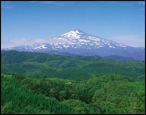
Mt. Chokai Akita (on the Sea of Japan about 100 miles south of Aomori) is large commercial and industrial city with about 300,000 people. It is also a place where old ways endure. About 80 percent of the town’s land is occupied by rice paddies and mountain forests. Sixty percent of children live in three generation households
Akita often receives of more than a meter of snow in the winter. Yokote in Akita is famous for its “kamakura” snow huts which are featured at the town’s snow festival in February. The huts typically stand three meters tall and have a diameter of 3.5 meters. In early August it hosts the famous Kanto Matsuri (Pole of Lanterns Festival), in which 12-meter-long bamboo poles holding 40 to 50 candle-lit paper lanterns and weighing to 50 kilograms are carried by individuals who do fancy steps as they try to balance the lanterns on their foreheads, shoulders, chins and hips.
Websites: Akita City site Akita City Akita Prefecture travel site visitakita.com ; Map: Encarta pref.akita.jp Hotel Web Sites: Akita Fan Akita Ryokan and Minshuku Japanese Guest Houses Japanese Guest Houses Budget Accommodation: Japan Youth Hostels Japan Youth Hostels Check Lonely Planet books Getting There: Akita is accessible by air and by bus and by train from Tokyo and Osaka and other Japanese cities. Akita has its own shinkansen line which branches off from the main northern line in Morioka and opened in the late 1990s. It takes about 2 hours and 10 minutes from Tokyo to Morioka Station on the Tohoku Shinkansen line. To reach Akita takes about 2-1/2 hours. From Tokyo there are Shinkansen trains directly to Akita. Lonely Planet Lonely Planet
Sights in Akita
Akita doesn't have much to see. Shimin Market, near JR Akita Station, is lively place. It is filled with locally-caught fish and locally-grown fruit and vegetables. Around 100,000 people visit the market every month. Most of the 92 stores are run by descendants of the original owners. Try the kiritampo, a regional dish from Akita consisting of mashed rice on a stick brushed with miso paste.
Akita Museum of Art was designed by Tadao Ando and houses Masakichi Hirano’s collection of significant works by Leonard (Tsuguharu) Foujita (1886-1968), a Japanese artist who lived in Paris and was contemporary of Picasso, which the local businessman had amassed through a relationship with the expatriate artist in the 1930s. Hirano later established a foundation that eventually merged with the state museum, and today the comprehensive collection includes paintings, watercolors, and sketches. Address: 1-4-2 Nakadori, Akita-shi, Akita 010-0001 Tel: +81-18-853-8686 Akita | Akita Museum
Akita International University’s Book Colosseum is a magnificent university library designed by Mitsuru Senda is open to serve its students 24 hours a day, 365 days a year, and is held together with bare wood beams and columns made of local cedar, forming what resembles a large umbrella. With rows of bookshelves in the stadium seats, watching over the students and their desks situated in the arena, the building is conceptually referred to as a “book colosseum”. Address: 193-2 Okutsubakidai, YuwaTsubakigawa, Akita-shi, Akita 010-1292, Tel: +81-18-886-5907
Akita Area
Akita Prefecture covers 11,637.54 square kilometers (4,493 square miles), is home to about 1 million people and has a population density of 87.9 people per square kilometer. Akita is the capital and largest city, with about 316,000 people. It is in Tohoku on northern Honshu island and has 6 districts and 25 municipalities.
Odate (Akita Prefecture) is the home of the Jukai Dome, a dome large enough to cover a baseball field made completely of wood. Completed in 1999, it is made of roughly 1,700 tons of Akita cedar wood and covers roughly the same size space as the Tokyo Dome. It is built so it can withstand the huge snowfalls that hit the area without the use of any pillars. Studies have shown that pound for pound wood is stronger than iron.
Oga-Hanto Peninsula(north of Akita) is somewhat reminiscent of Ireland. Jutting 20 kilometers into the Sea of Japan, it features grassy slopes and a rugged coastline. Cape Nyudo-zaki has a lighthouses and nice views. The Oga Suizoko-kan Aquarium has a wide variety of fish. Website: Ogata Geopark oga-ogata-geo.jp

Nyuto Onsen Area (eastern Akita Prefecture, reached by bus from JR Tazawako Station on the Tohoku-Alita Shinkansen) is wonderful hot spring areas with delightful outdoor baths set among splendid Alpine scenery, which is particularly striking when it is covered by thick layers of snow which remain until April. Nyuto means “nipple.” The area is so named because nearby Mt. Nyuto looks like, you guessed it, a nipple.
Some of the baths have clear water. Some have a reddish tint. Others are grayish. Each bath is said have curing powers for a different ailment. Most of the onsen have segregated indoor and outdoor baths for men and women and a large outdoor bath for both men and women. Many are open late into the night and allow guest to drink sake while they are taking a soak. Websites: Official Nyuto site nyuto-onsenkyo.com ; Japan Guide Japan-Guide ; Japanese Guest Houses japaneseguesthouses.com
Kakunodate (east of Akita) is a pleasant small castle town town with a well-preserved samurai district. A number of the houses are open to public. They have been meticulously preserved and offer a fascinating window into how the warrior class lived centuries ago. Websites: Japan Guide Japan-Guide ; JNTO article JNTO ; Getting There: Lonely Planet Lonely Planet
Akita Nairiku Railway (beginning at Kakunodate) is a delightful local train line with colorful cars that provides a two-hour journey across the untouched countryside. You’ll travel nearly 100 kilometers north amidst rustic villages and rice fields that are decorated with artistic patterns in the summer months, across deep valleys and through verdant forests. The end of the line is Takanosu, birthplace of Japan’s traditional “matagi” hunter culture, where bear cuisine and other delicacies await the adventurous gourmet. To can stop at Ani-Maeda Station for relaxing hot spring baths and ski resorts boasting sublime powder snow. With lily flowers and cherry blossoms in the spring to fireworks and festivals in summer, foliage in autumn and stunning snowscapes in the winter—don’t miss the majestic Mount Miyoshi and its famous hoar frost-covered trees, Website: Akita Nairiku Jukan Tetsudo akita-nairiku.com/en
Kamakura Ice Houses in Yokote, Akita
”Yokote (200 kilometers north of Sendai and 70 kilometers southeast of of Akita is known for kamakura, a snow domes created by hollowing out compacted snow. Originally, it was a traditional wintry event in the snowy areas of the Tohoku region, in which the deity of water was honored inside the dome. Today, kamakura are built at many events held in different places during the winter season. [Source: Atsuki Kira, Yomiuri Shimbun, October 6, 2012]
”For instance, the event of building kamakura in the city of Yokote in Akita Prefecture can be traced back about 400 years. For the Snow Festival in February, the local tourist association sets up nearly 100 kamakura. Each is three meters high and three meters across. In addition, many snow domes are built at home and in the grounds of the workplace. During the festival, visitors can enjoy making a kamakura with the help of the locals. In the evening, local children play inside the domes and enjoy chatting with the tourists.
”The city has a Kamakura Museum, where a kamakura made of local snow is stored in the exhibition room, with the temperature kept at-10 degrees Celsius, so that it can be viewed year round. The Yokote City Tourist Association dispatches skilled kamakura builders with decades of experience to set up full-size snow domes made from Yokote’s snow in other regions. It also sells miniature kamakura, which are dome-shaped foam containers of 30 centimeters x 30 centimeters packed with Yokote snow.”
Kazuno
Kazuno (80 kilometers north of Morioka) is known of it abandoned gold mine and Jomon sites: Yasuo Hayakawa wrote in on the Yomiuri Shimbun: “I visited the remains of Osarizawa Mine, one of the country’s largest. An industrial heritage site, the mine used to produce gold that is said to have been used in the construction of the Great Buddha at Todaiji temple in Nara and the golden hall of Chusonji temple in Iwate Prefecture. [Source: Yasuo Hayakawa, Yomiuri Shimbun, June 3, 2012]
“The mine was closed in 1978, but the pit is open to the public and contains simulations of past mining activities. As I ventured farther in, feeling the aura of gold mining, I reached the remains of a mining site from the Edo period (1603-1867).. Kimono-clad dolls appeared to be praying in a corner. "They're supposed to be clandestine Christians hiding from religious suppression. There’s a wall with a cross engraved on it that is not open to the public," guide Hideho Sekimura said. These Christians were ultimately found by the authorities, and many were executed, Sekimura said. I felt like I'd discovered an unofficial piece of history. At night, I bathed in the Oyu onsen spa and ate cow and pig organs, another regional speciality.
“The following day, I visited the Oyu Stone Circle, ruins from the Jomon period (ca 10,000 B.C.-ca 300 B.C.).. I got special permission to take a closer look at the circle and from there, I could view Mt. Kuromata. The three-sided mountain is so beautifully shaped that some believe it’s actually a pyramid. The stone circle and the mountain evoke an atmosphere of ancient times. Why this big circle was made is unknown, and there are other mysteries connected with this site as well. If a line were drawn from the center of the stone circle and a sundial-like collection of stones nearby, it would match the direction of the sunset at the summer solstice. "On top of that, a tablet unearthed from the ruins has holes that apparently signify numbers from one to six. The board might have been used to design the stone circle," said Kazunori Asari, the curator of the Oyu stone circle museum. Getting There: It takes about 2-1/2 hours from Tokyo to Morioka by Shinkansen bullet train. From there to Kazuno-Hanawa Station, it is about two hours by taking Iwate Galaxy Railway and switching to JR Hanawa Line. For more information, call the Towada-Hachimantai tourism and regional products association at (0186) 23-2019 or the Kazuno city tourism exchange section at (0186) 30-0248.
Lake Tazawa-ko and the World's Best Beer
Lake Tazawa-ko (east of Akita) is the deepest lake in Japan at 423 meters deep. It doesn’t freeze over in the winter, something which local people attribute to the lovemaking prowess of a dragon. Many people use the lake for watersports and as a starting point for hikes to 1,623-meter-high Komaga-take. The water in the lake is acidic Websites: Tohoku Tourism article tohokukanko.jp ; Lake Tazawa Map:PDF city.semboku.akita.jp Getting There: Lonely Planet Lonely Planet
Reporting from Semboku in Akita, Kenichi Sato wrote in the Yomiuri Shimbun, “Despite being in the midst of the Ou mountain range in the Tohoku region, I feel like I'm standing at the edge of the sea. Lake Tazawa — Japan’s deepest lake at 423 meters — has a bottomless presence. As I drive along the lakeside, the water surface is tinged with the colors of the mountains that surround it. I wonder if this navy blue is the natural color of the water, or the reflection of Akita’s cedar trees. A type of deepwater trout called kunimasu used to swim in this mysterious 20-kilometer-round lake until World War II. [Source: Kenichi Sato, Yomiuri Shimbun Staff Writer, September 2, 2012]
”According to "Tatsuko Hime Densetsu," a local folk story about Lake Tazawa, a girl who wished for undying youth and beauty turned into a dragon, and her lamenting mother cast a torch into the lake. The torch became a kunimasu. During my trip, I saw posters that read "undying fish" or "miraculous fish" on the wall on a shop in front of the Statue of Tatsuko, a tourist spot in the area. "I become a bit sad whenever my customers ask if the kunimasu ever returned," a woman at the shop said. Kunimasu was an indigenous species that lived only in Lake Tazawa. The fish was believed to have become extinct around 1940 when strongly acidic water entered the lake as a by-product of electric power generation and irrigation.
”Two years ago, however, the species was found in Saiko lake, one of the five lakes located at the foot of Mt. Fuji in Yamanashi Prefecture, after its eggs were transferred from Lake Tazawa to that lake before World War II. "Kunimasu were regarded as precious, and the value of one was comparable to 1.8 liters of rice back then," Hisashi Miura, 63, said. Miura’s grandfather fished in Lake Tazawa for kunimasu with gill nets from a dugout canoe. Miura showed a document written by his ancestors during the Edo period (1603-1867) that reads, "Don't give up our right to fish, even after I am dead."
"My father understood the anger and frustration that my grandfather bore because he was not able to fish [for kunimasu] anymore," Miura said. "So, my father kept going out to the lake in Yamanashi Prefecture, trying to catch kunimasu until he died in 2006," Miura said. Local people in Akita Prefecture are eager to bring the recovered fish back to Lake Tazawa, and Miura is preparing for the kunimasu’s homecoming by re-creating a dugout fishing canoe with his friends. The Lake Tazawa history museum displays items related to this fish — a "wanted" notice distributed across the nation in the 1990s; fishing manga Tsurikichi Sanpei that predicted the rediscovery of kunimasu in a story and two kunimasu suspended in formaldehyde that were caught before the end of war. The reproachful glances of the specimens look as if they yearn to return to the lake.
”Near Lake Tazawa, the "world’s best beer" is sold. Semboku-based theater company Warabi-za brews Tazawako Beer, which won the World’s Best Altbier Pale Ale at the World Beer Awards in Britain last year. I visited the factory housed in the Tazawako Art Village. "Akita Prefecture, the area known for brewing good sake, has a climate suitable for microorganisms for brewing," factory chief Katsuhisa Komatsu said. His friendly smile lured me into buying a bottle of the reddish-brown beer. I gulped it down at the hotel, and enjoyed its richness, which reminded me of the depth of the lake.”
Image Sources: 1) May Japanese Guest Houses 2) itako 3) Aomori City site 4) Aomori Museum site 5) Onsen Express 6) 7) Hirosaki City site 8) 9) Akita Prefecture site 10) 11) Sendai City site 12) 13) Wikipedia 14) Japan National Parks site 15) 16) Yamagata Prefecture 17 ) Samurai Dave blog 18) Aizu Wakamatsu city 19) Niigata city site 20) 21) Sado Island site
Text Sources: JNTO (Japan National Tourist Organization), Japan.org, Japan News, Japan Times, Yomiuri Shimbun, Japan Ministry of the Environment, UNESCO, Japan Guide website, Lonely Planet guides, New York Times, Washington Post, Los Angeles Times, National Geographic, The New Yorker, Bloomberg, Reuters, Associated Press, AFP, Compton's Encyclopedia and various books and other publications.
Updated in July 2020
