AGE OF EXPLORATION
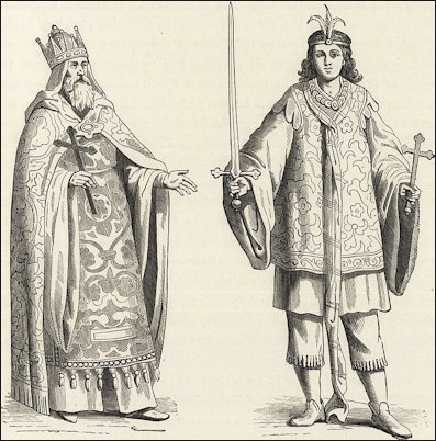
Prester-John, Chief of a Christian Tribe in Tartary and Prester-John's Page
In the Age of Exploration it was important not only to get there but also to return safely. Early discoveries in Asia and America were not as historically significant as Columbus's voyage because in most case the voyagers never returned to their homeland to tell their compatriots about what they saw and experienced. Vikings who traveled to North America returned home but news of their discoveries failed to reach most of Europe and thus had little impact.
In Columbus's time the Arab and Chinese empires were richer and more technologically advanced than those in Europe, but Europe was changing quickly as the continent’s social organization was moving from feudalism to mercantilism. In addition, 200 years of war and plague, created a sense of discovery and wanting to start fresh. European nations were also seeking a way to avoid the Venice-Ottoman monopoly on trade between Asia and Europe and meet Prester John. Overland trade between China and Europe had been virtually closed down by th Ottoman's who charged exorbitant taxes on trade through the large Middle Eastern empire they controlled.
The Portugese and Spanish launched their age of discovery in hopes of converting heathens to Christianity and increasing their country wealth through the seizure and treasures and the establishment of trade routes to bring items coveted by Europe from the Orient. The West needed products from the East much more than the East needed products from the West. Products from the East included perfumes from Arabia, silks from China and spices from India and Indonesia.
Prester John
Many of the early European explorers to Asia and Africa were hoping to meet up with Prester John, a mythological priest-king who resided somewhere in the East and was supposed to help the Crusaders reclaim Jerusalem. Portuguese explorers went looking for him up the Senegal and Congo Rivers in Africa.
The legend of Pester John began with a forged 13th century letter that was immensely popular and appeared as a 10-page manuscript booklet, written in numerous languages including Italian, German, English, Serbian, Russian and Hebrew. The legend of Prester John is believed to have originated with Saint Thomas, an Apostle of Christ, believed to have traveled to India in the first century A.D., who has had more miracles attributed to him than any other saint. Maps from the late 16th century had the kingdom of Prester John located in present-day Ethiopia.
The Kingdom of Prester John included 42 "mighty and good Christian kings;"the Great Feminie, ruled by three queens and defended by 100,000 women warriors; pygmies who fought wars with birds; bowmen "who from the waist up are men , but whose lower part is that of a horse;" worms that survived only in fires, maintained by 40,000 men, that produced silk that could only be cleaned in fires; and magic mirrors, enchanted fountains and underground rivers with waters that turned into precious stones. [Source: Daniel Boorstin, "The Discoverers"]
Early Travelers to Africa and Asia
Sailing out of trade centers like Sidon and Tyre, the Phoenicians became the greatest sailors of the Mediterranean by 1000 B.C. A Carthaginian navigator named Hanno explored the west coast of Africa between 500 and 450 B.C. It is not known how far he got. Forth century coins made in Carthage have been found in the Azores, a group of islands in the middle of the Atlantic. See Phoenicians
In 1291, the Vivaldi brothers of Genoa, Italy tried to sail Africa to get to the Orient. Their expedition never returned. No one knows how far they got.
It appears that the Atlantic islands—the Azores, the Canaries and the Madeiras—were discovered by Genoese sailors in the mid 1300s. The Azores were one third of the way across the Atlantic to the New World.
Nicolo de' Conti
One of the first Europeans to reach Indonesia and suggest that it was possible to reach Asia by sailing around Africa was a Venetian merchant named Nicolo de' Conti who traveled for 25 years in the Middle East and South Asia beginning in 1419. At the end of the 15th century maps began showing a sea route around Africa for the first time.
Paul Lunde wrote in Saudi Aramco World, “Nicolò dei Conti voyaged widely in the Indian Ocean between 1414 and 1439. His itinerary is remarkable: Baghdad–Hormuz–Qalhat–Cambay– Malabar–Madras–Malapur–Sumatra– Burma–Ava–Pegu–Java–Borneo– Champa–Quilon–Cochin–Calicut– Cambay again–Aden–Berbera–Jiddah– Makkah–Cairo–Venice. He spent nine months in Borneo and learned from traders of the existence of the far-off Moluccas, the Spice Islands that the early Arab geographers had known only as bilad manbit al-‘atar, “the country where the spices grow.” He is the first author to refer to the bird of paradise, species of which live only in New Guinea and adjacent islands and whose feathers were much prized by the Chinese and Ottoman Turks. [Source: Paul Lunde, Saudi Aramco World, July-August 2005]
“On his return to Europe, his caravan crossed with that of a Christian knight, Pero Tafur, near Mount Sinai. Nicolò told Pero Tafur that he had left home at 18, lost his inheritance, spent a year at the court of Tamerlane in Samarkand, then set off for India. In India, Nicolò claimed, he had been received by Prester John, “very graciously and [he] showed me many favors, and married me to the woman I now have with me, and she bore me these children.” Prester John, he said, was a great lord with 25 kings in his service, and he had sent two unsuccessful expeditions in search of the sources of the Nile.
“On his return to Italy, Nicolò dictated his travels to the papal secretary and learned humanist Poggio Bracciolini, to whom we owe the survival of so many key works. He toned down his account, producing a short, informative report of his travels. Much of his geographical information was recorded by the Venetian Fra Mauro on his wonderful map of 1459, a map which, incidentally, clearly shows Africa as a peninsula. Yet Nicolò’s conversation in the desert with Pero Tafur shows the medieval side of this remarkable man, whose obsession with Prester John and the sources of the Nile was shared by the Portuguese and spurred them to undertake their punishing voyages.
Nicolò visited present-day Indonesia because the overland routes between Europe and Asia were closed. “Nicolò had been able to travel freely while Tamerlane was alive, but when Tamerlane’s empire crumbled after his death in 1404, the overland routes were no longer safe, and Nicolò was forced to return to Italy by sea. He was not the only one inconvenienced by the death of the Central Asian conqueror, nor was he the only one to turn to the sea.”
See China
Dead Reckoning and Navigating in Columbus's Time
Many ancient mariners navigated by looking at the coast. Most vessels were designed for hugging the coast. Navigation at night was done using stars such as the North Star as a reference point. One of the great problems with venturing southward along the African Coast was that once mariners passed below the equator, the North Star, the main reference point for celestial navigation, was no longer visible.
In Columbus’s time, mariners understood weather and prevailing currents, estimated speed and distance, knew the constellations and how to mark the passage of the sun through the houses of the zodiac. They used the mariner’s compass, reading charts and a quadrant. They were able to calculate the complex time-speed equations important in dead-reckoning sailing and set anchors properly. Mariners in Columbus's time thought of direction not in terms of points on the compass but directions of the wind
Columbus measured speed and long distance by using dead reckoning, a technique that estimating how fast bubbles and ocean debris floated and dividing that by time measurements. To keep time on his ships Columbus used a sand hourglass that recorded the seven "canonical" hours. The first fairly accurate method of determining speed, the chip log, was not invented until the mid 16th century.
The expression for speed “knots” comes from the Middle Ages. Sailors used to drop a rope with knots tied at seven fathom intervals and a piece of wood to end off the bow of the ship. Using an sandglass the speed of the ship was calculated by how many knots passed by. This technique known as "heaving the log" was used until the 19th century.
Among the inventions developed by Galileo (1564-1642) were a marine clock and land surveying equipment. Galileo tried to create an ocean surveying devise that consisted of a helmet with a telescope and chair set on gimbals (a mechanism that keeps things horizontal). The Dutch scientist Christain Huygens (1629-1695) ushered in the era of precision time-keeping with the invention of the first pendulum clock in 1658. He also tried to develop a clock that could be used on ships, but the rocking motion of the ships kept his pendulums from functioning properly.
Astrolabs, Cross Staffs and Measuring Latitude
To figure out latitude, which was done by measuring the attitude of the sun at noon, mariners in the Age of Exploration used a cross-staff—"a handy graduated stick with a moving part which could be aligned with the horizon and the sun to measure the angle of the sun's elevation". This devise was easier to use than the more expensive and complicated astrolabe.
Astrolabes — - astronomical calculators used to solve problems relating to time and location based on the positions of the Sun and stars in the sky — -were invented by the Greeks and improved by the Arabs. The only thing the Greek mariners needed to measure their latitudinal position was a sighting device that measured degrees above the horizon of either the sun or the north star. The north star was the easiest to measure because adjustments did not have to be made for the season like they did with the sun. The simple measuring device was made of two rods, hinged at one end. Held sideways, the bottom rod was leveled to the horizon and the upper one was pointed at the sun or star. The angle between the two rods yielded the angle of inclination of the sun or star, and with tables the latitude could be ascertained. More sophisticated astrolabes evolved from these devises.
The Astrolabe enabled ship pilots to calculate latitude using the sun and stars. This in turn enabled the early explorers to venture out into the open sea without worrying about getting lost. Before the invention of the astrolabe most navigators stayed close to the shore so they could see where they were going. Longitude was more difficult to figure out. [Source: Merle Severy, National Geographic, November 1992]
The astrolabe allowed navigators and astronomers to "observe the altitudes and positions of heavenly bodies." The accuracy of this device was greatly improved by the Portuguese mathematician-cosmographer Pedro Nunes (1502-1578), who added a attachment called a "nonius" (after Nunes), which allowed astrolabe users to measure fractions of a degree of arc by using a scale made of concentric circles. Astrolabes were replaced by the octant and the the sextant in the 18th century. [Source: Daniel Boorstin, "The Discoverers"]
Compass
Before the advent of the magnetic compass, European sailors navigated by the winds which were represented on charts coming from certain direction that became known as the compass zone. Mariners navigated by techniques of dead reckoning and following charts that showed a zigzag of tacks rather than a direct compass bearing. By Columbus's time the compass had become an indispensable navigation tool.
The first compasses were associated with sorcery and black magic, and early sea captains often consulted them only in the privacy of their quarters. Even in Colombus’s time, navigators might have had to explain themselves in front of Inquisition for using a compass. Its defenders noted that it formed the holy cross.
The Chinese are credited with inventing the magnetic needle (an early form of compass) around 1000 A.D., although they may have used similar devices long before that. There are records of them being used for navigation in 1119. Compasses were used in ships in Europe (first by the Vikings) around A.D. 1200. Around that time compass markings showed up on land surveys in China. The first recorded evidence of a compass in Europe is by an English monk named Alexander Neckham (1157-1217) who studied at the University of Paris. Chinese and early European land compasses "pointed" south. Even though compasses appeared first in China, scholars believe that they were likely developed independently in Europe than imported from China.
Ancient Chinese and Greeks had been familiar with magnets since at least 500 B.C. and Chinese chronicles contain references to the ability of magnetic lodestones to point south as early as 300 B.C. Historians believe that lodestones were probably first used in fortunetelling. As early as the 2nd century A.D. lodestones may have been used by navigators on the open sea.
The world’s first compasses looked like spoons and evolved from the game of chess, which developed in China as a divination technique used to unravel the meanings hidden in the universal forces of Yin and Yang. In early Chinese chess the Great Bear, or Northern Dipper, was represented by a spoon that was spun about. The spoon came to be made of magnetite after its seemingly magical properties were discovered, and so served as a divining device when it was rotated according to the complicated rules of the game. [Source: Daniel Boorstin, "The Discoverers"]
The first compasses used by Europeans consisted of magnetic needle floating in water on a piece of cork or straw. Next to this was a "wind rose"—a small chart showing four, eight or twelve "wind directions.” In the 14th century someone finally had the bright side of idea attaching the wind chart to the floating compass.
Difficulty in Determining Longitude
Measuring latitude and determining direction could be determined by observations of the stars and the sun, but as late as the early 18th century a system of measuring longitude had yet to be devised. The chronometer, the devise that determines longitude, was not used until 1765.
During the Age of Discovery, sailors determined longitude by making careful observations of the moon with delicate instruments and complicated conversion tables. The measurements had to be precise. An error of 5' in observations translated to an error of 2½ degrees in longitude (about 150 miles). An inaccurate measure could beach a ship on sand bar or tear its hull open on a dangerous reef.
In 1604, King Philp III of Spain offered a prize of 10,000 ducats for a solution to the longitude problem. Later King Louis XIV of France offered 100,000 florins. Galileo responded to a prize announced by the Dutch States General. The "discovery" of a longitude system was considered so important that the British Parliament offered 20,000 pounds (millions of dollars in today's money) to anyone would figure out how to calculate longitude at sea.
Proposals included a network of anchored marker ships spread around the world; astronomical-observing contraptions filled with dials and lenses; and even a magical long-distance-determining powder. This powder was discovered in the south of France, where it was applied to a wounded dog whose yelps, calculated in conjunction with the highest trajectory of the sun, determined longitude.
The problem on longitude was finally solved by an uneducated clockmaker named John Harrison who figured out that all that was needed was an accurate clock. Sir Kenelm Digby had observed earlier that for every 15 degree sailed west there was a one hour difference in time. Harrison surmised if one had an accurate clock that kept time in England (Greenwich Mean Time) longitude could be figured out by determining the time difference between the ship and Greenwich mean time.
After 46 years of work in his workshop, Harrison finally developed a waterproof, motion-proof clock that was accurate enough to keep Greenwich time over several months (clocks in his time often lost several minutes a day). The Board set up by Parliament to give longitude money refused to give Harrison the 20,000 pounds because his clocks had small flaws and the Board, dominated by scientists with complicated astronomical devices, considered his scheme to be too ridiculously simple-minded. King George III finally had to intervene to make sure Harrison got his money.
Ships in the Age of Discovery
Most of the ships that plied the Mediterranean in the years before the Age of Discovery—the heavy, square-rigged barca and the larger and similarly- designed Venetian carrack— were best suited for sailing with the wind. The largest square rigged carracks carried six hundred tons or more. Portuguese navigators in the early 15th century used one or two-masted barcas. Large square-rigged, three-masted carracks first appeared in 1450 and were originally designed in Venice. Their ability to carry large loads for transoceanic voyages made them the standard for ships of trade, warfare and exploration.
Caravels were introduced in 1441. These light, shallow ships were ideal for exploring rivers, bays and coastal waters. Their lateen sails made it possible for them to beat upwind. Naos, or great ships, were used in the 16th and 17th centuries on the Lisbon-to-Goa trade route. Merle Severy wrote in National Geographic, these "broad beamed, multi-decked, high in bow and stern [were] square-rigged carracks or galleons...open ocean cargo carriers routed to sail before the wind. [Source: Merle Severy, National Geographic, November 1992]
In the 17th century oak forests in Poland were cleared to supply wood for Dutch ships used in voyages to the East Indies, About 4,000 planks were needed for each ship, which lasted only one or two voyages before the wood rotted and the ship fell apart. Spaniards boiled tar to get pitch to caulk their ships. This was one of the early uses of a petroleum material.
Caravel
The shipbuilders at Sangres. Portugal developed the caravel, a ship that would dominate the Age of Discovery. Influenced by Arab ships known as carvos, which had slanting, triangular "lanteen" sails, caravels could sail into the wind as well as with the wind. Caravels were small. The earliest ones displaced two tons, were 75 feet long and 25 feet wide. They had two or three lanteen sails and the small crew of 20 or 30 or so, usually slept on the deck and went below during bad weather. Columbus's Niña, Pinta and Santa María were all caravels. The Santa María was only fifth the size of the largest Venetian square-rigger of his day. [Source: Daniel Boorstin, "The Discoverers"]
The square-rigged barca could at best sail 67 degrees into the wind, while the lanteen-sailed caravel could sail 55 degrees. This meant that to cover an equal distance a barca would have to tack ten times while the caravel would tack six times. This meant that a caravel could reach a destination in two thirds the time of a barca and on a long voyage and shave off valuable weeks.
Also influenced by Portuguese river boats known as caravelas, the sea going caravel had a shallow draft, which made it ideal for exploring shallow waters close to shore and beaching for repairs.
The Portuguese town of Lagos became a major center of caravel building. Oak for the keels came from Alenejo and pine trees along the Portuguese coast, which were protected by law, provided wood for the hulls and resin which was used to waterproof the rigging and fill in the cracks between the beams of the hull.
Life on the Ships
The 350 or so personnel aboard large British ships included sailors, soldiers, craftsmen, cooks, stewards, coopers, smiths, swabbers, latrine cleaners and musicians (for ceremonies and to keep up morale). The job of captain was regarded as professional position. Other important mariners included the master (in charge of navigation), master carpenter, quartermaster (in charge of preparing the ship for action), coxswain and boatswain. There were various mates and deputies.
Meals were made from foods that could be prepared in advance and wouldn't spoil after months at sea. These foods included condensed soup, beer, biscuits, salted beef and pork, peas and dried cod. Vitamin-C rich lemons were introduced in the 17th century to prevent scurvy. On the use of lemons to prevent scurvy the late 17th century naval leader John Hawkins wrote: "This is a wonderful secret to the power and wisdom of God that hath hidden so great and unknown virtue on this fruit, to be a certain remedy for this infirmity."
Fighting Ships
Fighting ships included ocean-going vessels with defenses and man-of-wars built specifically to fight wars. Unlike Greek fighting galleys, which carried limited provisions, wooden man-of-wars carried stores and water to keep them going for many months. Portuguese ships that sailed around the Cape of Good Hope were able the fight with Indian rulers, months after they arrived. [Source: "History of Warfare" by John Keegan, Vintage Books]
As was true with the ancient Greeks, l6th century sea battles were essentially land battles at sea. A ship tried to sink the ship of its enemy by either piecing it with a cannon ball or ramming it (the same tactics used in the siege of a castle); or the ship tried to maneuver close enough that it soldiers could leap onto the ship and conquer them as they would on a battlefield. Battles were rarely fought in bad weather because large waves made it too difficult to maneuver. They were usually fought close to shore because rival fleets had difficulty finding each other in the open sea.
The Spanish used galleons to transport treasures home and fight battles. Galleons used under Queen Elizabeth I, according to historian Geoffrey Parker, were "larger than a country house, carried more artillery than a fortress, took over a year to build and absorbed about 1 percent of the total budget. Also beyond the mass of technical, industrial and professional skill required to build and equip the ships, every navy required a sophisticated system of management to mold them into an effective fighting force."
Ship Cannons and Weapons
The first canons were placed on the bow. If they were fired while the ship was moving the ship slowed down slightly. If they were fired while the ship was stationary the ship was driven slightly backwards. The Ottoman Turks used galleys (rowed by paid Albanians) with forward mounted cannon in their conquest of the Mediterranean. Their main rivals, Venice, Genoa and Spain, used galleys powered by criminals and slaves. [Source: "History of Warfare" by John Keegan, Vintage Books]
Cannons changed the nature of sea battles. Before they were introduced naval engagements had remained essentially unchanged since ancient Greece (galleys trying to ram each other or get close enough to unload their troops). Sailing ships were not used because they were not maneuverable enough. With canons it was no longer necessary to ram a ship or get close enough to board it. All a ship had to do was get close enough to fire a canon ball in an attempt to sink an enemy ship, something a sailing ship with holes cut into its side could do. By 1650 broadside fighting ships carried 50 cannons; by the Battle of Trafalgar (1805) the largest ones carried 100. [Source: "History of Warfare" by John Keegan, Vintage Books]
Cannons adapted themselves better to ships (which were essentially floating platforms) than land (where the they were difficult and time-consuming to transport). Ships were essentially load carrying vehicles, and it was no problem adapting them carry cannon and ammunition. The only problem that had be overcome was adapting the ship to absorb the cannon's recoil which was achieved by putting the cannon on wheels and strapping them to harnesses. [Source: "History of Warfare" by John Keegan, Vintage Books]
On old ships, splinters sent flying by a striking cannonball often did the most damage. When the rifle was invented in 1475 shots could fire from the deck of a ship towards sailors on an enemy ship.
Image Sources:
Text Sources: New York Times, Washington Post, Los Angeles Times, Times of London, Lonely Planet Guides, Library of Congress, Ministry of Tourism, Government of India, Compton’s Encyclopedia, The Guardian, National Geographic, Smithsonian magazine, The New Yorker, Time, Newsweek, Reuters, AP, AFP, Wall Street Journal, The Atlantic Monthly, The Economist, Foreign Policy, Wikipedia, BBC, CNN, and various books, websites and other publications.
Last updated June 2015